

My Favorite Hikes and Activities
““Not all who wander are lost.””
All photographs captured by Chris Heaton at specified locations
-

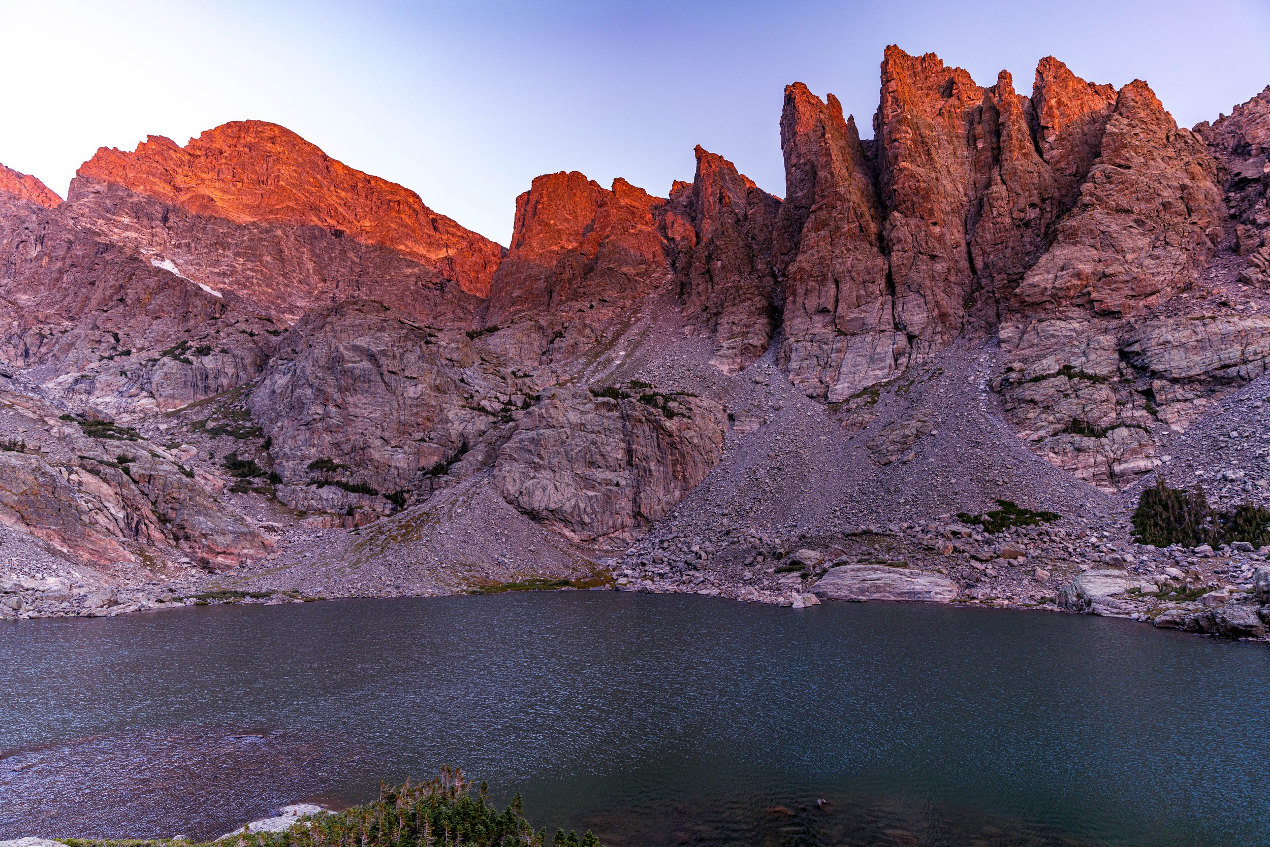
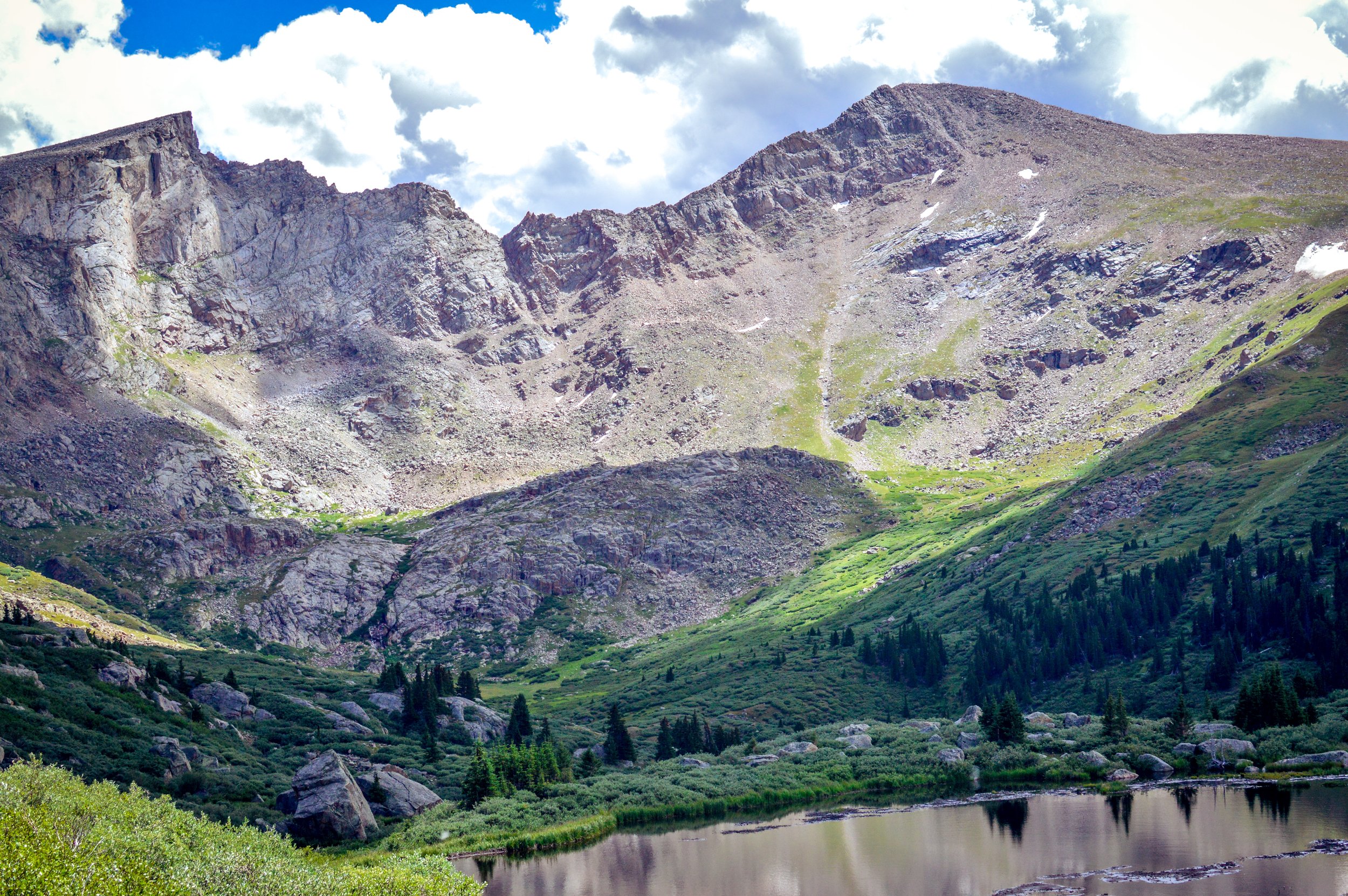
Lone Eagle Peak
Touted as the most beautiful mountain in Colorado, Lone Eagle Peak is a striking mountain that appears to defy gravity. Visiting Lone Eagle Peak requires an extremely long day hike or an overnight, but it’s certainly worth the effort to visit this fantastic piece of Colorado scenery.
Lone Eagle Peak is hands-down the most photogenic mountain in Colorado, but it takes a little effort to get there. Fortunately, if you’re an avid mountain hiker, the trail to Lone Eagle Peak isn’t too tough.
-

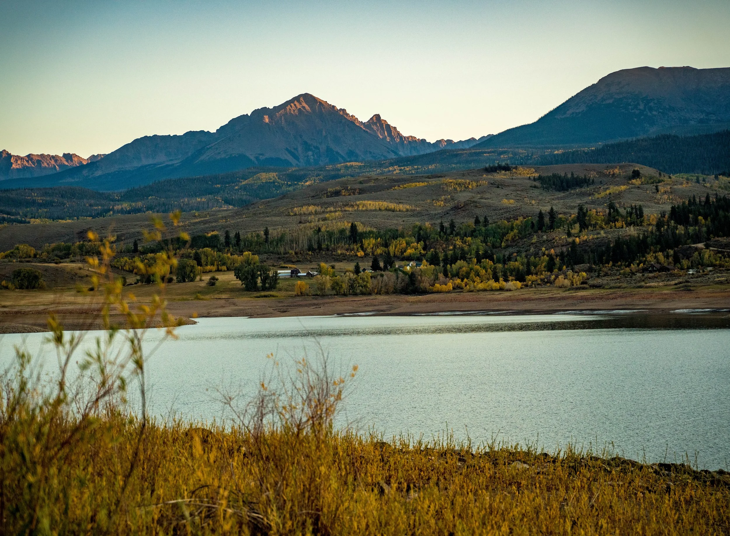
Golden Ponds
With a magnificent view of Longs Peak and the Front Range, Golden Ponds park features 94 acres with 56 acres of water surface in four ponds. The park is a trailhead to the western end of the St.Vrain Greenway and has 2.6 miles of park trails, an ADA-accessible fishing pier, two restrooms and nine picnic shelters. A 140-foot span bridge crosses the river just downstream of a concrete cascade; a reminder of the gravel and concrete operations that created the ponds. Wildlife of all kinds, especially waterfowl like great blue herons and cormorants, are easily viewed in the park. The land was donated to the City of Longmont by the V.V. Golden Foundation. Vernon Golden, who had mined gravel on this site, donated the land to Longmont citizens as a place to fish, walk and enjoy nature. A bronze sculpture of 'Vern' helping a small boy fish was donated by the family and is located along the path just west of the parking lot.
-
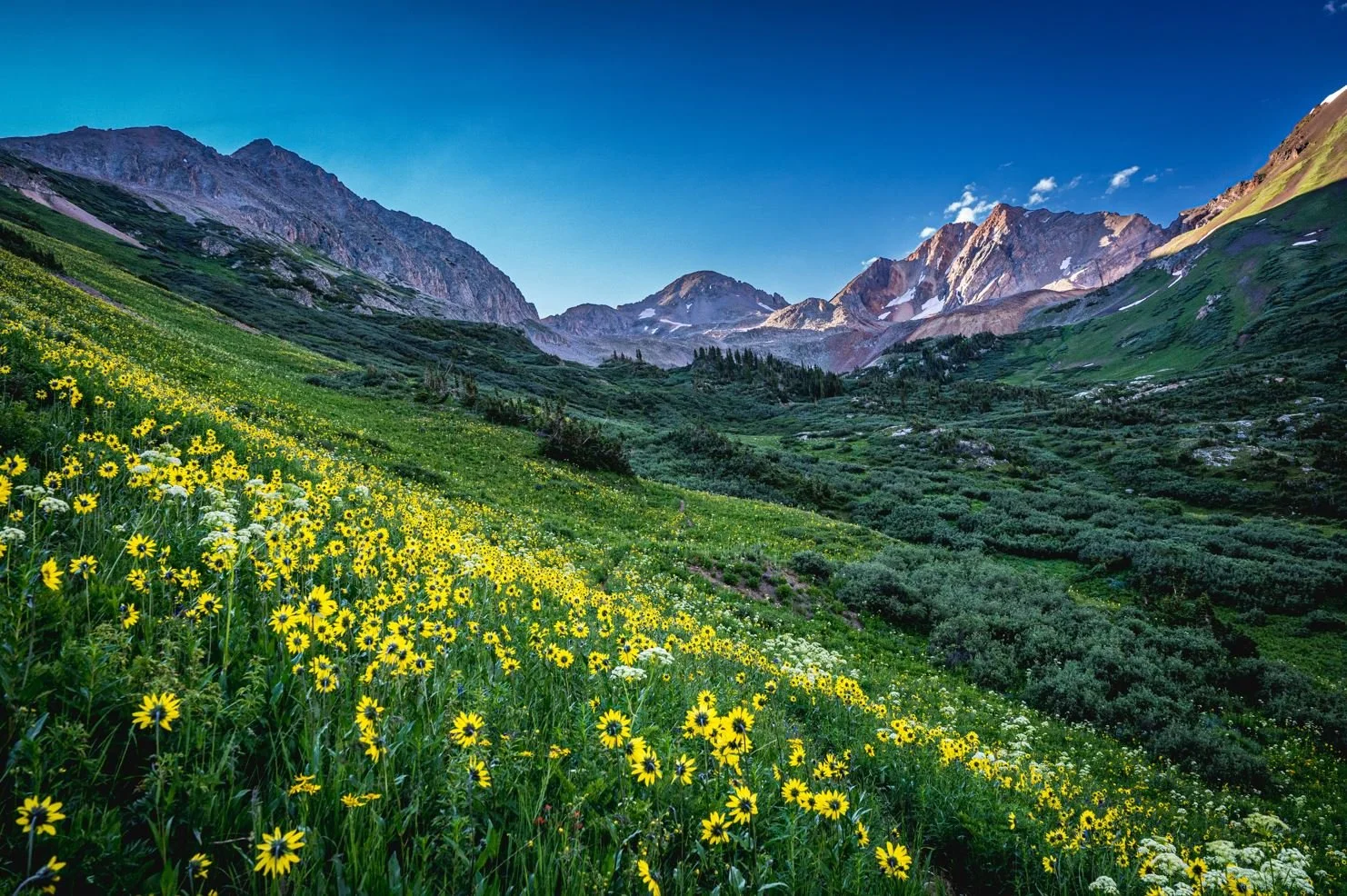
Rustler's Gulch
Discover this 9.0-mile out-and-back trail near Crested Butte, Colorado. Generally considered a moderately challenging route, it takes an average of 4 h 27 min to complete. This is a very popular area for hiking and trail running, so you'll likely encounter other people while exploring. The best times to visit this trail are May through October. Dogs are welcome, but must be on a leash.
-

Lizard Head Pass
Lizard Head Pass is a breathtaking 10,246 foot mountain pass along the San Juan Skyway. Accessible via State Highway 145, Lizard Head Pass offers spectacular views above beautiful, Southwest Colorado.
It connects Ames, a tiny unincorporated community south of Telluride, with Rico, even further south of Telluride.
-

Lower, Middle and Upper Blue Lakes
Explore this 8.7-mile out-and-back trail near Ridgway, Colorado. Generally considered a challenging route, it takes an average of 5 h 8 min to complete. This trail is great for backpacking, camping, and hiking.
-

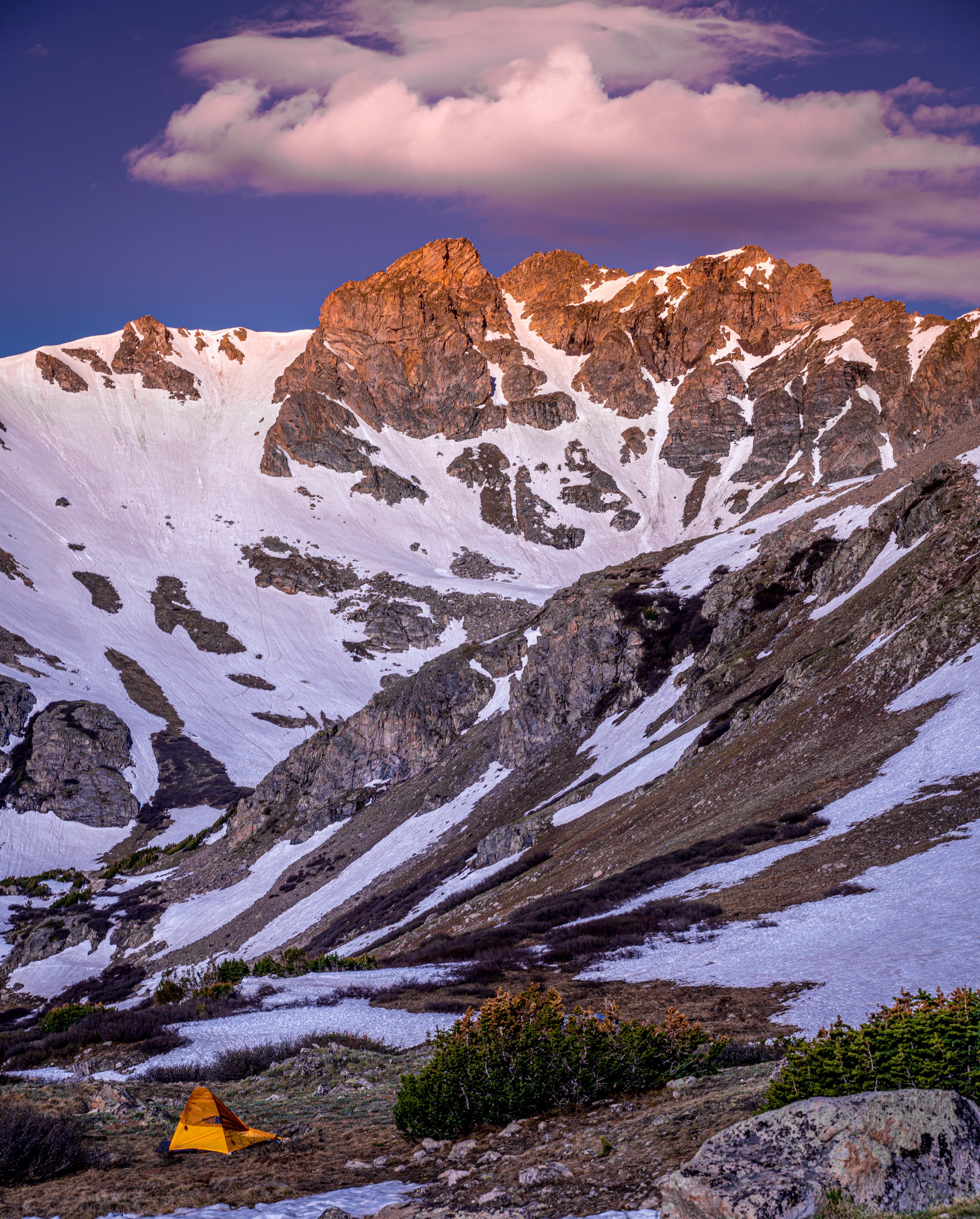
Mayflower Gulch
Mayflower Gulch Grand Traverse is a 6.1 mile heavily trafficked out and back trail located near Climax, Colorado that features beautiful wild flowers and is rated as moderate. The trail offers a number of activity options and is best used from March until September. Dogs are also able to use this trail.
-
Herman Gulch Trail
Experience this 11.6-km out-and-back trail near Silver Plume, Colorado. Generally considered a moderately challenging route, it takes an average of 3 h 56 min to complete. This is a very popular area for cross-country skiing, hiking, and horseback riding, so you'll likely encounter other people while exploring. The best times to visit this trail are June through October. Dogs are welcome and may be off-leash in some areas.
-

Paint Mines
The Paint Mines Interpretive Park is one of El Paso County’s most unique open spaces. The Paint Mines are named for their colorful clays that were collected by American Indians to make paint. Brightly colored bands, caused by oxidized iron compounds, are found in varying amounts throughout the many different layers of clay. The Paint Mines Interpretive Park is located in the northeast section of the County near Calhan with approximately 750 acres. The paint mines have evidence of human life as far back as 9,000 years ago. The park features fantastic geological formations including spires and hoodoos that form through erosive action that creates incised gullies and exposed layers of selenite clay and jasper.
-

Turquoise Lake Trail
This 6.4 mile trail parallels the shoreline of Turquoise Lake from the Dam to May Queen Campground. The section of trail from the Dam to Tabor Campground is 2.2 miles of easy hiking, passing by many picnic areas and campgrounds. The remainder of this trail offers moderate hiking with spectacular views of the Turquoise Lake Recreation Area. Pick up your trail guide to learn about the flora and fauna along the trail.
-

Mestaa’Ėhehe Mountain Fire Lookout
The Mestaa’ėhehe (pronounced mess-taw-HAY) Mountain Fire Lookout is located directly off of Colorado Highway 103 west of Bergen Park and sits at the summit of Mestaa’ėhehe Mountain, which is an active communication tower site in Clear Creek County. In addition to being an active communication site, the area is a popular dispersed recreation use area with hiking, recreational shooting, cross country skiing, snowshoeing, and camping. The lookout is a unique structure constructed of native granite which is situated at over 11,000 feet elevation and was built in the 1940s by the Civilian Conservation Corps. The cab measures 14 feet by 14 feet and is completely lined by windows on each side and surrounded by a catwalk, all of which sit on top of a one story stone base.
-

Pawnee Buttes
The Pawnee Buttes are located in the northeast corner of Weld County, Colorado, approximately 13 miles south of the Wyoming border. A predominant geologic feature within the Pawnee National Grassland, the Buttes rise 300 feet above the prairie.
-

Lake Helene
Lake Helene via Fern Lake Trail is a 6.1 mile heavily trafficked out and back trail located near Estes Park, Colorado that offers the chance to see wildlife and is rated as moderate. The trail is primarily used for hiking, walking, running, horses, and snowshoeing and is best used from May until October. Horses are also able to use this trail.
-

Red Mountain Pass
Red Mountain Pass is the stunning 11,018-foot summit of the Million Dollar Highway in Southwest Colorado. Although the road may be both treacherous and intimidating, adventurous drivers are rewarded with breathtaking views from the top.
Colorado’s “Million Dollar Highway” is a 25 mile stretch of U.S. 500 that is consistently rated as one of the most scenic drives in the country. Red Mountain Pass is the highest point on that road. It is also one of the most dangerous sections during the winter, because of its steep grade and lack of guardrails.
-

Garden of the Gods
Explore Colorado Springs' paradise in one magical stop. Garden of the Gods Park is a registered National Natural Landmark. Imagine dramatic views, 300' towering sandstone rock formations against a backdrop of snow-capped Pikes Peak and brilliant blue skies. This world-class Visitor & Nature Center and museum is the most visited attraction in the region with all new interactive exhibits. Learn how the amazing red rocks got there with the NEW Geo-Trekker theater experience, shown every 20 minutes. Delight in one of Colorado's most photographed views while eating in our glass-enclosed café or from our terrace overlooking Pikes Peak and Garden of the Gods.
-

Abyss Trail to Helms Lake
Abyss Trail to Helms Lake is a 11.7 mile heavily trafficked out and back trail located near Grant, Colorado that features a river and is rated as moderate. The trail is primarily used for hiking, walking, nature trips, and bird watching and is best used from May until September. Dogs are also able to use this trail but must be kept on leash.
-

Moraine Park
Moraine Park is the gateway to Colorado adventures, whether it is backpacking, hiking, mountain climbing or snowshoeing. This valley in Rocky Mountain National Park is a photographer's delight and has many trails to explore.
-

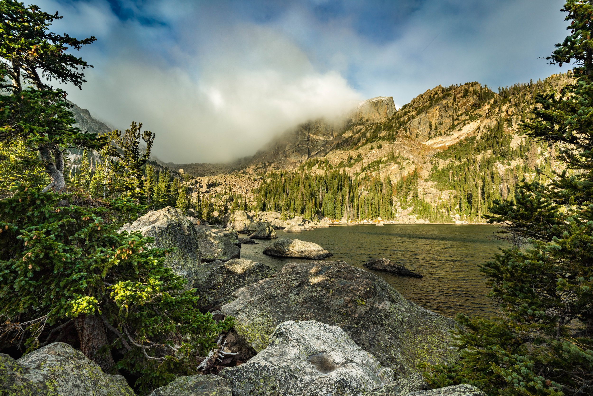
Dream Lake
Dream Lake is a high alpine lake located in Rocky Mountain National Park in northern Colorado, located east of the continental divide. The lake is accessed via the popular Bear Lake trail head and is at the base of Hallett's Peak, and is well known for its stunning views caused by surrounding steep cliffs, and a popular destination for casual hiking.
-

Mount Morrison
Mount Morrison South Ridge Trail is a 3.6 mile heavily trafficked out and back trail located near Morrison, Colorado that offers scenic views and is rated as difficult. The trail is primarily used for hiking. Dogs are also able to use this trail but must be kept on leash.
-

Sawhill Ponds Wildlife Preserve
Sawhill Ponds Wildlife Preserve is made up of 18 individual ponds with many surrounding trails and bench areas. The Sawhill Ponds Wildlife Preserve is owned by Colorado Parks & Wildlife (CPW) and managed by the Open Space and Mountain Parks Department.
-

Lake Isabelle
Lake Isabelle via Pawnee Pass Trail is a 5.5 mile heavily trafficked out and back trail located near Ward, Colorado that features a waterfall and is rated as moderate. The trail is primarily used for hiking and is best used from June until October. Dogs are also able to use this trail but must be kept on leash.
-
Lake Haiyaha
Lake Haiyaha is a 3.6 mile heavily trafficked out and back trail located near Estes Park, Colorado that features a waterfall and is rated as moderate. The trail is primarily used for hiking and is best used from June until October.
-

Continental Divide National Scenic Trail (CDT)
"One of the largest conservation efforts in the history of the United States"
The Continental Divide National Scenic Trail (CDT) is much more than just a line on a map: it is a living museum of the American West, a place to reconnect with nature, and a unifying force bringing people of all walks of life together.
-
Three Mile Creek
Three Mile Creek Trail is a 9.4 mile heavily trafficked out and back trail located near Grant, Colorado that features a river and is rated as moderate. The trail is primarily used for hiking and horses and is best used from May until October. Dogs are also able to use this trail but must be kept on leash.
-

Diamond Lake Trail
Diamond Lake Trail is a 5.4 mile heavily trafficked out and back trail located near Nederland, Colorado that features a lake and is rated as moderate. The trail offers a number of activity options and is best used from April until October. Dogs are also able to use this trail but must be kept on leash.
-

Emerald Lake
Discover this 3.20 mile, out&back trail near Estes Park, Colorado. Generally considered a moderately challenging route, it takes an average of 1 h 46 min to complete. This is a very popular area for hiking and snowshoeing, so you'll likely encounter other people while exploring. The trail is open year-round, but the best times to visit are June through October. You'll need to leave pups at home — dogs aren't allowed on this trail.
-
Green Mountain Reservoir
The reservoir was built to replace water to the Colorado River that gets sent to the Front Range through the Big Thompson Project. It is a storage reservoir so the levels will flucuate as water is called for on the Western Slope.
-

Old Dillon Reservoir Trail
Old Dillon Reservoir Trail is a 1.7 mile heavily trafficked loop trail located near Dillon, Colorado that features a lake and is good for all skill levels. The trail is primarily used for hiking and walking and is best used from May until October. Dogs are also able to use this trail but must be kept on leash.
-
Sky Pond
Enjoy this 9.40 mile, out&back trail near Estes Park, Colorado. Generally considered a challenging route, it takes an average of 4 h 58 min to complete. This is a very popular area for hiking and snowshoeing, so you'll likely encounter other people while exploring. The trail is open year-round, but the best times to visit are June through October. You'll need to leave pups at home — dogs aren't allowed on this trail.
-

Clear Creek Welch Ditch
As you enter Clear Creek Canyon, just before Tunnel 1, several ice flows appear extending from an aqueduct on the south side of the road on the opposite side of Clear Creek. Due to the low elevation and dependence upon the state of repair of the aqueduct, these flows do not form regularly. When they do, they provide some excellent local ice climbing. There are at least three other very short smears with ice-bouldering potential farter down the trail behind Tunnel 1. The details of these are not listed here. Some of these climbs start directly from Clear Creek. Climb these when the creek is well-frozen otherwise lower/rap from the top.
-

Loveland Pass
It is located on the Continental Divide in the Front Range, west of Denver on U.S. Highway 6 (US 6). The twisty road is considered to be especially treacherous during the winter months. A steep, steady 6.7% grade, along with numerous hairpin turns on either side, make it difficult to snowplow the road regularly. The pass is named for William A.H. Loveland, the president of the Colorado Central Railroad and a resident of Golden during the late 19th century. The city of Loveland, in Larimer County near Fort Collins, is also named after him. Loveland held a railroad charter and was an advocate for a wagon road between Denver and Leadville. In 1869, he opened this section of wagon road now known as Loveland Pass. It would be abandoned in 1906 and then restored for vehicle use in 1920 by the U.S. forest Service.[
-

Chasm Lake
Explore this 8.80 mile, out&back trail near Estes Park, Colorado. Generally considered a challenging route, it takes an average of 5 h 16 min to complete. This is a very popular area for hiking, horseback riding, and snowshoeing, so you'll likely encounter other people while exploring. The trail is open year-round, but the best times to visit are June through October. You'll need to leave pups at home — dogs aren't allowed on this trail.
-

The Loch
Try this 5.40 mile, out&back trail near Estes Park, Colorado. Generally considered a moderately challenging route, it takes an average of 2 h 53 min to complete. This is a very popular area for hiking, snowshoeing, and trail running, so you'll likely encounter other people while exploring. The trail is open year-round, but the best times to visit are March through October. You'll need to leave pups at home — dogs aren't allowed on this trail.
-

Wellington Lake
Whether you’re interested in an overnight stay or a fun day trip,Wellington Lake is the perfect venue for all of your favorite outdoor activities! From camping to fishing, swimming and canoeing, mountain biking and hiking- it’s all possible. During winter months, the fun continues with ice fishing, cross-country skiing, and snowshoeing. A short drive from Denver and Colorado Springs, we welcome all visitors looking for a relaxing mountain getaway in the great outdoors!
-

Roxborough State Park
One of the Denver-area backyard jewels, Roxborough State Park is just a short drive southwest of Denver. With close to 4000-acres, Roxborough State Park is filled with dramatic red-rock formations, distinct plant communities and a variety of wildlife ranging from black bears to mule deer. Enjoy hiking, wildlife viewing, trail running, photography, bird watching or one of our many programs and events. Whether you are new to the outdoors or an experienced outdoor enthusiast, Roxborough State Park has an opportunity for you.
-

Sprague Lake Trail
Sprague Lake Trail is a 0.8 mile heavily trafficked loop trail located near Estes Park, Colorado that features a lake and is good for all skill levels. The trail is primarily used for hiking, walking, running, fishing, and snowshoeing and is accessible year-round.
-

Hoosier Pass
Hoosier Pass is a high elevation mountain pass that is part of the Great Continental Divide in Colorado. The 11,542-foot pass can be reached via State Highway 9 between the towns of Alma and Breckenridge. There is also another “Hoosier Pass”, which sits at 10,313 feet in Teller County, Colorado. Hoosier Pass lies on the border between Park and Summit County, Colorado. It’s found in the Mosquito mountain range and is the highest point on the TransAmerica bicycle trail that travels between coasts in Oregon and Virginia.
-

Buffalo Herd Nature Preserve
The County of Denver maintains this buffalo herd about twenty miles west of the city. The bison are direct descendants of the last wild herd of bison in the U.S. They all came from a herd of 7 bison brought from Yellowstone National Park in 1914. The bison herd can be seen from I-70 when heading west into the mountains on the right side of the road.
-

Barr Lake
There’s something for every type of outdoors person - from the fishing enthusiast and boater to the naturalist - at Barr Lake State Park, a short drive northeast of the Denver area.
-

Lookout Mountain
Lookout Mountain is a foothill of the Rocky Mountains. The 7,377-foot peak is located in Lookout Mountain Park, 1.7 miles (2.7 km) west of downtown Golden. Known for its natural scenery, Lookout Mountain has played a major role in area recreation, transportation, water supply and telecommunications over the years. Its earliest known inhabitants were the Ute tribe of American Indians, who used the mountain as a lookout point for the surrounding region. Downtown Denver, only 12 miles to the east, can be seen clearly from the mountain.
-

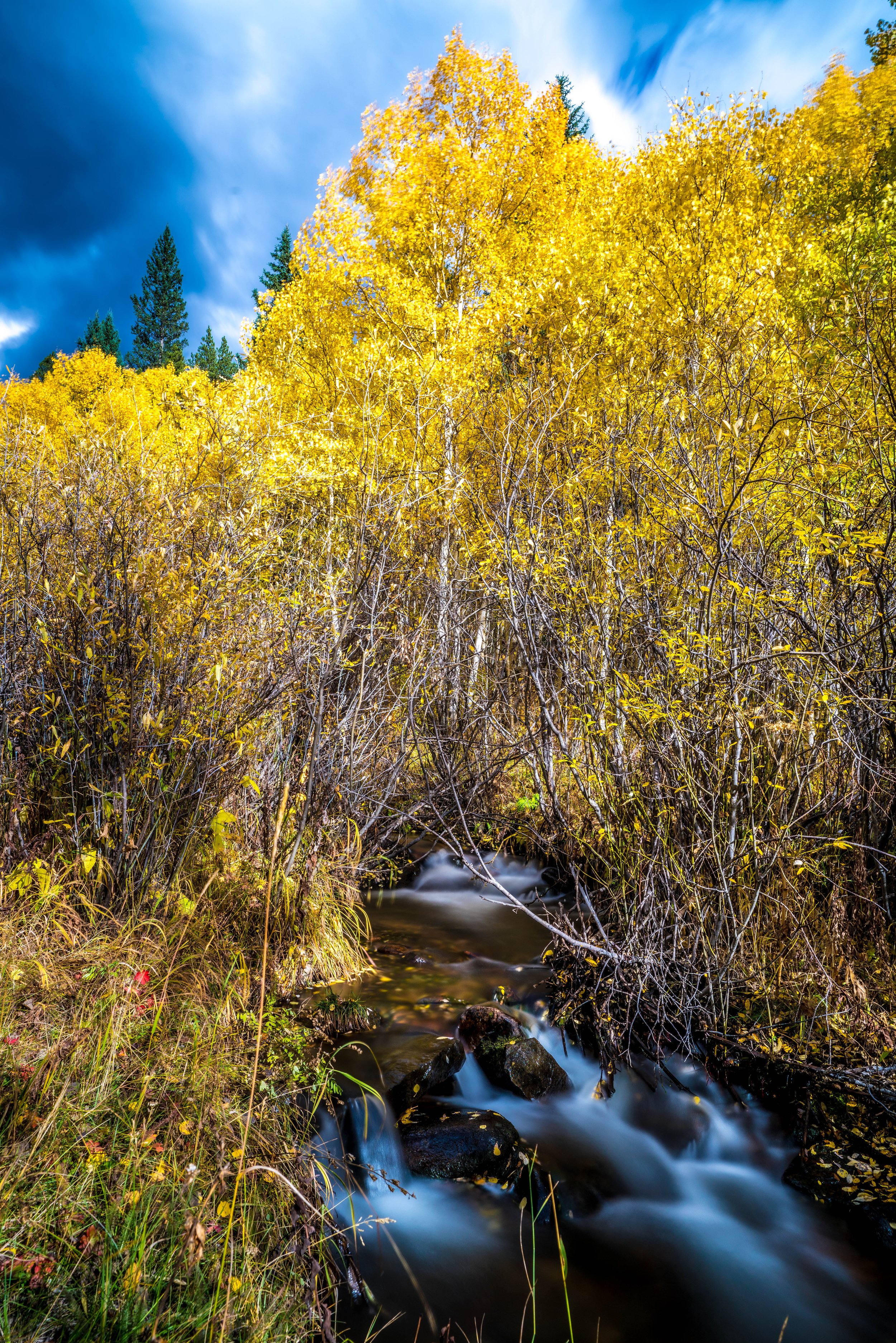
Snodgrass Mountain
For easily accessible and excellent views of Mt. Crested Butte, the Elk Mountains to the north, and beautiful sunsets, Snodgrass Mountain is your choice. In addition to its proximity to town, there are some fantastic aspen groves, which turn bright yellow in the fall. Some of the best scenery can be seen along the first mile of the trail, so feel free to shorten this to a quicker 45 or 90 minute hike.
-

Lone Eagle Peak
Cascade Creek Trail to Mirror Lake and Crater Lake is a 16 mile heavily trafficked out and back trail located near Tabernash, Colorado that features a waterfall and is rated as difficult. The trail offers a number of activity options and is best used from June until November. Dogs are also able to use this trail but must be kept on leash.
-

South Table Mountain Park
South Table Mountain Park combines panoramic mesa-top views, habitat for cliff-nesting raptors and proximity for many visitors to enjoy hikes, runs and rides. Stay on trail as undesignated paths degrade the mesa ecology or cross into areas where public access is not allowed. That includes the private property on which Golden landmark rock outcropping, Castle Rock, resides.
-

Emerald Lake
Emerald Lake is a short and sweet hike to one of the most picturesque high alpine lakes in the area. Just a short drive from town and you'll get a treat of beautiful emerald colored waters in a basin of steep pine and wildflower covered hillsides. This is a great place to spend the day, SUP or hang up a hammock with a view.
-
Snowmass Trail
West Snowmass Trail is a 16.8 mile moderately trafficked out and back trail located near Snowmass, Colorado that features beautiful wild flowers and is rated as difficult. The trail is primarily used for hiking, nature trips, and bird watching and is best used from May until September. Dogs are also able to use this trail but must be kept on leash.
-

Abbott Church
THE ABBOTT CHURCH IS A tiny nondenominational church about 100 miles east of Denver. The church is off the beaten path and stands in stark comparison to the surrounding farmlands. To truly understand why the church is so far off the beaten path, is to understand the history of the region. The Homestead Act of 1862, a law that gave willing settlers 160 acres of public land to make their new homes, brought hundreds of settlers to the area. After six years of cultivating the land, the settlers were then given ownership of the property.
-
Beaver Brook
Beaver Brook Trail is a 13.4 mile heavily trafficked out and back trail located near Golden, Colorado that features a lake and is rated as difficult. The trail offers a number of activity options and is best used from May until November. Dogs are also able to use this trail but must be kept on leash.
-

Berkeley Lake
Berkeley Lake Park Loop is a 1.1 mile moderately trafficked loop trail located near Wheat Ridge, Colorado that features a lake and is good for all skill levels. The trail is primarily used for walking, running, bird watching, and fishing. Dogs are also able to use this trail but must be kept on leash.
-

Booth Falls
Explore this 4.20 mile, out&back trail near Vail, Colorado. Generally considered a moderately challenging route, it takes an average of 2 h 37 min to complete. This is a very popular area for hiking and other nature trips, so you'll likely encounter other people while exploring. The trail is open year-round, but the best times to visit are May through October. Dogs are welcome, but must be on a leash.
-

Carter Lake
Carter Lake Sundance Trail is a 5.9 mile heavily trafficked out and back trail located near Berthoud, Colorado that features a lake and is good for all skill levels. The trail is primarily used for hiking, running, camping, fishing, and horses. Dogs are also able to use this trail but must be kept on leash.
-

Central City Masonic Cemetery
The Central City Masonic Cemetery Is One Of Colorado’s Spookiest Cemeteries. If you have a love of the spooky and paranormal, you are always on the lookout for creepy places to explore. Does this sound about right? If so, get ready to shake in your boots at the spooky and legendary Central City Masonic Cemetery. Tucked away between Central City and Black Hawk, the aptly named Central City Masonic Cemetery may seem innocent enough at first glance but is home to several downright disturbing legends.
-

Georgetown Loop Railroad
Located just off I-70 and only 45 miles west of Denver, the Georgetown Loop Railroad and Mining Park is one of Colorado’s most authentic living museums and historically immersive experiences. Bring your family and friends for a narrow gauge train ride, book a real silver mine tour, or learn how to pan for gold. Discover the rugged romance of the Colorado Rockies in the 1880s. Climb aboard and travel back in time. We may just become part of the colorful history and traditions of your family too!
-

Chatfield Reservoir
Float your boat in the lake, bicycle or hike on a trail that provides scenic views of the neighboring foothills and Platte River valley, camp, ride a horse and even fly a model airplane - all at Chatfield State Park, nestled next to the foothills southwest of Denver.
-

Cherry Creek Reservoir
Welcome to Denver’s natural and spacious backyard playground. There’s so much to see and enjoy. Summers are busy and action packed while off-peak times are quiet and laid back. Anchored around a 880 surface acre reservoir, the park offers a natural prairie environment of gentle, rolling hills and complete outdoor recreation facilities, including camping, picnicking and facilities for group events.
-

Crater Lakes
The Crater Lakes are a cluster of 5 lakes spread about a rugged valley that forms a major tributary to South Boulder Creek. They offer excellent fishing and diverse backcountry camping experiences apart from the crowds.
-

Crown Hill Lake
Crown Hill Lake Loop is a 1.3 mile heavily trafficked loop trail located near Wheat Ridge, Colorado that features a lake and is good for all skill levels. The trail offers a number of activity options and is best used from April until December. Dogs are also able to use this trail but must be kept on leash.
-

Dakota Ridge Trail
Dakota Ridge Trail is a 5.4 mile heavily trafficked out and back trail located near Golden, Colorado that features beautiful wild flowers and is rated as moderate. The trail is primarily used for hiking, walking, running, and nature trips. Dogs are also able to use this trail.
-

The Decalibron
The Decalibron: Mounts Democrat, Cameron, Lincoln, and Bross Trail is a 7 mile heavily trafficked loop trail located near Alma, Colorado that features a lake and is rated as difficult. The trail is primarily used for hiking and is best used from June until October. Dogs are also able to use this trail.
-

Devil's Head
Devil's Head Lookout Trail takes you to a distinct granite rock outcropping in the front range west of Castle Rock. The outcropping is clearly visible from Castle Rock to Woodland Park. It is also home to the only fire lookout tower in Colorado that is staffed by the National Forest Service. This grants it a spot on the National Register of Historic Places. It should also have a spot on your hiking list! The route offers historical significance, excellent views of the Rampart Range of the Rocky Mountains for 100 miles in all directions from the lookout tower, as well as a whole lot of fun!
-

Denver
Urban sophistication meets outdoor adventure in Denver. Get acquainted with The Mile High City, including history, transportation and neighborhood guides. Welcome to Denver where 300 days of sunshine, a thriving cultural scene, diverse neighborhoods and natural beauty combine for the world's most spectacular playground.
-

Grays and Torreys Peak
Grays and Torreys Peak is a 8.1 mile heavily trafficked out and back trail located near Idaho Springs, Colorado that features a river and is rated as difficult. The trail is primarily used for hiking and is best used from June until October. Dogs are also able to use this trail but must be kept on leash.
-
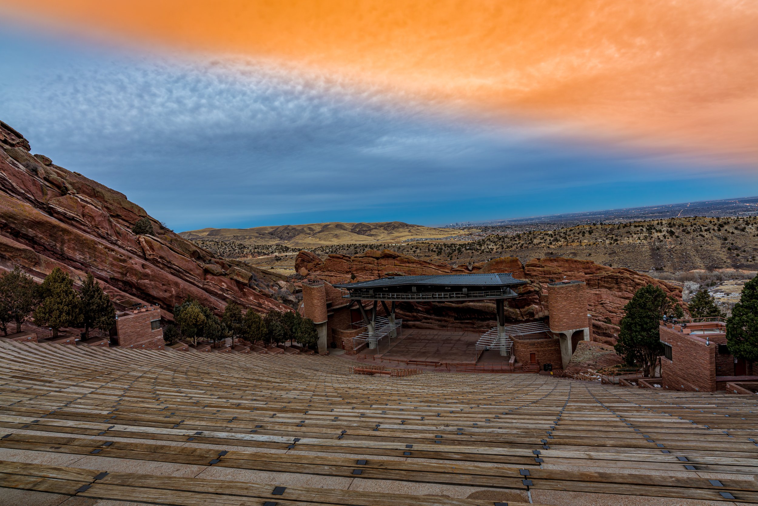
Red Rocks
If you think of Red Rocks Park as just a beautiful place to see a concert, think again! All around you are 738 total acres of deer, dinosaurs, pines and prairie, geological wonders and spectacular vistas. At 6,450 feet above sea level, Red Rocks Park is a unique transitional zone where the Great Plains meet the Rocky Mountains. The diverse environment allows visitors to see plants, birds and animals of both regions. Red Rocks Amphitheatre is a geological phenomenon – the only naturally-occurring, acoustically perfect amphitheatre in the world. From Sting and The Beatles, to opera stars and U2, every artist aspires to play on this magical, spiritual and emotional stage.
-

Hanging Lake
Hanging Lake Trail is one of Colorado's most visited and beautiful short hikes. Perched high in the mountains, the trail takes you along Dead Horse Creek and through the rocky Glenwood Canyon. It is a national natural landmark in the White River National Forest near Glenwood Springs, Colorado that can be reached easily from Denver.
-

Hells Hole
Hells Hole Trail is a 8 mile heavily trafficked out and back trail located near Idaho Springs, Colorado that features a river and is rated as moderate. The trail offers a number of activity options and is best used from March until October. Dogs are also able to use this trail but must be kept on leash.
-
Huron Peak
Huron Peak via North Huron Trail is a 6.6 mile heavily trafficked out and back trail located near Buena Vista, Colorado that features beautiful wild flowers and is rated as difficult. The trail is primarily used for hiking, running, and backpacking and is best used from May until September. Dogs are also able to use this trail but must be kept on leash.
-

Teddy's Winter Trail
Teddy’s is a great addition to the network of CBMBA groomed singletrack up at the Snodgrass/Gothic Trailhead area. Start by heading up Snodgrass road itself, and just before the road gets really steep the Winter Teddy’s turns off to the right and then does a 1-mile loop in some aspens and up and down some groovy terrain. Ride it both ways, and enjoy this great amenity brought to us by the CB Land Trust, the Town of Mt. Crested Butte, and Colorado Open Space.
You can also connect it with North Village via the trail connector off Snodgrass rd. Crazy fun going down, a bit of a beast going up, but connect it all and loop it up for mad mileage! Add in Gothic and Snodgrass Roads for big mileage!
-

Isak Heartstone
Isak Heartstone is a 15-foot tall wooden troll sculpture located on the Trollstigen Trail in Breckenridge, Colorado. The newly constructed trailhead is located in the southeast corner of the Stephen C. West Ice Arena parking lot, next to Illinois Gulch Trailhead.
-

James Peak
James Peak Trail is a 8 mile heavily trafficked out and back trail located near Black Hawk, Colorado that features a lake and is rated as difficult. The trail is primarily used for hiking, downhill skiing, and snowshoeing and is best used from June until October. Dogs are also able to use this trail but must be kept on leash.
-

La Plata Peak
La Plata Peak North Trail Summer Route is a 9.6 mile heavily trafficked out and back trail located near Twin Lakes, Colorado that features beautiful wild flowers and is rated as difficult. The trail offers a number of activity options and is best used from June until August. Dogs are also able to use this trail but must be kept on leash.
-

Longs Peak
Try this 14.80 mile, out&back trail near Allenspark, Colorado. Generally considered a challenging route, it takes an average of 9 h 22 min to complete. This is a very popular area for hiking and trail running, so you'll likely encounter other people while exploring. The trail is open year-round, but the best times to visit are April through November. You'll need to leave pups at home — dogs aren't allowed on this trail.
-

Lost Lake
Get to know this 4.00 mile, out&back trail near Nederland, Colorado. Generally considered a moderately challenging route, it takes an average of 2 h 10 min to complete. This is a very popular area for backpacking, camping, and fishing, so you'll likely encounter other people while exploring. The trail is open year-round and is beautiful to visit anytime. Dogs are welcome, but must be on a leash.
-
Mohawk Lakes
Mohawk Lakes are situated in the mountains south of Breckenridge, Colorado. Less than a 2-hour drive from Denver, this moderately demanding hike leads through pine and aspen forest, along a mountain stream, to a beautiful waterfall spilling over granite slabs. Breaking out above treeline at mile 3, hikers will arrive at Lower Mohawk Lake, and a bit further up the trail, can take in spectacular views of the neighboring mountain ranges at Upper Mohawk Lake.
-

Mt Belford
Mount Belford is a 8.1 mile heavily trafficked out and back trail located near Granite, Colorado that features beautiful wild flowers and is rated as difficult. The trail is primarily used for hiking, running, nature trips, and horses and is best used from May until October. Dogs and horses are also able to use this trail.
-
Mt Bierstadt
Discover this 7.80 mile, out&back trail near Idaho Springs, Colorado. Generally considered a challenging route, it takes an average of 5 h 1 min to complete. This is a very popular area for hiking, so you'll likely encounter other people while exploring. The trail is open year-round, but the best times to visit are May through October. Dogs are welcome, but must be on a leash.
-

Mt Elbert
Check out this 10.40 mile, out&back trail near Twin Lakes, Colorado. Generally considered a challenging route, it takes an average of 7 h 13 min to complete. This is a very popular area for hiking, so you'll likely encounter other people while exploring. The trail is open year-round, but the best times to visit are May through October. You'll need to leave pups at home — dogs aren't allowed on this trail.
-
Mt Evans
Mount Evans and Mount Spalding Trail is a 5.2 mile heavily trafficked out and back trail located near Georgetown, Colorado that features a lake and is rated as difficult. The trail is primarily used for hiking and rock climbing and is best used from April until November. Dogs are also able to use this trail but must be kept on leash.
-
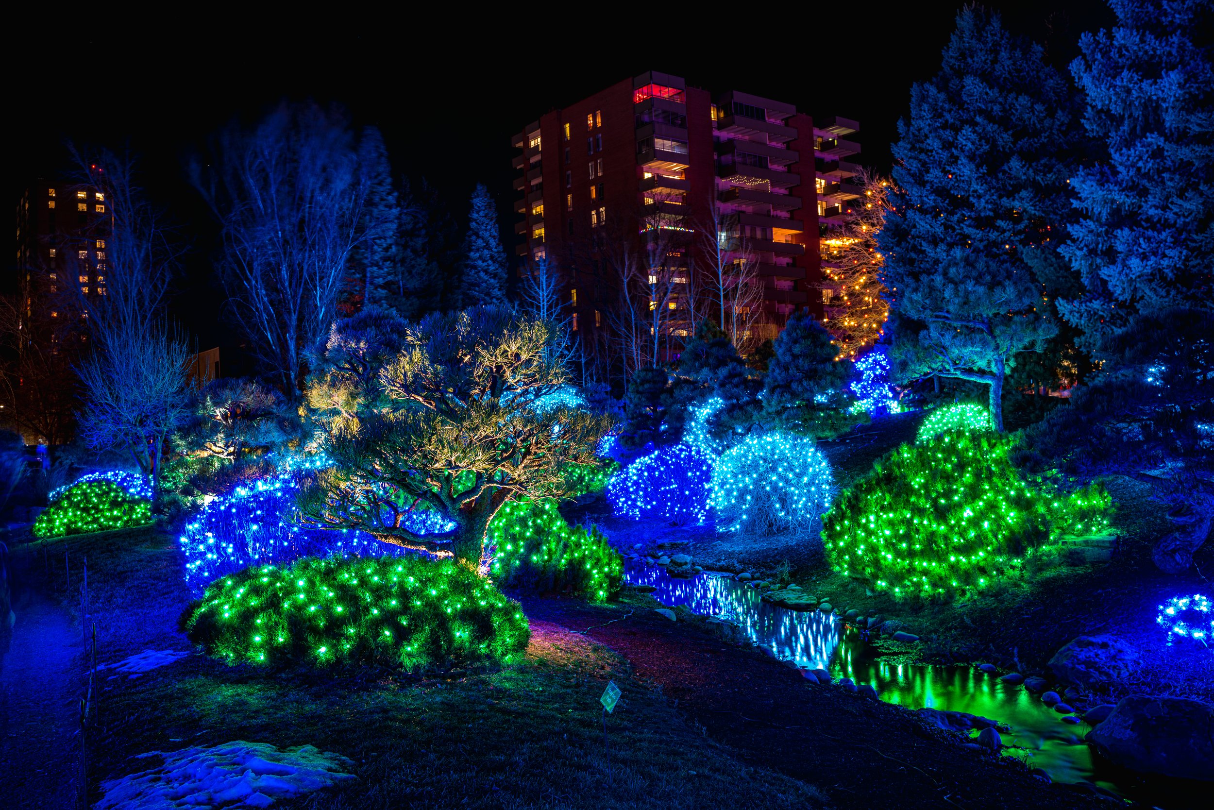
Denver Botanic Gardens
Denver Botanic Gardens is one of the most visited and well-loved botanical gardens in the United States. Accredited by the American Alliance of Museums, the Gardens’ living collections encompass specimens from the tropics to the tundra, showcasing a plant palette chosen to thrive in Colorado’s semi-arid climate. The Gardens’ York Street location is a dynamic, 24-acre urban oasis in the heart of the city, offering garden experiences for the whole family, as well as world-class education and plant conservation research programs. While most of the gardens highlight Colorado native plants, there are beautiful gardens designed to showcase plants from around the globe. Special events, art exhibits and guided tours take place throughout the year
-

Mt Falcon
Mount Falcon Castle Trail Loop is a 6.7 mile heavily trafficked loop trail located near Morrison, Colorado that offers the chance to see wildlife and is rated as moderate. The trail is primarily used for hiking, running, and horses and is best used from March until October. Dogs are also able to use this trail but must be kept on leash.
-

Mount Holy Cross and Halo Ridge
Mount of the Holy Cross via Halo Ridge Route is a 13.8 mile lightly trafficked out and back trail located near Minturn, Colorado that offers the chance to see wildlife and is only recommended for very experienced adventurers. The trail is primarily used for hiking, nature trips, and bird watching and is best used from May until September.
-

Denver City Park
Denver's premier regional park contains the Denver Zoo; the Denver Museum of Nature and Science and IMAX; tennis courts; horseshoes; baseball, football and soccer fields; two lakes; historical monuments and statuary; picnic sites and two playgrounds.
-

Mount Massive
Mount Massive Southwest Slopes Trail is a 7 mile heavily trafficked out and back trail located near Twin Lakes, Colorado that features beautiful wild flowers and is only recommended for very experienced adventurers. The trail is primarily used for hiking, nature trips, and bird watching and is best used from April until October. Dogs are also able to use this trail but must be kept on leash.
-

Clear Creek Trail
Clear Creek Trail is a 19.1 mile heavily trafficked point-to-point trail located near Golden, Colorado that features a lake and is good for all skill levels. The trail offers a number of activity options and is best used from March until October. Dogs are also able to use this trail but must be kept on leash.
-

Mount Shavano
Mount Shavano is a 9.3 mile moderately trafficked out and back trail located near Salida, Colorado that features beautiful wild flowers and is rated as difficult. The trail offers a number of activity options and is best used from April until September. Dogs are also able to use this trail but must be kept on leash.
-

Sloan's Lake
There’s no shortage of green space in Denver, and each of its more than 270 public parks has its own appeal. Sloan’s Lake Park, on the city’s western border, is The Mile High City’s second-largest park and claims the capital’s largest body of water. Legend has it that the lake was created accidentally when homesteader Thomas Sloan struck an aquifer while digging an irrigation well. Soon, his land was flooded with water, and Sloan’s Lake was formed. Originally the site of an amusement park (Ferris wheel included), it became a public park in 1923. Today, Sloan’s 290 acres are often filled with tennis players, water-skiers, SUPers, runners darting around the 2.6-mile path that encircles the water, and families enjoying the playgrounds. (And a healthy population of Canada geese.)
-

Mount Sherman
Mount Sherman from Iowa Gultch is a 4.4 mile moderately trafficked out and back trail located near Leadville, Colorado that offers scenic views and is rated as difficult. The trail is primarily used for hiking and is best used from June until October.
-

Mount Yale
Mount Yale Summit Trail is a 10.2 mile heavily trafficked out and back trail located near Buena Vista, Colorado that features a river and is rated as difficult. The trail is primarily used for hiking, running, camping, and snowshoeing and is best used from July until September. Dogs are also able to use this trail but must be kept on leash.
-

Pikes Peak
Pikes Peak via Barr Trail is a 25 mile heavily trafficked out and back trail located near Manitou Springs, Colorado that features a waterfall and is only recommended for very experienced adventurers. The trail offers a number of activity options and is best used from May until October. Dogs are also able to use this trail but must be kept on leash.
-

Quandary Peak
Quandary Peak Trail is a 6.6 mile heavily trafficked out and back trail located near Blue River, Colorado that features beautiful wild flowers and is rated as difficult. The trail is primarily used for hiking and snowshoeing and is accessible year-round. Dogs are also able to use this trail but must be kept on leash.
-

Rainbow Lakes
Rainbow Lakes Trail heads west from the Rainbow Lakes Trailhead located before the Rainbow Lakes Campground. It soon enters the Indian Peaks Wilderness. The trail is an easy, short hike up to the Rainbow Lakes, a series of small lakes and beaver ponds.
-

Great Sand Dunes
Open 24/7 year round! There are no reservations to visit or limit on the number of visitors in the park and preserve, but there is currently limited capacity in the visitor center. The tallest dunes in North America are the centerpiece in a diverse landscape of grasslands, wetlands, forests, alpine lakes, and tundra. Explore this website to learn more!
-

Staunton State Park
Staunton State Park opened to the public on May 18, 2013. The park is located approximately 40 miles southwest of downtown Denver, north of US Highway 285 and about six miles west of Conifer. The Park sits divided between Park and Jefferson counties, in Pine, Colorado.
-
Waterton Canyon
he winding dirt road trail of Waterton Canyon takes you along the South Platte River and into a canyon where you might spy some Bighorn sheep or catch the sight of massive eagles soaring on the warm air currents rising from the rock. It’s an out-and-back hike, and you have a lot of options, from a short hike in to have a picnic, all to way to 12.4-mile round-trip adventure to the Strontia Springs Dam. You can hike, bike, and fish on this hike near Denver. Explore the five different options we have detailed below. We’ll describe the location of a few destinations, including the best places to rest and have a picnic, and some of the other trails that join up with this Colorado canyon hike.
-

Kebler Pass
Kebler Pass is a terrific high-mountain pass connecting Crested Butte with Paonia to the west. It’s a gorgeous seasonal shortcut to Aspen in the Roaring Fork Valley.
The pass summits at 10,007 feet above sea level, passing through the Gunnison National Forest. It’s probably best known as one of the premiere spots to be blown away by the fall aspens. It’s home to one of the largest aspen groves in the United States, situated in the West Elk Mountains.