Continental Divide National Scenic Trail (CDT)
Colorado's highest long trail: roughly 750 miles of ridgeline, tundra and wilderness along the spine of the continent.
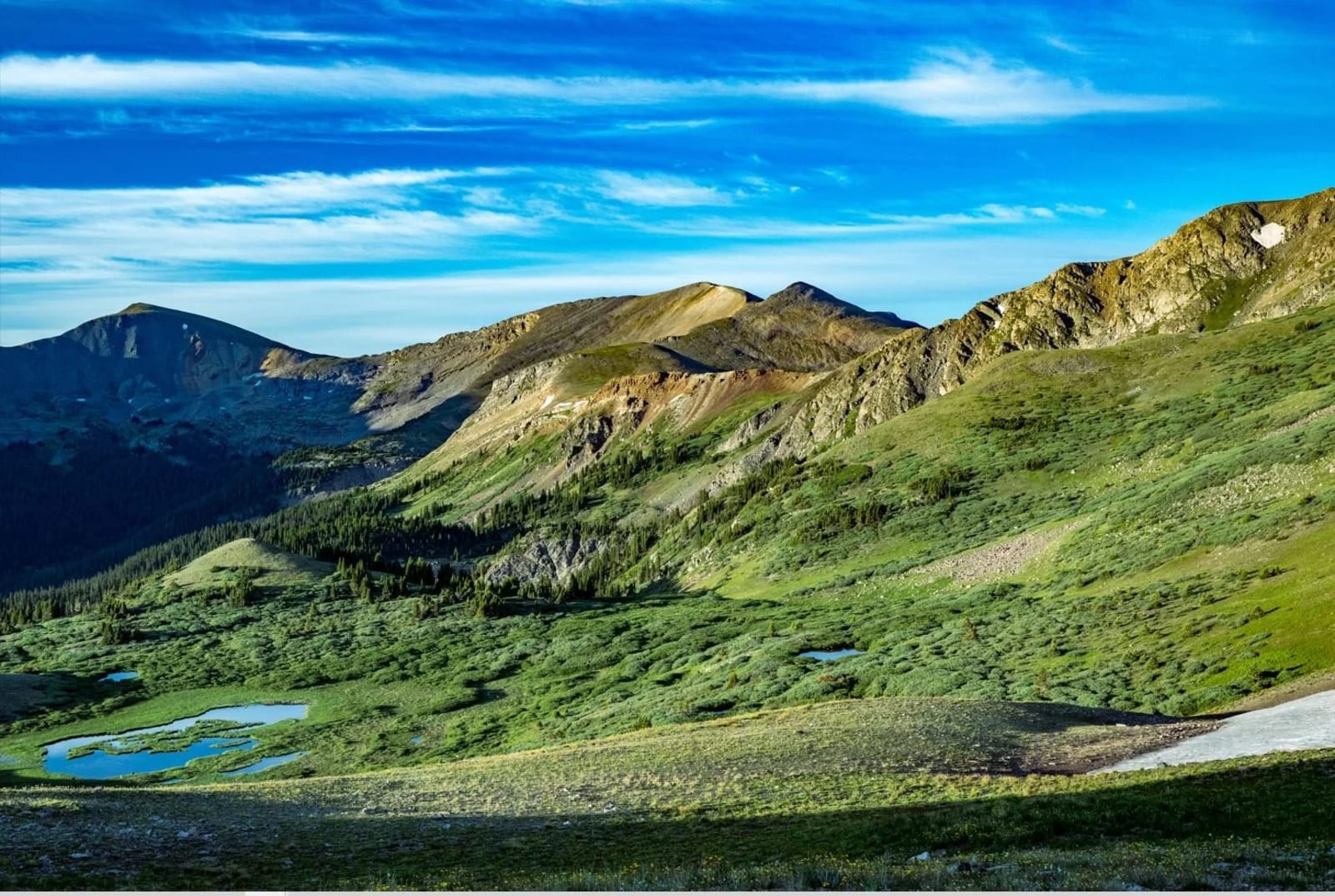
About Continental Divide National Scenic Trail
The Continental Divide National Scenic Trail runs about 3,000 miles from Mexico to Canada, and Colorado holds some of its highest and most dramatic miles. The trail's Colorado segment is usually given as roughly 735 to 750 miles, threading the San Juans, the Collegiate Peaks, the Front Range near Denver and the Never Summer and Mount Zirkel wildernesses before slipping into Wyoming.
You don't need to thru-hike to experience it. Plenty of Front Range trailheads put you on the CDT within an hour or two of Denver, including the stretch between Herman Gulch and Berthoud Pass off I-70. Much of the Colorado route sits above treeline, so a short day hike can deliver huge, wide-open tundra views.
For a photographer, the CDT is less a single spot than a thread connecting countless high viewpoints: wildflower ridges in July, golden tundra in September and long, layered ranges stacking toward the horizon at sunrise.
A continuous footpath tracing the spine of the Rockies from Canada to Mexico — one of the more ambitious conservation projects in the country. You don't need to hike the whole thing to appreciate a section of it; even a short stretch puts you on genuinely wild, undeveloped terrain, and ridge-walking sections often open up wide views in both directions at once.
History
The idea of a trail along the Continental Divide is credited largely to Jim Wolf, a Baltimore lawyer who had hiked the Appalachian Trail and who organized the Continental Divide Trail Society in 1978. Congress formally established the Continental Divide National Scenic Trail that same year, with the U.S. Forest Service as the lead managing agency.
The trail is still a work in progress, mixing purpose-built tread with dirt and paved road walks, and is one of the three long trails that make up hiking's Triple Crown alongside the Appalachian and Pacific Crest trails. In Colorado it reaches its highest point anywhere on the route at Grays Peak, just over 14,000 feet, and shares roughly 200 miles with the Colorado Trail.
Photographing Continental Divide National Scenic Trail
Best light: Sunrise is the prime time on the Divide: east-facing slopes catch first light and afternoon thunderstorms are less likely. Mid-July brings peak alpine wildflowers on many Front Range sections, while September turns the tundra gold and russet with fewer storms.
Shots to look for
- Layered ridgelines from a high saddle at sunrise with a telephoto (70-200mm) to compress the ranges
- The trail itself as a leading line snaking across open tundra, shot wide from a slight rise
- Wildflower foregrounds (columbine, paintbrush, alpine sunflowers) against distant peaks with a wide-angle lens close to the flowers
- Cairns or trail posts on the Divide silhouetted against a colorful pre-dawn sky
- Building storm clouds over the Divide in late morning, shot from a safe spot below the ridge
Photo tips
- Plan to be off exposed ridgelines by early afternoon in July and August; lightning is a real danger above treeline
- Pack a graduated ND filter or bracket exposures for bright skies over shaded valleys at sunrise
- Wind on the Divide can be strong; bring a sturdy tripod and hang your pack from the center column
- Drones are prohibited in designated wilderness and Rocky Mountain National Park, which cover a lot of the Colorado CDT
- Carry layers even in summer; temperatures at 12,000+ feet can drop fast when clouds roll in
Know before you go
- Snow lingers on many high sections into June or even July; inexperienced snow travelers should wait for melt-out
- Overnight permits are required in some areas, including Rocky Mountain National Park and Indian Peaks Wilderness (June 1 to September 15); check current rules with the land manager
- Large stretches are above treeline with no shelter from lightning, wind or hail
- Some segments are road walks or shared routes; check a current map before planning a point-to-point day
Frequently asked questions
How long is the Continental Divide Trail in Colorado?
The Colorado section is roughly 735 to 750 miles depending on the source and current routing. It is generally considered the highest and most mountainous part of the trail.
Where can I day hike the CDT near Denver?
One of the easiest options is the section between Herman Gulch and Berthoud Pass off I-70, about an hour from Denver. Many Front Range passes and trailheads also intersect the route.
When is the best time to hike the CDT in Colorado?
July through September is the most reliable window. Snow often covers high sections into June, and afternoon thunderstorms are common in July and August, so start early.
Combine it with
Berthoud Pass · Herman Gulch · Grays Peak · Indian Peaks Wilderness
More Colorado spots
Sources & further reading: en.wikipedia.org · cdtcoalition.org · hikingproject.com. Conditions, fees and rules change; check with the managing agency before you go.