Diamond Lake Trail
Waterfalls, wildflower meadows and a subalpine lake tucked beneath the Divide in the Indian Peaks.
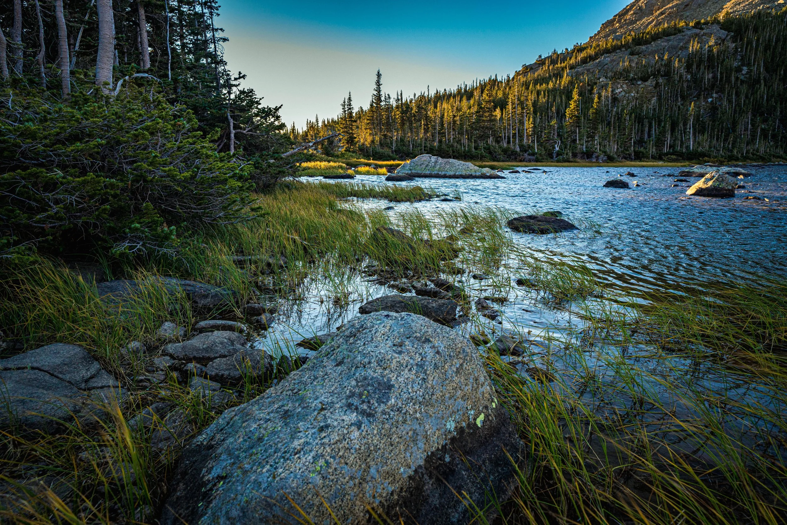
About Diamond Lake Trail
Diamond Lake is a classic Indian Peaks Wilderness day hike starting from the Fourth of July Trailhead above Eldora, west of Nederland in Boulder County. The route begins on the Arapaho Pass Trail, then branches left onto the Diamond Lake Trail at about 1.25 miles, passing a creekside waterfall and crossing a footbridge before the final climb to the lake.
The lake sits at roughly 10,900 feet in a bowl ringed by high ridges, and you'll see its outlet waterfall spilling down across the valley well before you arrive. Expect about 5 to 6 miles round trip and around 1,100 feet of gain to the lower lake.
In July the meadows along the way are some of the best wildflower displays on the Front Range. Strong hikers can continue off-trail-ish to Upper Diamond Lake for a more alpine setting.
Near Nederland, this 5.4-mile out-and-back leads to a lake and is rated moderate enough to stay approachable. It's open April through October and allows dogs on leash, with several other activity options along the way — the surrounding peaks catch good alpenglow on clear mornings if you're willing to start in the dark.
History
The Fourth of July Trailhead takes its name from the nearby Fourth of July Mine, a reminder of the mining era that also gave nearby Eldora its start; the old mine site is reached via the Arapaho Pass Trail beyond the Diamond Lake junction.
The area became part of the Indian Peaks Wilderness, designated by Congress in 1978. Because of heavy use, the Diamond Lake backcountry zone is one of several where camping is restricted to designated sites.
Photographing Diamond Lake Trail
Best light: Morning is best: you'll usually find calmer water for reflections and clearer skies before summer afternoon storms build over the Divide. Mid-July through early August is peak wildflower season; mid to late September adds golden willows and fewer people.
Shots to look for
- The Diamond Lake outlet waterfall from the trail across the valley with a 70-200mm
- Columbine and paintbrush in the meadow near the unnamed creekside waterfall, shot low and wide
- Diamond Lake from the rocks along the shore with the cirque walls behind, using a wide-angle
- Mount Neva and Jasper Peak views as the forest opens up early in the hike
- Intimate cascades below the footbridge with a slow shutter
Photo tips
- Parking fills very early on summer weekends, sometimes before 7 a.m.; arrive early or go midweek
- The access road is rough dirt; most cars can make it slowly but it is not paved
- Bring a polarizer for the lake and wet rocks, and an ND filter for the waterfalls
- Drones are prohibited in the Indian Peaks Wilderness
- The lakeshore is marshy; tread carefully to protect fragile vegetation
Know before you go
- Overnight camping requires an Indian Peaks permit June 1 to September 15, and camping at Diamond Lake is in designated sites only with bear canisters required
- Campfires are prohibited east of the Divide, including Diamond Lake
- Dogs must be on a hand-held leash at all times
- There are no restrooms at the Fourth of July Trailhead per the Forest Service; plan accordingly
- The road beyond Eldora is generally not drivable in winter
Frequently asked questions
How long is the Diamond Lake hike?
Plan on about 5.8 miles round trip with roughly 1,100 feet of elevation gain to the lower lake. Continuing to Upper Diamond Lake adds distance and requires some route-finding.
Do you need a permit to hike to Diamond Lake?
Small groups don't need a permit to day hike. Overnight camping from June 1 to September 15 requires an Indian Peaks Wilderness permit, and Diamond Lake has designated campsites only.
Can you drive to the Fourth of July Trailhead in any car?
The Forest Service describes the final roughly five miles as rough two-wheel-drive road. Go slowly; higher clearance helps.
Featured in: Best Alpine Lake Hikes in Colorado · Best Wildflower Hikes in Colorado · Colorado Waterfall Hikes
Combine it with
Arapaho Pass · Lost Lake · Lake Dorothy · Hessie Trailhead
More Colorado spots
Continental Divide National Scenic Trail (CDT) · Roxborough State Park · Sprague Lake Trail
Sources & further reading: fs.usda.gov · fs.usda.gov · denver7.com. Conditions, fees and rules change; check with the managing agency before you go.