Crater Lakes
A cluster of lakes beneath the Continental Divide, reached from the Moffat Tunnel's East Portal.
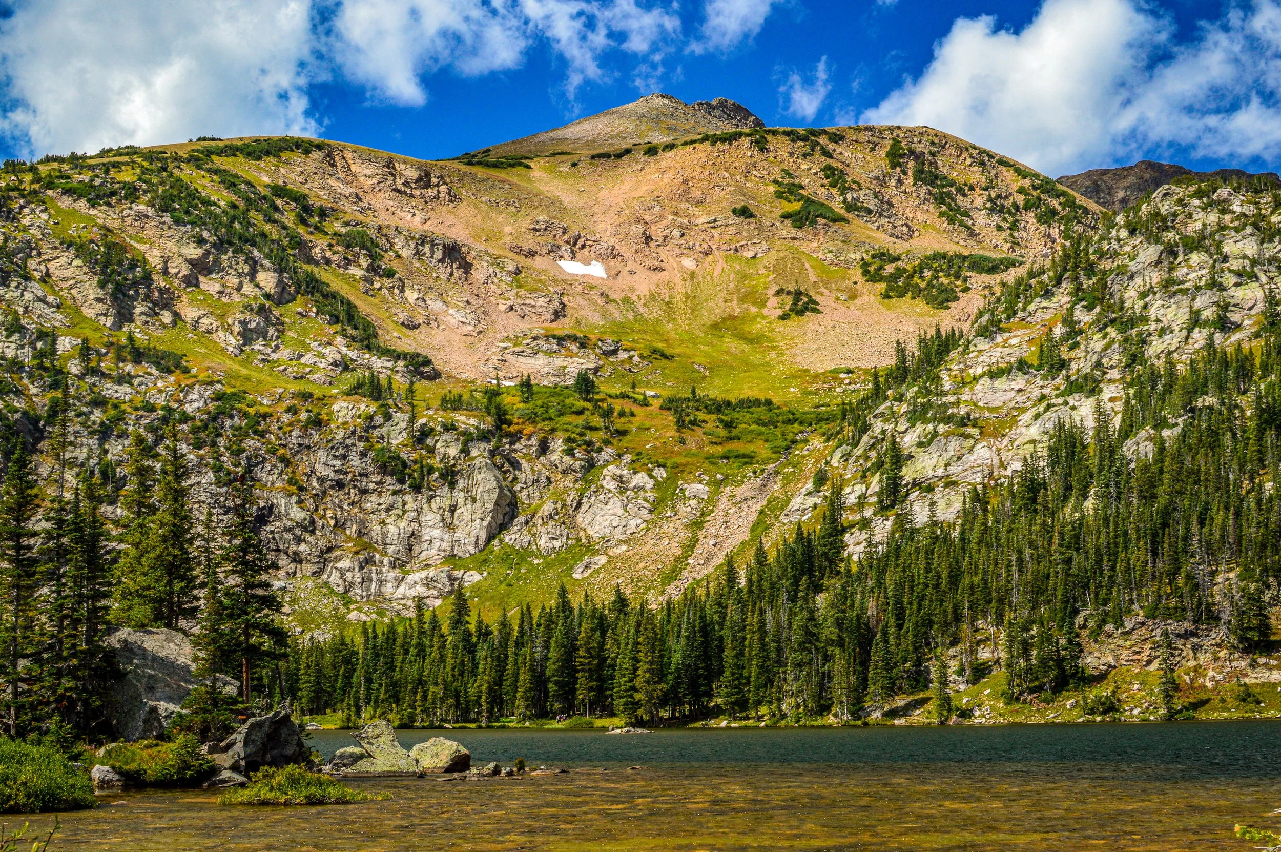
About Crater Lakes
The Crater Lakes sit in a cirque just below the Continental Divide in the James Peak Wilderness, immediately south of the Indian Peaks. The hike starts at the East Portal Trailhead west of Rollinsville, right beside the mouth of the Moffat Tunnel, and follows the South Boulder Creek Trail before branching up to the lakes.
The first two miles climb gently through forest and meadows, then the trail steepens for the final push to the two main lower lakes. Plan on roughly 6 miles round trip and about 1,400 to 2,200 feet of gain depending on how far you explore. Strong hikers can scramble higher to the upper lakes near a waterfall at their outlet.
The lakes sit near treeline with the rugged Divide wall rising behind them, making this a striking alpine destination only about an hour and a half from Denver.
Five lakes clustered in a rugged valley that feeds a major tributary of South Boulder Creek, offering solid fishing and backcountry camping well away from the more crowded trailheads nearby. Having five distinct lakes in one basin means you can chase whichever one has the best light without backtracking far.
History
The trailhead is defined by the Moffat Tunnel, a 6.2-mile railroad tunnel under the Continental Divide conceived by Colorado rail pioneer David Moffat. Moffat died in 1911 before he could fund it, and the tunnel finally opened in 1928, replacing the snowbound route over Rollins Pass. Trains still rumble through, and the big ventilation fans at the portal clear exhaust after they pass.
The land around the lakes became part of the James Peak Wilderness, created by Congress in the early 2000s and named for 13,294-foot James Peak. Remnants of old cabins and scattered metal debris along the trail hint at earlier human use of the valley.
Photographing Crater Lakes
Best light: Early morning is best for calm reflections of the Divide in the lower lakes, before wind and afternoon storms arrive. Mid-July brings wildflowers in the meadows along South Boulder Creek, and mid to late September adds golden willows and fewer crowds.
Shots to look for
- The Divide headwall reflected in the lower lakes from the shoreline, shot with a 16-35mm
- Wildflowers in the big meadow near the Forest Lakes junction with peaks behind
- The waterfall at the outlet of the upper lakes with a slow shutter
- Looking down on the lower lakes and valley from the scramble toward the upper lakes
- A passing train exiting the Moffat Tunnel at the trailhead for a bonus railroad frame
Photo tips
- The East Portal lot is large but fills on summer weekends; illegal parking gets ticketed
- Watch carefully for the Crater Lakes turnoff about 0.75 mi past the Forest Lakes junction; it's easy to miss
- Signed mileages are outdated; use a GPS map such as COTREX
- Bring a polarizer and ND filter for the lakes and waterfall
- Drones are prohibited in designated wilderness
Know before you go
- Reaching the upper lakes requires rock scrambling and route-finding
- Afternoon thunderstorms are common in summer near the Divide
- Restrooms are at the trailhead, but bring your own supplies
- Follow wilderness regulations; check the Boulder Ranger District for current rules
Frequently asked questions
How long is the Crater Lakes hike?
About 6 miles round trip to the main lower lakes, with roughly 1,400 to 2,200 feet of gain depending on the source and how far you go. The upper lakes add distance and a scramble.
Where does the Crater Lakes trail start?
At the East Portal Trailhead beside the Moffat Tunnel, west of Rollinsville. You follow the South Boulder Creek Trail before turning off for the lakes.
Is Crater Lakes in the Indian Peaks?
The lakes are in the James Peak Wilderness, which borders the Indian Peaks Wilderness to the north. The two are often lumped together.
Featured in: Best Alpine Lake Hikes in Colorado
Combine it with
Forest Lakes · Heart Lake · Rollins Pass · Rollinsville
More Colorado spots
Cherry Creek Reservoir · Crown Hill Lake · Teddy's Winter Trail
Sources & further reading: trails.colorado.gov · cmc.org · denver7.com · en.wikipedia.org. Conditions, fees and rules change; check with the managing agency before you go.