Three Mile Creek
A quiet, stream-laced valley climb off Guanella Pass Road into the southern Mount Blue Sky Wilderness.
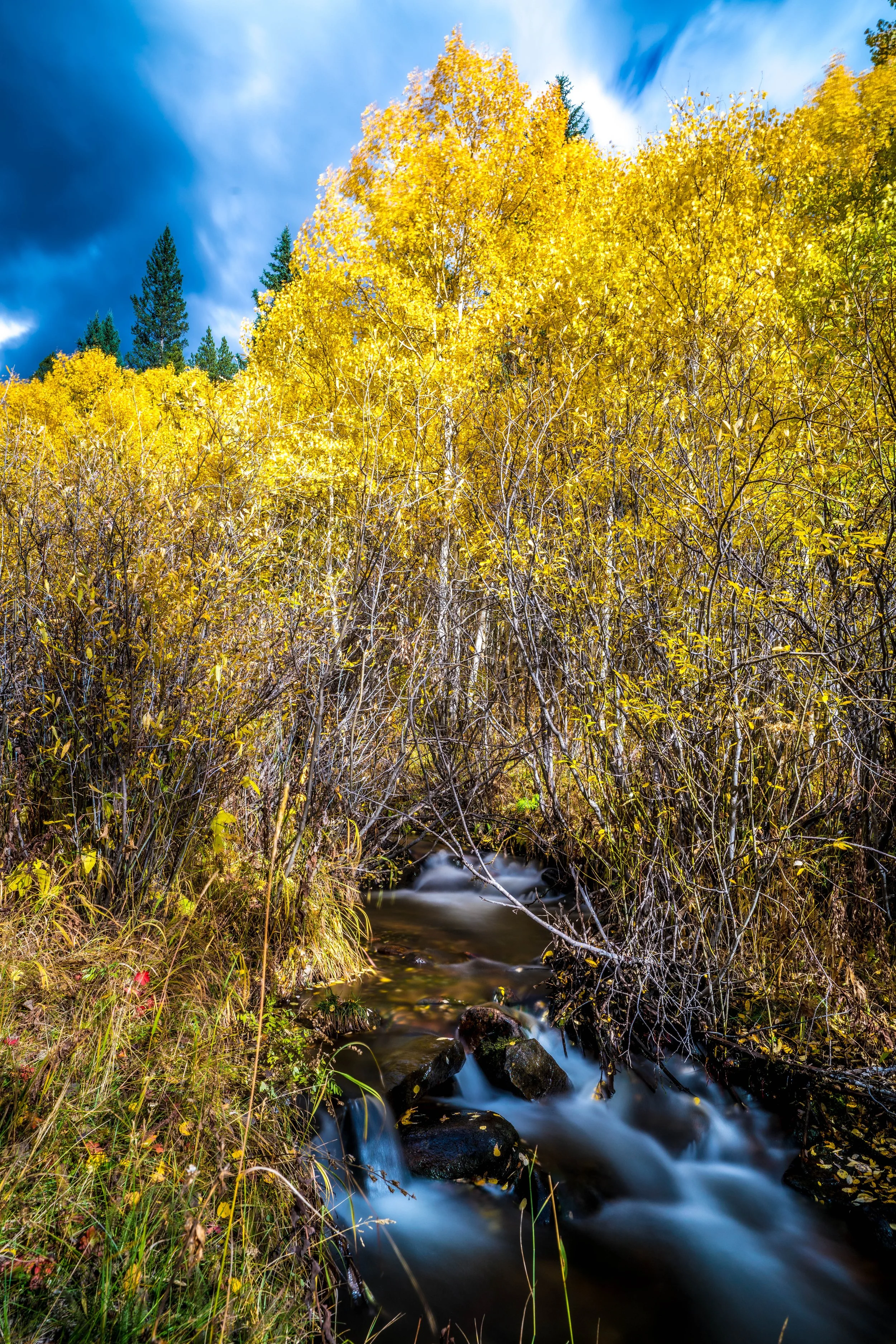
About Three Mile Creek
The Threemile Trail (Forest Service Trail #635) leaves Guanella Pass Road a few miles north of Grant and climbs along Threemile Creek into the southern edge of the Mount Blue Sky Wilderness (formerly Mount Evans Wilderness). It is a far quieter alternative to the crowded trailheads at the top of the pass.
From the trailhead near the Whiteside Picnic Area, the route follows Geneva Creek briefly, then turns up a narrow, forested valley with repeated creek crossings on simple log bridges. Higher up it switchbacks out of the trees into open meadows and tundra before eventually meeting the Rosalie Trail.
The trailhead sits around 9,000 feet, about 40 miles southwest of Denver via US-285 and Guanella Pass Road, making it an easy add-on to a Guanella Pass photo day.
Following a river for most of its 9.4 miles near Grant, this out-and-back trail allows horses as well as hikers and is rated moderate. Best from May through October, with dogs welcome on leash — the creek stays close to the trail nearly the whole way, so a slow-shutter water shot is never far off.
History
The trail lies within the Pike National Forest's South Platte Ranger District and provides access to the southern part of the wilderness long known as the Mount Evans Wilderness. In 2023 Mount Evans was officially renamed Mount Blue Sky, and the wilderness name followed.
When Guanella Pass Road was improved, the Forest Service moved the Threemile trailhead about a half mile south of its original location, to the Whiteside Picnic Area. The broader Guanella Pass corridor connects the old mining towns of Georgetown and Grant and is a designated scenic byway.
Photographing Three Mile Creek
Best light: The narrow valley stays shaded early and late, so mid-morning to early afternoon gives the best light on the creek. Late September brings golden aspen along Guanella Pass Road on the drive in, and July wildflowers fill the upper meadows.
Shots to look for
- Slow-shutter cascades along Threemile Creek with moss and fallen logs as foreground, using a 16-35mm
- Rustic log footbridges as a leading element through the forest
- The broad upper meadow around 10,500 feet with surrounding ridges, shot wide with wildflowers in front
- Intimate forest details (lichen, roots, creek-polished stones) on overcast days with a macro or short telephoto
Photo tips
- Bring a polarizer to cut glare on wet rocks and a 3-6 stop ND for silky water in the creek
- Expect several creek crossings; waterproof boots help in early summer runoff
- Combine with sunrise or sunset at Guanella Pass, a short drive north
- Drones are not allowed in designated wilderness
Know before you go
- Fill out the free, mandatory wilderness permit at the trailhead register box
- No water is available at the trailhead; treat any creek water
- Guanella Pass Road can have seasonal snow closures and chain requirements; check conditions before driving
- Fire restrictions are common in Pike National Forest; check current rules with the South Platte Ranger District
Frequently asked questions
Do you need a permit to hike Three Mile Creek?
Yes, but it's free. You fill out a self-issued wilderness permit at the register box at the trailhead and carry your copy.
Where is the Three Mile Creek trailhead?
It's at the Whiteside Picnic Area on Guanella Pass Road (Park County Road 62), about 2.5 miles north of Grant off US-285.
Is the trail open in winter?
The Forest Service lists it as a year-round trail, and it's used for snowshoeing and cross-country skiing. Expect snow and ice in the narrow valley.
Combine it with
Guanella Pass · Geneva Creek · Rosalie Trail · Mount Bierstadt
More Colorado spots
Central City Masonic Cemetery · Dakota Ridge Trail · Lost Lake
Sources & further reading: fs.usda.gov · summitpost.org · cmc.org. Conditions, fees and rules change; check with the managing agency before you go.