Dakota Ridge Trail
A rocky hogback ridge walk above Morrison, with Red Rocks on one side and the Denver skyline on the other.
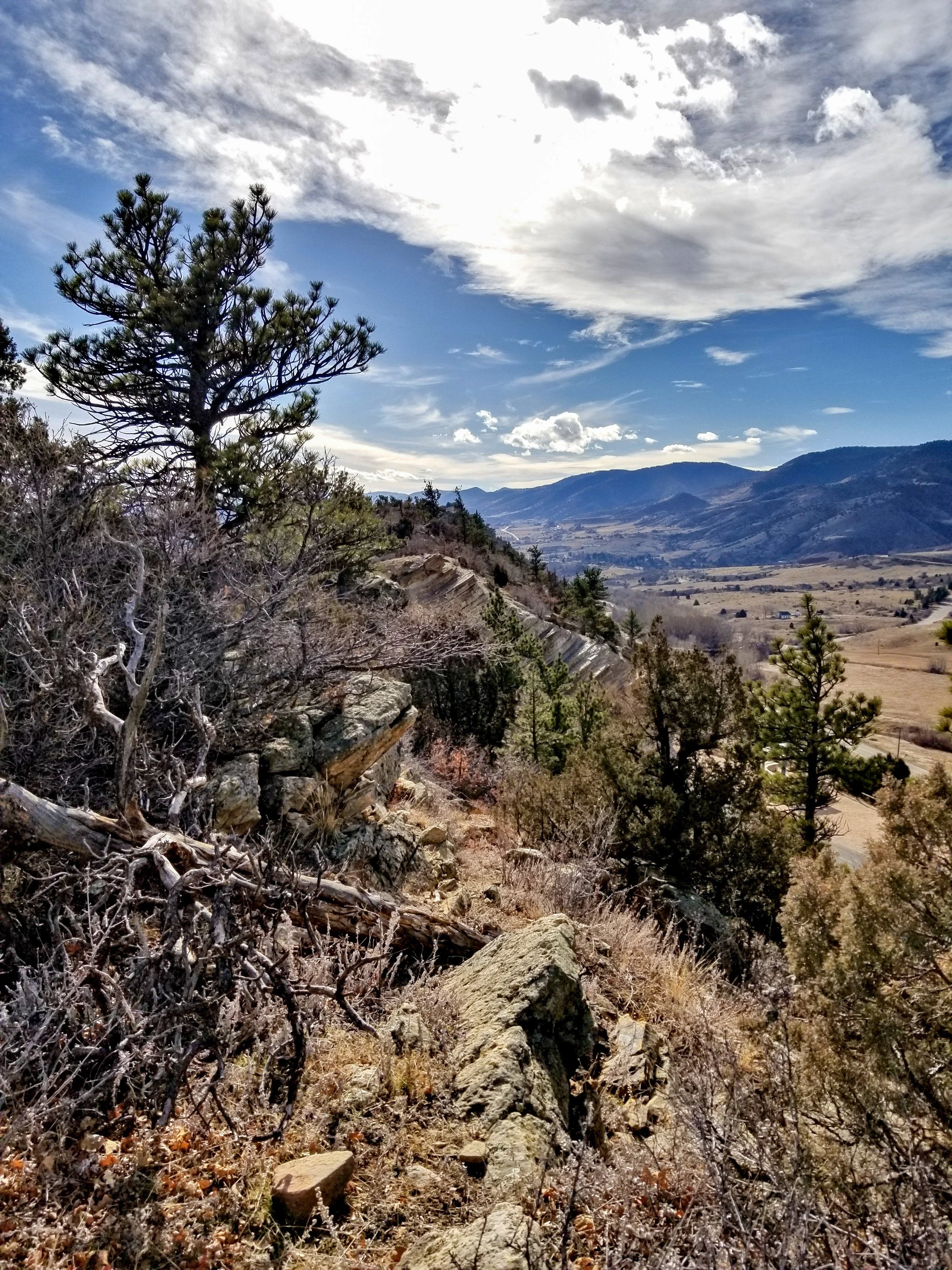
About Dakota Ridge Trail
The Dakota Ridge Trail runs along the crest of the Dakota Hogback in Matthews/Winters Park, a Jefferson County Open Space park just south of I-70 near Golden and Morrison. Every access point starts with a stiff climb. After that, the trail follows the spine of the ridge for about two miles, with a few short scrambles over tilted sandstone.
The Colorado Mountain Club lists the trail at about 4.25 miles with roughly 750 feet of gain. You can reach it from the Stegosaurus lot just south of I-70 exit 259 or from access points along Rooney Road. It's a mixed-use trail, so expect plenty of mountain bikers.
Photographically, few places this close to Denver are so open. Looking west, you see the red sandstone fins of Red Rocks Park against the foothills. Looking east, the plains run out to the downtown skyline.
A 5.4-mile out-and-back near Golden rated moderate, with wildflowers along the route and steady use from hikers, walkers, and runners. Dogs are welcome here — the ridge's tilted sandstone slabs make for striking leading lines pointing straight toward the Front Range peaks behind them.
History
The ridge is part of the Dakota Hogback, which runs along the base of the Front Range. Hard Cretaceous Dakota sandstone forms its crest, and the softer layers around it have eroded away. Its name comes from its resemblance to the bristled back of a razorback hog.
The southern end of the same ridge is Dinosaur Ridge, one of Colorado's most important fossil sites. In 1877 Arthur Lakes found dinosaur bones there in the Jurassic Morrison Formation, and excavation began that year under paleontologist O.C. Marsh. In 1937, WPA crews building Alameda Parkway uncovered dinosaur tracks on the ridge's east face. The area was designated a National Natural Landmark in 1973.
Photographing Dakota Ridge Trail
Best light: Sunrise is the classic time here. The first light hits the east-facing sandstone of the hogback and the red fins of Red Rocks to the west, while the city glows behind you. Sunset gives you silhouettes of the foothills and sometimes city lights coming on to the east. Green grass in spring and snow-dusted red rock in winter are both strong.
Shots to look for
- From the crest, shoot west with a 24-70mm, using the tilted ridge-top slabs as foreground and the Red Rocks fins and foothills beyond.
- At blue hour, use a telephoto from the ridge to compress the downtown Denver skyline across the plains.
- Shoot along the ridge spine with a wide lens so the trail and the jagged sandstone teeth form a leading line.
- On days with mountain-bike traffic, frame a rider cresting the rocks against open sky to show scale.
- In winter, look for snow lingering on the north-facing ledges against red rock.
Photo tips
- Expect many mountain bikers and check Jeffco's designated-use rules. A 0.8-mile Dakota Ridge South segment is bike-only.
- The ridge is fully exposed, with no shade and real wind. Carry water and secure your tripod.
- Trailhead parking near I-70 fills early on weekends. Come for sunrise or on a weekday.
- A free summer weekend shuttle (Westracks) has linked Matthews/Winters, Dinosaur Ridge and Red Rocks. Check whether it's running this season.
- Don't touch or collect fossils or tracks on the Dinosaur Ridge end.
Know before you go
- Every access point starts with a steep climb, and there's minor scrambling along the crest.
- The trail is shared with mountain bikers, and some nearby segments have designated-use rules. Check Jeffco Open Space's current map.
- Rattlesnakes and summer lightning are real hazards on this exposed ridge. Get off early if storms build.
- Check Jeffco Open Space for current hours and dog rules. Dogs are prohibited on the nearby Mount Morrison trail.
Frequently asked questions
How hard is the Dakota Ridge Trail?
It's moderate. The climb up is steep, there are short rocky scrambles along the crest, and the total is roughly 750 feet of gain over about 4 miles.
Where do you park for Dakota Ridge?
Use the Stegosaurus lot just south of I-70 exit 259 at Matthews/Winters Park, or the access points along Rooney Road.
Is Dakota Ridge the same as Dinosaur Ridge?
Both are parts of the same Dakota Hogback. Dinosaur Ridge, with its tracks and visitor center, is at the southern end along Alameda Parkway.
Featured in: Photography Spots Near Denver
Combine it with
Red Rocks Park · Dinosaur Ridge · Golden · Clear Creek Trail
More Colorado spots
Sources & further reading: cmc.org · jeffco.us · en.wikipedia.org. Conditions, fees and rules change; check with the managing agency before you go.