Gore Range (general)
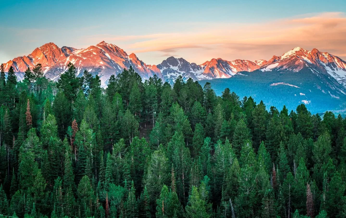
Colorado's most jagged range: knife-edge ridges, hidden alpine lakes and the rugged Eagles Nest Wilderness.
About Gore Range
The Gore Range runs northwest from Vail toward Gore Canyon on the Colorado River, with the Blue River valley and Silverthorne along its eastern flank. It's a compact, steep range where peaks hover around 12,000 to 13,000 feet, topped by Mount Powell at 13,566 feet.
Much of the range is protected in the Eagles Nest Wilderness, more than 130,000 acres with about 180 miles of trail, most ending at alpine lakes. The terrain is famously vertical: sheer faces, narrow ridges, deep valleys and spiky summits.
For photographers, the Gore offers easy roadside views from I-70 and the Silverthorne area, plus some of the most dramatic backcountry lakes in the state for those willing to hike. Classic access points include Piney Lake near Vail and the Cataract Lake area near Green Mountain Reservoir.
A jagged, largely trail-less range running roughly from Vail Pass to Kremmling, named for the Irish nobleman who financed an infamous 1850s hunting expedition through the area. Unlike more accessible ranges nearby, the Gore's serrated ridgeline is best photographed from a distance — Willow Lakes, Silverthorne, or Ptarmigan Peak all offer strong vantage points without requiring technical climbing to get close.
History
The Ute called the range the Shining Mountains. The current name honors Sir St George Gore, an Irish baronet who hunted extensively in the area in the 1850s with guide Jim Bridger.
Geologically, the Gore is a fault-block range of ancient Paleoproterozoic granite, gneiss and schist, bounded by the Gore fault on the west and the Blue River fault on the east. Pleistocene glaciers carved its U-shaped valleys, cirques and sharp aretes. Congress designated the Eagles Nest Wilderness in 1976, and gold was once found near Piney Lake.
Photographing Gore Range
Best light: From the Blue River side around Silverthorne, the range faces east, so sunrise lights the jagged skyline while the valley is still blue. Late September aspens around Piney Lake and the Vail side, and snowy ridges in late fall, are standout seasons.
Shots to look for
- The serrated Gore skyline at sunrise from the Blue River valley north of Silverthorne, 70-200mm to compress the spires
- Piney Lake with the Gore peaks behind, morning reflections, 16-35mm
- Alpine lakes below cirque walls deep in the Eagles Nest Wilderness
- Fall aspens on the Vail side with snow-dusted ridges above
- Moonset or alpenglow over the range from Dillon Reservoir
Photo tips
- Wilderness rules apply: no drones, no bikes, group size limits; check current Forest Service regulations
- Many Gore routes are steep and rough with off-trail scrambling; know your limits
- Trailheads near Vail fill early on summer weekends
- Afternoon storms are common in summer; plan high shots for mornings
- Bring bear-aware food storage on overnight trips
Know before you go
- Off-trail travel in the Gore is difficult and foot travel can be strenuous
- Eagles Nest Wilderness follows standard wilderness regulations; check for any permit or campsite rules before backpacking
- Some access roads, like the road to Piney Lake, are rough dirt and close seasonally
Prints from Gore Range
Every photo is available as a print on metal, canvas, wood or fine art paper.

Frequently asked questions
What is the highest peak in the Gore Range?
Mount Powell, at 13,566 feet.
Who is the Gore Range named after?
Sir St George Gore, an Irish baronet who led a long hunting expedition through the area in the 1850s with guide Jim Bridger.
Where can I see the Gore Range without hiking?
The Blue River valley around Silverthorne and the I-70 corridor offer good roadside views, and Piney Lake near Vail is a short drive on a dirt road.
Combine it with
Piney Lake · Silverthorne · Vail · Green Mountain Reservoir
More Colorado spots
Sources & further reading: en.wikipedia.org · wilderness.net · en.wikipedia.org. Conditions, fees and rules change; check with the managing agency before you go.