Hoosier Pass
An 11,542-foot Continental Divide crossing between Breckenridge and Alma with tundra ridges right off the pavement.
About Hoosier Pass
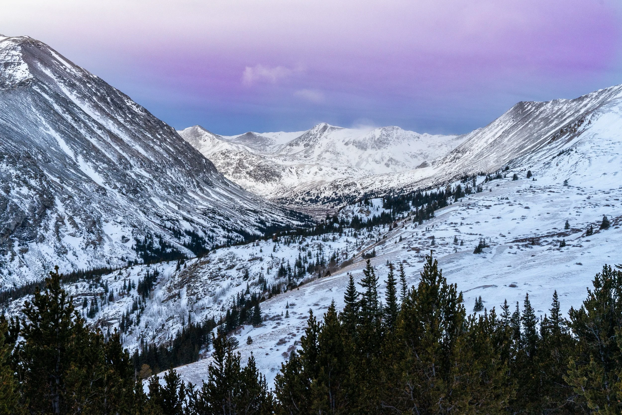
Hoosier Pass carries Colorado Highway 9 over the Continental Divide at 11,542 feet, linking Breckenridge in Summit County with Alma and Fairplay in Park County. It sits at the northern end of the Mosquito Range, between Mount Lincoln to the west and Hoosier Ridge to the east, and the road is generally kept open year-round.
The summit has a large parking area and the classic Continental Divide sign, and it doubles as a high trailhead. Routes lead west up the long east ridge of North Star Mountain and east onto Hoosier Ridge, putting you above treeline almost immediately.
For photographers it's an easy roadside stop with real alpine scale, plus quick access to sweeping views north toward the Tenmile Range and south into South Park. It's roughly two hours from Denver via I-70 and Highway 9.
An 11,542-foot pass on the Continental Divide between Alma and Breckenridge, sitting on the border of Park and Summit counties in the Mosquito Range. It also happens to be the highest point on the entire TransAmerica bicycle route, which runs coast to coast between Oregon and Virginia — the summit's wide-open sightlines make it a solid stop for both sunrise color and night sky work in the same visit.
History
The pass takes its name from Hoosier Gulch, a placer mining camp worked around 1860 by miners from Indiana, the Hoosier State. The surrounding Mosquito Range was heavily mined, and old mine sites still dot the slopes of North Star Mountain.
Hoosier Pass is also notable in Colorado water history. Ditches carrying water across the Divide here were operating by 1929, and Colorado Springs later built the Hoosier Pass Tunnel, completed in 1951, which feeds Montgomery Reservoir just southwest of the pass. Cyclists know it as the high point of the cross-country TransAmerica Trail bike route.
Photographing Hoosier Pass
Best light: Sunrise and sunset both work: the ridgelines on either side catch warm side light, and from the slopes above the pass you can look north down the Blue River valley toward the Tenmile Range. July brings tundra wildflowers; late September turns the willows and grasses gold.
Shots to look for
- The Continental Divide sign with snowy peaks behind for a classic road-trip shot
- North Star Mountain's ridge as a leading line from a short walk west of the parking area
- Telephoto layers of the Mosquito and Tenmile ranges from the slopes of Hoosier Ridge
- Montgomery Reservoir below North Star from the south side of the pass
- Winter wind-sculpted snow and cornices along the ridges after a storm
Photo tips
- Wind at the pass can be fierce; weight your tripod and protect gear from blowing snow
- Afternoon thunderstorms are common in summer and the ridges offer no shelter
- Respect private mining claims and posted signs around North Star Mountain
- Check CDOT road conditions in winter; storms can temporarily close the pass
- Breathing is noticeably harder at 11,500+ feet; pace yourself on the ridge hikes
Know before you go
- Parking is on the west side of Highway 9 at the summit
- Much of the terrain around the pass includes private mining claims; access can change, so obey signs
- Weather above treeline changes fast; carry layers even in summer
- Winter conditions bring avalanche terrain on surrounding slopes; check CAIC forecasts if venturing off the road
Prints from Hoosier Pass
Every photo is available as a print on metal, canvas, wood or fine art paper.

Frequently asked questions
How high is Hoosier Pass?
Hoosier Pass sits at 11,542 feet on the Continental Divide along Colorado Highway 9.
Is Hoosier Pass open in winter?
Generally yes. It's a year-round highway, though winter storms can close it temporarily. Check CDOT conditions before you go.
What hikes start at Hoosier Pass?
The pass is the trailhead for the east ridge of North Star Mountain (about 7.8 miles round trip) and for routes onto Hoosier Ridge, both above treeline.
Featured in: Winter Photography Spots in Colorado
Combine it with
Breckenridge · Alma · Quandary Peak · Montgomery Reservoir
More Colorado spots
Sprague Lake Trail · Buffalo Herd Nature Preserve · Lookout Mountain
Sources & further reading: en.wikipedia.org · climb13ers.com · summitpost.org. Conditions, fees and rules change; check with the managing agency before you go.