← All themes · All hikes and spots
Winter Photography Spots in Colorado
Winter strips the landscape down to shape and light, and some of these spots are quieter and more beautiful in January than in July. These are places that stay accessible in winter, either by plowed road or a popular snowshoe route.
Tip: Check CDOT and avalanche conditions before you go, carry traction, and keep spare batteries in an inside pocket; cold drains them fast. Overexpose snow slightly so it stays white, not gray.
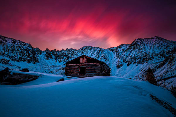
1.Mayflower Gulch
A short walk from Highway 91 to old mining cabins under a wall of Tenmile Range peaks.
Distance: About 3-6 mi round trip, depending on how far you go · Elevation gain: About 500-1,200 ft · Trailhead elevation: About 11,000 ft
Best light: The peaks ring the gulch to the east and south of the cabins, so their faces take warm side and front light late in the day and at sunset alpenglow, while sunrise gives softer backlit and side-lit scenes. Wildflowers peak in July into early August, and winter scenes with snow-loaded cabins are among the best here.
Full guide →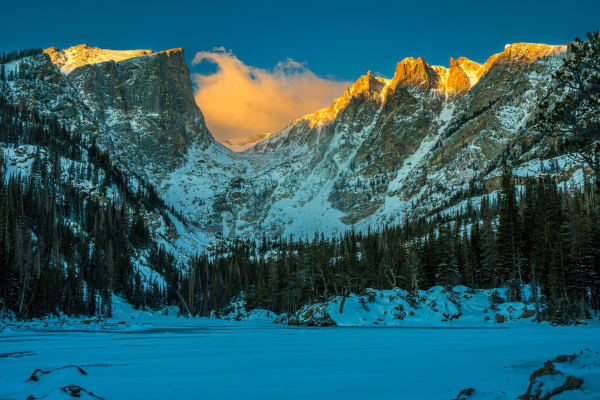
2.Dream Lake
Rocky Mountain National Park's postcard lake, framed by Hallett Peak and Flattop Mountain.
Distance: 2.2 mi round trip · Elevation gain: About 425 ft · Lake elevation: About 9,900 ft
Best light: Sunrise is the classic: you look west up the lake as first light turns Hallett Peak orange while the water is often glassy. Arrive well before sunrise for a calm surface. Late September brings golden grasses and occasional early snow; winter offers frozen shoreline textures and far fewer people.
Full guide →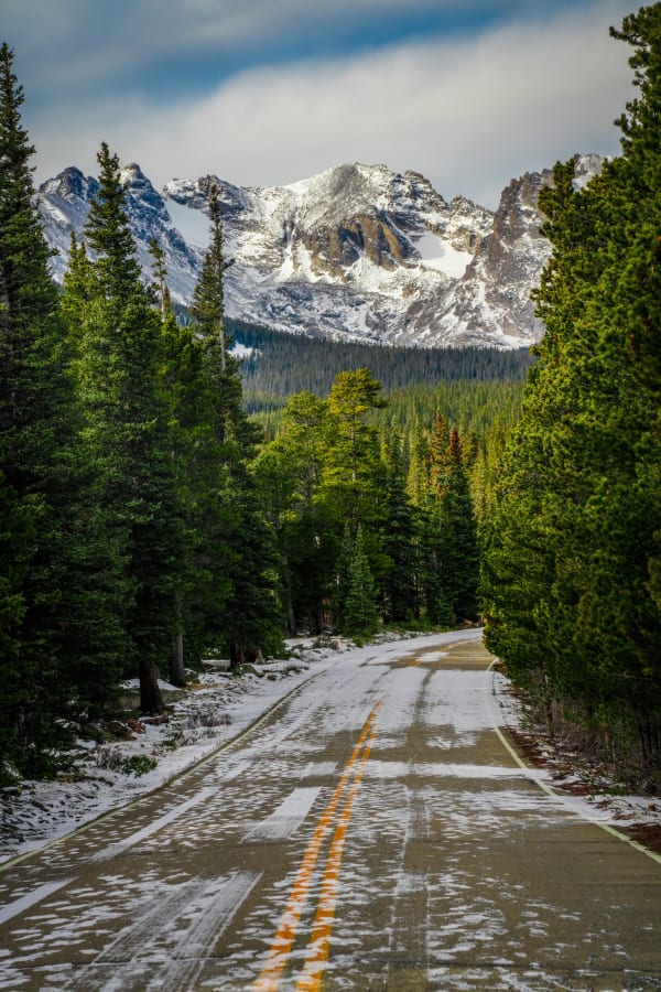
3.Brainard Lake Recreation Area
The Indian Peaks skyline reflected in a subalpine lake, an hour and change from Denver.
Elevation: About 10,600 ft · Access: Brainard Lake Road west from CO 72 at Ward · Fees/permits: Timed-entry reservation to park inside (Recreation.gov); $10 day-use fee to walk or bike in from Gateway
Best light: Sunrise is the classic: the peaks to the west catch first alpenglow while the lake is often glassy before the wind rises. Late September brings golden willows and a chance of early snow on the summits; winter offers snowy solitude on skis or snowshoes.
Full guide →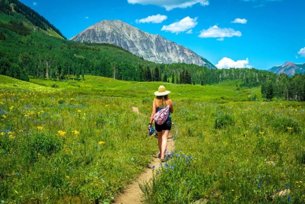
4.Teddy's Winter Trail
A short groomed loop through Snodgrass aspens above Crested Butte, built for fat bikes and snowshoes.
Distance: About a 1 mi loop · Elevation: Roughly 9,700 to 9,800 ft · Uses: Groomed for fat biking; also used by snowshoers
Best light: Late afternoon is ideal. The low winter sun rakes through the aspens and throws long blue shadows across the groomed track. On bluebird mornings after fresh snow, the trunks and flocked branches look their cleanest. In fall, come back for the summer Teddy's Trail, when its aspens turn gold, usually around late September.
Full guide →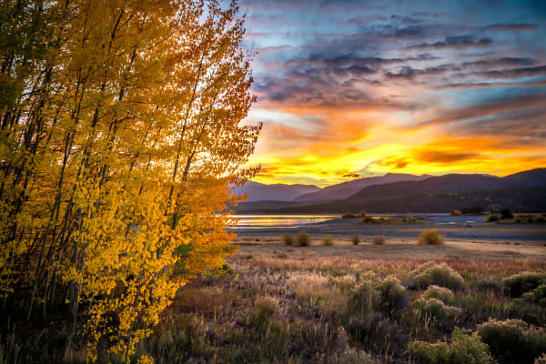
5.Lake Dillon
Summit County's big blue reservoir, ringed by the Tenmile and Gore ranges and three mountain towns.
Lake elevation: About 9,017 ft · Shoreline: About 27 mi · Completed: 1963
Best light: Sunrise from the Dillon side lights the Tenmile Range and the peaks above Frisco across the water; sunset from the Frisco Peninsula or Sapphire Point backlights the Gore Range. Calm water is most likely at dawn, and late September brings aspen on the surrounding hills plus the first snow on the peaks.
Full guide →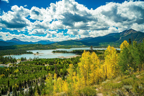
6.Old Dillon Reservoir Trail
A short, easy climb to a hidden pond with big views of Lake Dillon and the Tenmile Range.
Distance: About 1.7 mi round trip · Elevation gain: About 200 ft · Trailhead elevation: 9,203 ft
Best light: Morning light falls on the Tenmile Range to the west and southwest, and calm dawn conditions give reflections in the small reservoir. Late September aspen color along the trail and wildflowers in July make both seasons rewarding; sunset brings colorful skies over the peaks.
Full guide →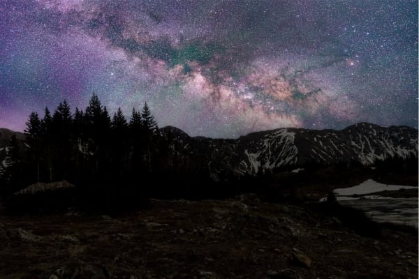
7.Loveland Pass
Drive straight onto the Continental Divide at nearly 12,000 feet, then walk the ridges for sweeping alpine views.
Elevation: 11,990 ft · Highway: US 6 · Counties: Clear Creek and Summit
Best light: Both ends of the day work because you're right on the Divide with open horizons; sunset paints the surrounding peaks and ridges, and sunrise brings low light raking across the alpine tundra. Summer offers wildflowers along the ridges, while winter delivers snow-loaded cornices and clear, cold air.
Full guide →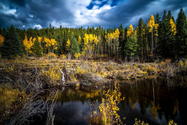
8.Guanella Pass
A paved scenic byway to 11,669 feet, with fall aspens, willow flats and Mount Bierstadt right off the road.
Summit elevation: 11,669 ft · Route: Georgetown to Grant (CR 381 / CR 62), fully paved · Distance: About 11 mi from Georgetown to the summit; 13.5 mi from Grant
Best light: Sunrise is the move at the summit: Mount Bierstadt and the Sawtooth sit to the east, so you can shoot the alpenglow on the Square Top side to the west or a backlit sunrise silhouette of Bierstadt over the willows. In fall, mid-morning light on the aspens of the Georgetown side is beautiful once the sun clears the ridges.
Full guide →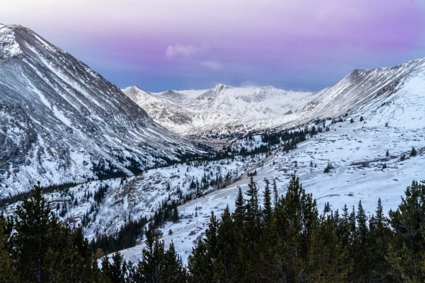
9.Hoosier Pass
An 11,542-foot Continental Divide crossing between Breckenridge and Alma with tundra ridges right off the pavement.
Elevation: 11,542 ft · Highway: Colorado Highway 9 (Breckenridge to Fairplay) · Counties: Summit (north) and Park (south)
Best light: Sunrise and sunset both work: the ridgelines on either side catch warm side light, and from the slopes above the pass you can look north down the Blue River valley toward the Tenmile Range. July brings tundra wildflowers; late September turns the willows and grasses gold.
Full guide →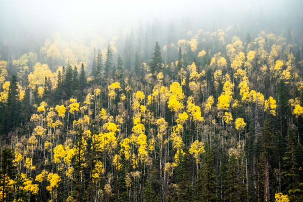
10.Steamboat Springs
A ranching and ski town on the Yampa River, ringed by hot springs, waterfalls and aspen country.
Elevation: About 6,870 ft · County: Routt County (county seat) · Incorporated: 1900
Best light: Fish Creek Falls sits in a shaded canyon east of town, so overcast days or early morning give the most even light on the water. Late September is prime for aspens in the surrounding hills, and winter evenings bring lit ski jumps and steaming hot springs.
Full guide →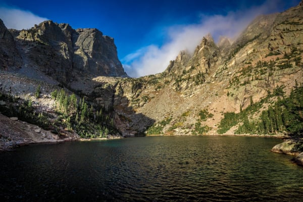
11.Emerald Lake
Three lakes in under two miles, ending beneath the towering face of Hallett Peak.
Distance: About 3.5 mi round trip · Elevation gain: About 650 ft · Lake elevation: 10,110 ft
Best light: Sunrise is the classic: Hallett Peak's face catches warm first light above Emerald and Dream Lakes while the water is calm. Late June through August adds wildflowers between Nymph and Dream Lake, and winter brings frozen lakes and snow-plastered peaks with far fewer people.
Full guide →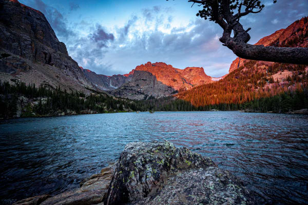
12.The Loch
A moderate walk past Alberta Falls to a sparkling subalpine lake beneath Taylor Peak and the Sharkstooth.
Distance: About 5.7 mi round trip · Elevation gain: About 1,040 ft · Lake elevation: 10,190 ft
Best light: Morning is best: the peaks at the head of Loch Vale catch early light while the lake often sits calm, though wind can rise quickly. Mid to late September brings aspen color around Alberta Falls, and winter turns The Loch into a frozen, snow-covered amphitheater.
Full guide →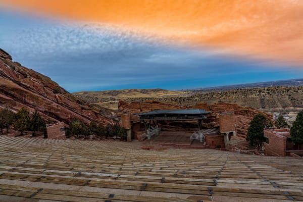
13.Red Rocks
Towering red sandstone monoliths and a world-famous amphitheater, 30 minutes from downtown Denver.
Park size: 868 acres · Location: Morrison, Jefferson County · Trading Post Trail: 1.4 mi loop
Best light: Sunrise is the prime time: the east-facing sides of the monoliths light up first and glow intensely, and the amphitheater looks out toward the rising sun over the plains. Fresh snow on red rock in winter is a special treat, and early mornings avoid both crowds and event setups.
Full guide →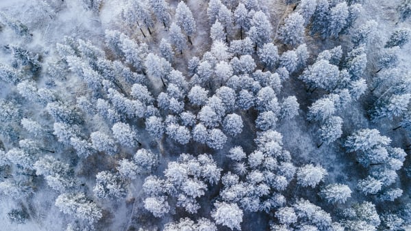
14.Evergreen
A pine-scented foothills town with a lake at its heart and elk in its meadows.
Elevation: 7,162 ft · County: Jefferson · Drive from Denver: About 19 mi west
Best light: Sunrise at Evergreen Lake brings mist on cold mornings and calm reflections of the Lake House and pines. In winter, the frozen lake and skaters make lively scenes, and fall rut season brings elk activity to local meadows.
Full guide →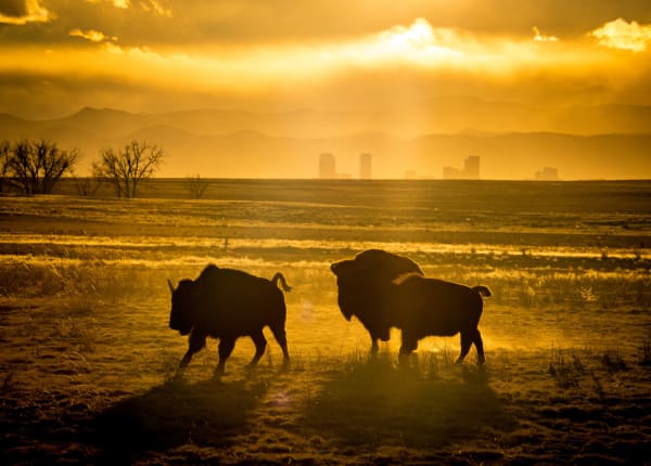
15.Rocky Mountain Arsenal NWR, Commerce City
Bison, bald eagles and the Denver skyline in one frame, on a former chemical weapons site turned wildlife refuge.
Size: About 15,000 acres · Wildlife Drive: 11 miles · Trails: About 20 miles
Best light: Open from sunrise, so early morning gives you low side light on the bison with the skyline and mountains to the southwest and west. Winter is prime for bald eagles, and spring brings bison calves.
Full guide →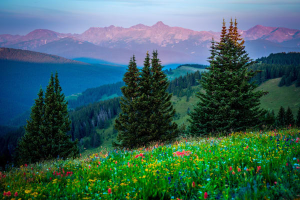
16.Shrine Pass
A high dirt road off Vail Pass with wildflower meadows and a distant view of Mount of the Holy Cross.
Elevation: 11,094 ft · Road: Unpaved; high-clearance recommended · Shrine Ridge Trail: About 2.2 mi one way, roughly 750-850 ft gain
Best light: Morning brings calm air for wildflower close-ups and side light on the meadows; Mount of the Holy Cross lies to the west and catches warm evening light. Wildflowers typically peak mid to late July after the snow melts, and early-season drifts can linger into July.
Full guide →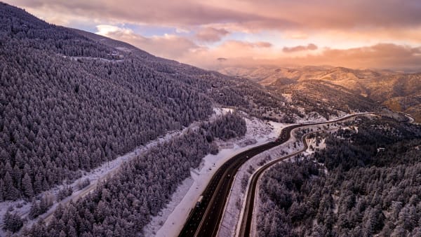
17.Floyd Hill
A quick I-70 foothills escape with rolling trails and big views west toward the Continental Divide.
Distance: About 5 mi (Outer Limits Loop) · Elevation gain: About 775 ft · High point: About 8,600 ft
Best light: Late afternoon and sunset are best, when light rakes across the ridges and the high peaks to the west silhouette. Winter after a light snow is also excellent, with snowy forest and clear distant views.
Full guide →
More Colorado guides
Best Fall Color Spots in Colorado · Best Sunrise Photography Spots in Colorado · Easy Colorado Hikes With Big Views · Best Alpine Lake Hikes in Colorado · Colorado 14ers: Hiking and Photography Guide · Photography Spots Near Denver · Best Wildflower Hikes in Colorado · Colorado Waterfall Hikes · Where to Photograph Wildlife in Colorado · Night Sky and Storm Photography in Colorado