Mount Sniktau
A quick, high-altitude ridge walk from Loveland Pass to a 13,000-foot summit above I-70.
About Mount Sniktau
Mount Sniktau is a 13,240-foot peak in Clear Creek County, rising about 1.6 miles northeast of Loveland Pass and just south of I-70. It's one of the most accessible thirteeners in Colorado: the hike starts at the top of Loveland Pass on US 6, already near 12,000 feet.
The route climbs straight up a steep ridge east of the pass, then turns north at a junction where the trail to Grizzly Peak splits off. From there you follow an open ridge over a sub-summit, drop a bit, and climb to the top. It's about four miles round trip but every step is above treeline.
The views are huge: the Continental Divide, Arapahoe Basin, the Loveland ski area and the deep cut of the I-70 corridor all spread out around you.
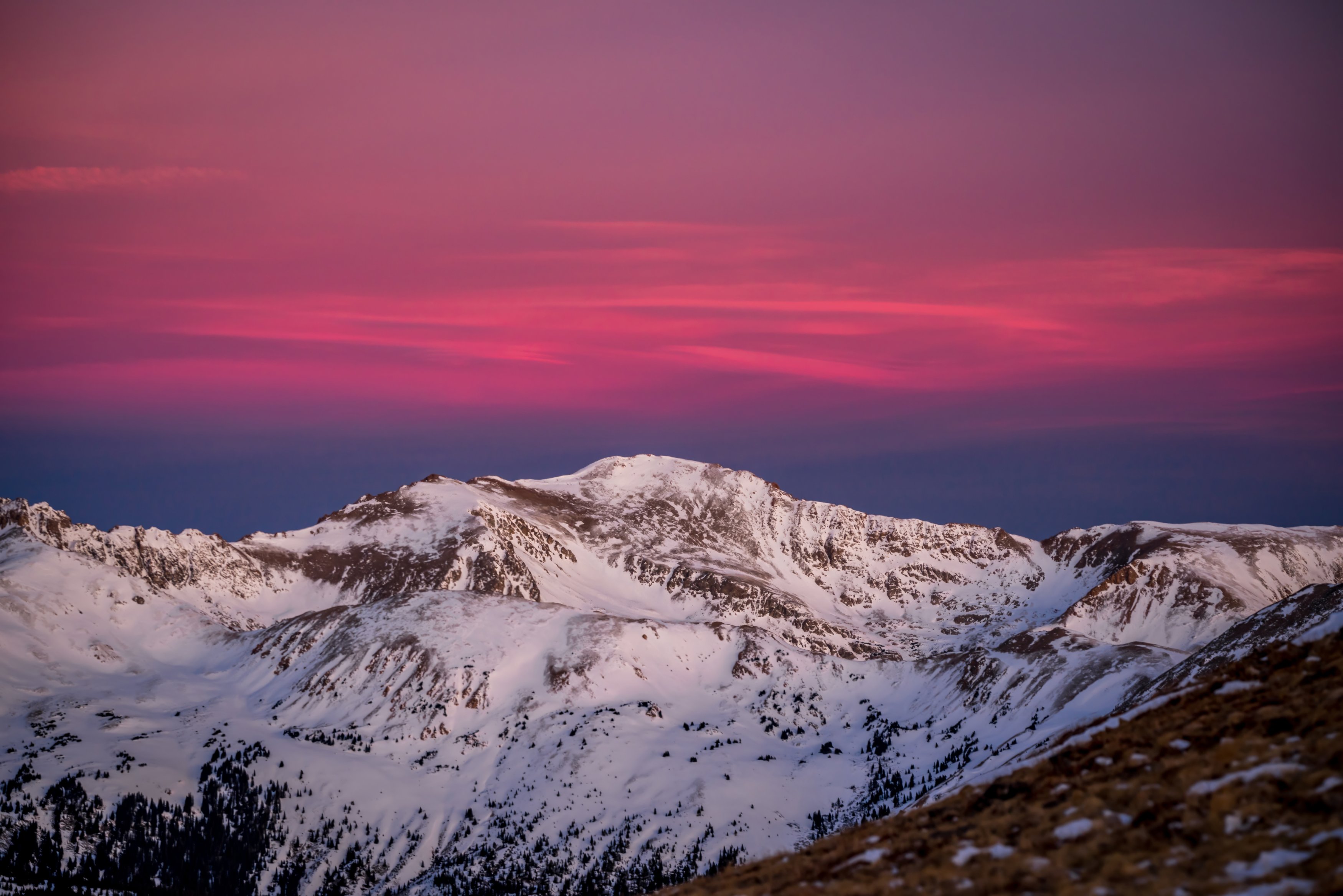
A 13,000-foot peak reached directly from the Loveland Pass summit, popular as a relatively approachable ridge walk given how much elevation you start with already. The ridgeline here catches alpenglow early and cleanly since there's nothing blocking the horizon in any direction — one of the more reliable sunrise-color spots for a peak this easy to reach from the highway.
History
The peak takes its name from Edwin H. N. Patterson, a Clear Creek County journalist of the 1860s who wrote under the pen name "Sniktau." Patterson said the nickname came from Native Americans, but it may have been borrowed from fellow newspaperman W.F. Watkins, who signed his work with his own name reversed, "Sniktaw."
Loveland Pass, the starting point, is named for William A.H. Loveland, a Colorado Central Railroad president from Golden. A rough trail crossed the pass by 1879, and the modern road was paved by 1950.
Photographing Mount Sniktau
Best light: Sunrise is the classic: the ridge faces east and northeast, so first light pours across the Front Range and lights the snow-streaked peaks to the west. In early summer, cornices and snowfields add graphic foregrounds; by late summer tundra flowers and golden grasses take over.
Shots to look for
- Hikers on the narrow ridge with the Continental Divide behind, 24-70mm
- Looking down on the switchbacks of Loveland Pass and Arapahoe Basin with a telephoto
- Sunrise over layered Front Range ridges to the east from the summit
- Lingering cornices on the ridge edge in June, shot from a safe distance
- Mountain goats and pikas among the talus, 100-400mm
Photo tips
- Start early; afternoon lightning is a serious hazard on this exposed ridge
- Loveland Pass can be windy and cold any month; bring gloves and a shell
- The Loveland Pass summit lot fills quickly on summer weekends
- Use the pass parking for blue hour shots of headlights winding over US 6
- Respect cornices in early season; don't stand near the edge of snow overhangs
Know before you go
- The entire route is above treeline with no shelter; turn back if storms build
- You start near 12,000 feet; altitude sickness is possible even on a short hike
- US 6 over Loveland Pass is steep with many hairpins, and hazmat trucks are routed over it; drive carefully, especially in winter
- Snow can linger on the ridge into early summer; winter travel brings avalanche risk
Prints from Mount Sniktau
Every photo is available as a print on metal, canvas, wood or fine art paper.

Frequently asked questions
How long is the Mount Sniktau hike?
About four miles round trip from the top of Loveland Pass, with a steep start and a ridge walk over a sub-summit before the true top.
How high is Mount Sniktau?
About 13,240 feet, roughly 1,250 feet higher than the Loveland Pass trailhead.
Where does the name Sniktau come from?
It's the pen name of 1860s Clear Creek County journalist Edwin H. N. Patterson, possibly borrowed from a colleague who wrote his name, Watkins, backwards.
Combine it with
Grizzly Peak · Loveland Pass · Arapahoe Basin · Georgetown
More Colorado spots
Sources & further reading: en.wikipedia.org · hikingincolorado.org · en.wikipedia.org. Conditions, fees and rules change; check with the managing agency before you go.