Turquoise Lake Trail
A nearly flat shoreline singletrack around Leadville's big reservoir, framed by the high Sawatch peaks.
About Turquoise Lake Trail
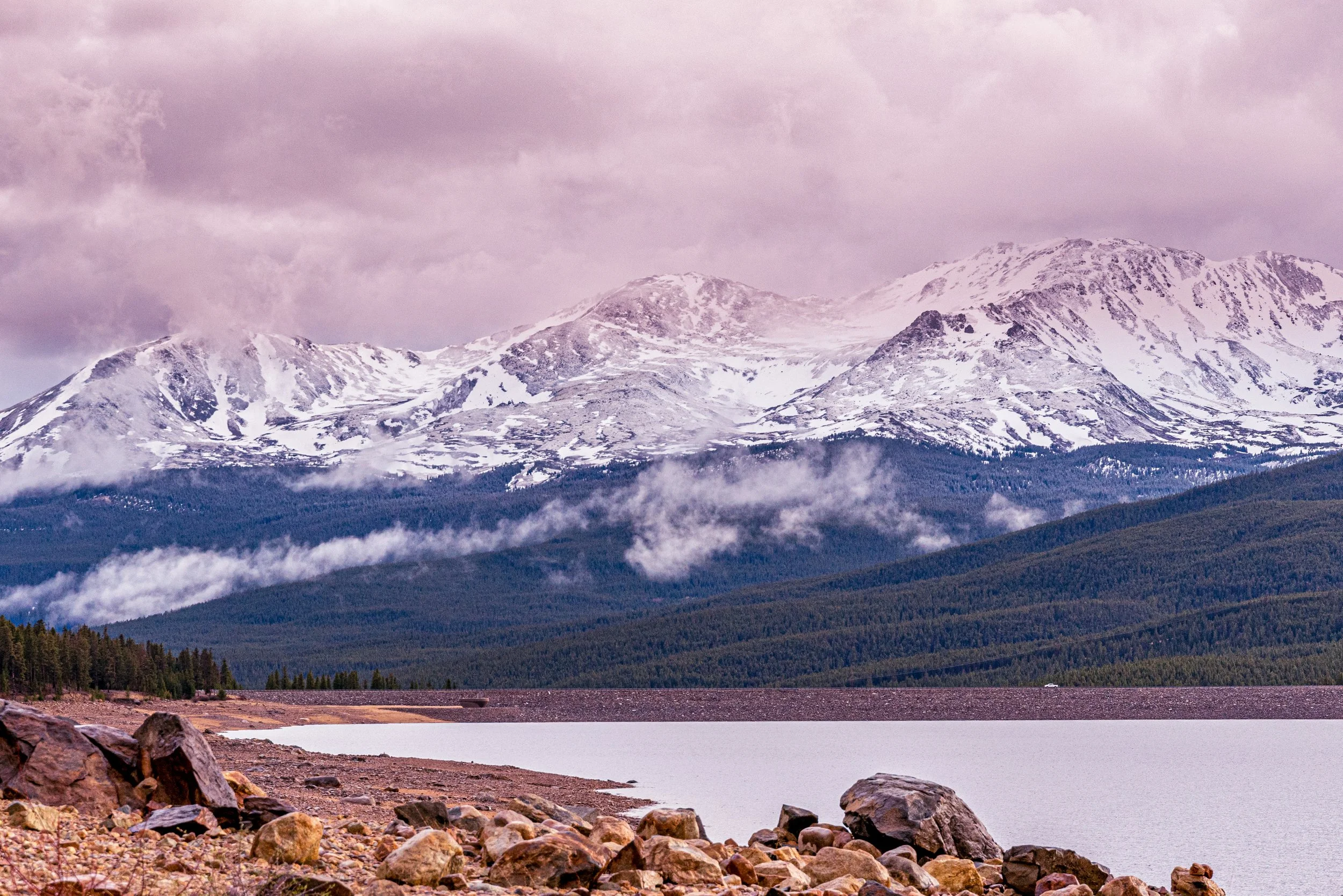
Turquoise Lake sits a few miles west of Leadville, cupped below the high peaks of the Sawatch Range. The Turquoise Lake Trail traces the shore for about 6.4 miles between Sugar Loaf Dam and May Queen Campground, rolling through lodgepole forest with almost no elevation gain. Most people hike or run it as an out-and-back and simply turn around wherever they like.
At nearly 10,000 feet, it is an ideal acclimatization hike before tackling nearby fourteeners, and an easy place to catch sunrise or sunset over water without a big climb. The lake is surrounded by Forest Service campgrounds and boat ramps, so in summer it is a busy recreation hub.
For a shorter version, start at the Tabor Boat Ramp and head west toward May Queen.
A 6.4-mile trail tracing the shoreline of Turquoise Lake from the dam to May Queen Campground, with the first 2.2 miles being genuinely easy and the rest stepping up to moderate. There's a posted trail guide covering the local flora and fauna if you want more than just the view, and the lake's namesake color shows up best under full midday sun rather than the soft light most landscape shooters chase.
History
Turquoise Lake is a reservoir created by Sugar Loaf Dam, an earthen dam about 135 feet high on the Lake Fork of the Arkansas River. The Bureau of Reclamation built it as part of the Fryingpan-Arkansas Project, authorized by President Kennedy in 1962 and completed in 1981. The project collects Western Slope water from the Fryingpan basin and sends it through the 5.5-mile Charles H. Boustead Tunnel under the Continental Divide into Turquoise Lake. From there it travels by conduit to the Mt. Elbert Power Plant and on to farms and cities along the Arkansas River. The Forest Service manages recreation around the lake as part of the San Isabel National Forest.
Photographing Turquoise Lake Trail
Best light: Sunrise is the classic window: light reaches the Sawatch summits above the lake while the water is often still calm. Late September brings golden aspen patches on the surrounding slopes, and early-season snow on the peaks makes June and October especially striking.
Shots to look for
- Wide shoreline reflection of the snowy Sawatch peaks from the east end near Sugar Loaf Dam, using boulders as foreground
- Lodgepole trunks framing the lake from the trail, shot at 24-35mm
- Long exposures of morning mist drifting off the water with a 10-stop ND
- Telephoto compressions of distant ridgelines layered behind the lake (100-400mm)
Photo tips
- Wind usually builds by late morning; plan reflection shots for dawn
- Bring a warm layer even in summer; mornings near 10,000 ft are cold
- Day-use fees apply at some sites like May Queen/Butcher Boy; the dam pullout is a free alternative
- Black bears are present around the campgrounds; store food properly
- Expect mosquitoes near the inlets in early summer
Know before you go
- Elevation is close to 10,000 ft; take it easy if you are coming up from Denver
- Campground facilities close in winter, though the lake is popular for ice fishing
- Summer weekends are busy; arrive early for parking and quiet shoreline
- The trail is rocky in places despite being flat
Frequently asked questions
How long is the Turquoise Lake Trail?
It runs about 6.4 miles one way between Sugar Loaf Dam and May Queen Campground, so the full out-and-back is close to 13 miles. You can turn around at any point.
Is the Turquoise Lake Trail hard?
No. It gains very little elevation, but it sits near 10,000 feet and can be rocky, so pace yourself.
Who manages Turquoise Lake?
The reservoir belongs to the Bureau of Reclamation's Fryingpan-Arkansas Project, and the Forest Service manages recreation there.
Featured in: Easy Colorado Hikes With Big Views
Combine it with
Leadville · Mount Massive · Hagerman Pass Road · Twin Lakes
More Colorado spots
Sources & further reading: hikingproject.com · en.wikipedia.org · recreation.gov · leadvilletwinlakes.com. Conditions, fees and rules change; check with the managing agency before you go.