← All themes · All hikes and spots
Easy Colorado Hikes With Big Views
You don't need a 14er to get a great photo. Every spot here is an easy walk or a short, gentle trail, and most work well for kids, visiting friends, or days when you just want to carry the tripod instead of hauling it uphill.
Tip: Easy and popular usually go together, so the earlier the better for parking and empty frames. Altitude still matters: bring water and layers even on short walks above 9,000 feet.
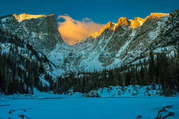
1.Dream Lake
Rocky Mountain National Park's postcard lake, framed by Hallett Peak and Flattop Mountain.
Distance: 2.2 mi round trip · Elevation gain: About 425 ft · Lake elevation: About 9,900 ft
Best light: Sunrise is the classic: you look west up the lake as first light turns Hallett Peak orange while the water is often glassy. Arrive well before sunrise for a calm surface. Late September brings golden grasses and occasional early snow; winter offers frozen shoreline textures and far fewer people.
Full guide →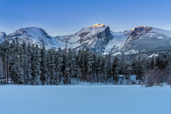
2.Sprague Lake Trail
An easy, flat lakeside loop with one of Rocky Mountain National Park's best sunrise reflections of the Divide.
Distance: About 0.8-0.9 mi loop · Elevation gain: Minimal (essentially flat) · Elevation: About 8,690 ft
Best light: Sunrise is the classic shot: the peaks to the west take first alpenglow while the lake is often glassy before morning breezes kick in. Mid to late September adds golden aspen along Bear Lake Road, and winter brings snow-plastered peaks with fewer people.
Full guide →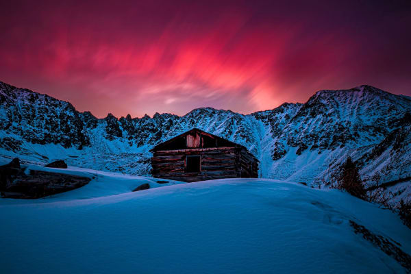
3.Mayflower Gulch
A short walk from Highway 91 to old mining cabins under a wall of Tenmile Range peaks.
Distance: About 3-6 mi round trip, depending on how far you go · Elevation gain: About 500-1,200 ft · Trailhead elevation: About 11,000 ft
Best light: The peaks ring the gulch to the east and south of the cabins, so their faces take warm side and front light late in the day and at sunset alpenglow, while sunrise gives softer backlit and side-lit scenes. Wildflowers peak in July into early August, and winter scenes with snow-loaded cabins are among the best here.
Full guide →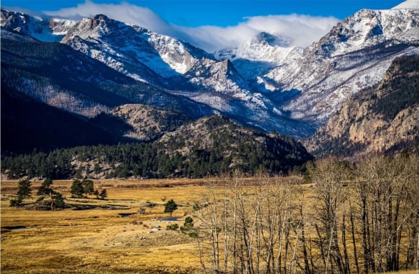
4.Moraine Park
A glacier-carved meadow where the Big Thompson meanders, elk bugle in fall and the Divide fills the horizon.
Elevation: About 8,040 ft · Loop distance: About 4.8 mi, ~120 ft gain · Difficulty: Easy
Best light: Sunrise lights the peaks to the west and often brings fog or frost to the meadow; sunset gives warm side light on elk and silhouettes along the moraines. September and October are prime for the elk rut, and the willows and grasses turn amber in fall.
Full guide →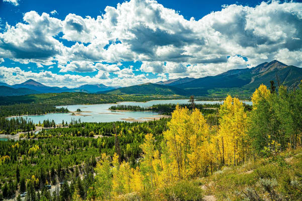
5.Old Dillon Reservoir Trail
A short, easy climb to a hidden pond with big views of Lake Dillon and the Tenmile Range.
Distance: About 1.7 mi round trip · Elevation gain: About 200 ft · Trailhead elevation: 9,203 ft
Best light: Morning light falls on the Tenmile Range to the west and southwest, and calm dawn conditions give reflections in the small reservoir. Late September aspen color along the trail and wildflowers in July make both seasons rewarding; sunset brings colorful skies over the peaks.
Full guide →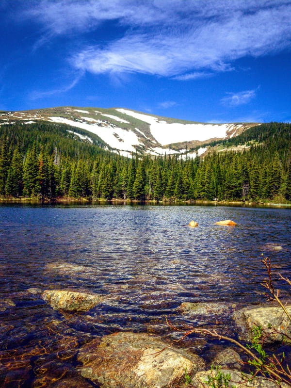
6.Rainbow Lakes
A short, gentle walk to a string of forest-ringed lakes and beaver ponds on the edge of the Indian Peaks Wilderness.
Distance: About 3 mi round trip · Highest lake: About 10,250 ft · Difficulty: Easy
Best light: The lakes sit in trees with the Arapaho high country to the west, so calm early mornings give the best reflections before wind picks up. Late June through July brings wildflowers along the wet margins, and the last light of evening warms the treetops while the water stays glassy.
Full guide →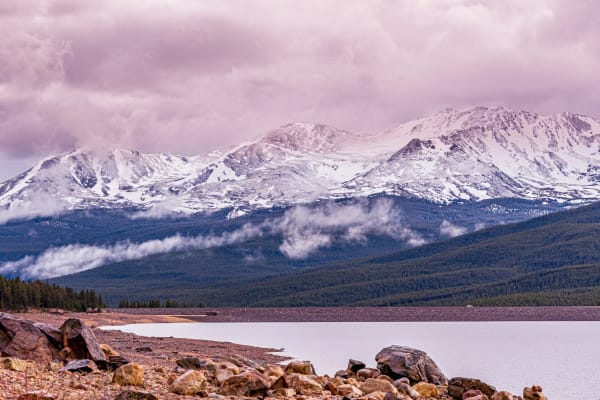
7.Turquoise Lake Trail
A nearly flat shoreline singletrack around Leadville's big reservoir, framed by the high Sawatch peaks.
Distance: About 6.4 mi one way (12.8 mi round trip); 8.3 mi round trip from Tabor Boat Ramp · Elevation gain: Minimal, around 100-150 ft · Trail elevation: Roughly 9,880-9,940 ft
Best light: Sunrise is the classic window: light reaches the Sawatch summits above the lake while the water is often still calm. Late September brings golden aspen patches on the surrounding slopes, and early-season snow on the peaks makes June and October especially striking.
Full guide →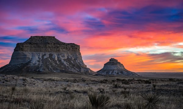
8.Pawnee Buttes
Twin sandstone buttes rising 300 feet above the shortgrass prairie in Colorado's far northeast corner.
Distance: About 4.4 mi round trip · Elevation gain: About 320 ft · Butte height: About 300 ft above the prairie
Best light: Sunrise and sunset are both strong because nothing blocks the horizon: the buttes glow warm against the sky at either end of the day. Late spring brings green grass and wildflowers, and summer afternoons can deliver dramatic thunderstorms building over the plains.
Full guide →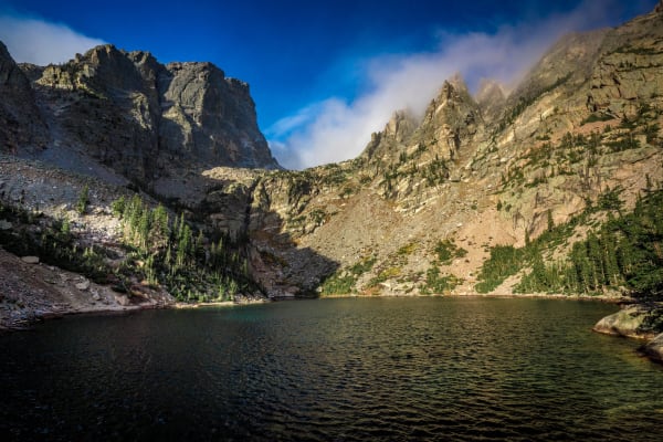
9.Emerald Lake
Three lakes in under two miles, ending beneath the towering face of Hallett Peak.
Distance: About 3.5 mi round trip · Elevation gain: About 650 ft · Lake elevation: 10,110 ft
Best light: Sunrise is the classic: Hallett Peak's face catches warm first light above Emerald and Dream Lakes while the water is calm. Late June through August adds wildflowers between Nymph and Dream Lake, and winter brings frozen lakes and snow-plastered peaks with far fewer people.
Full guide →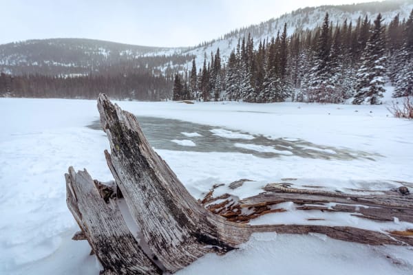
10.Lost Lake
A waterfall-lined hike from the Hessie ghost town to a subalpine lake ringed by old mine workings.
Distance: About 4.2 mi round trip from shuttle drop-off · Elevation gain: About 800 ft · Lake elevation: Roughly 9,800 ft
Best light: Morning is best. The lake is calmest early, before breezes and crowds pick up, and the waterfalls are easier to expose in open shade. Late September brings golden aspens along the Hessie road and lower trail. June and early July have the strongest snowmelt in the cascades.
Full guide →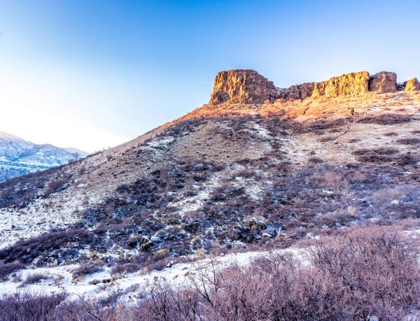
11.South Table Mountain Park
A lava-capped mesa above Golden with Front Range sunsets, city lights and a surprising backstory.
Summit elevation: Castle Rock, 6,338 ft (private) · Trailheads: Camp George West (Kilmer St), Golden Hills Rd, Rimrock Dr · Difficulty: Easy to moderate
Best light: Sunset is the classic shot here: the west rim faces straight into the foothills and the light rakes across Castle Rock and the mesa-top grasses. Spring green-up and the golden grasses of late summer and fall both work, and a dusting of snow on the basalt cliffs is a winter bonus.
Full guide →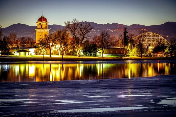
12.Berkeley Lake
A historic northwest Denver lake park with a flat shoreline loop and a full Front Range skyline to the west.
Park size: 83 acres · Lake size: 34 acres · Location: Berkeley neighborhood, northwest Denver
Best light: Sunset from the east shore is the signature shot, with the sky and the Front Range reflected in the lake. Calm winter evenings give the cleanest reflections and snow on the peaks, while autumn adds gold cottonwoods along the shoreline.
Full guide →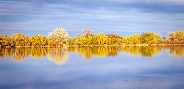
13.Crown Hill Lake
An easy paved lake loop between Wheat Ridge and Lakewood, with waterbirds and the Front Range out past the water.
Distance: About 1.3 mi paved Lake Loop · Elevation: About 5,570 ft · Difficulty: Easy, essentially flat
Best light: Calm mornings are best. The water is often glassy, and the low sun from the east lights the foothills and the cottonwoods along the west shore. On clear evenings the sun drops behind the foothills, so you can shoot silhouettes and color in the sky over the water from the east side. Fall cottonwood color and spring migration are the strongest seasons.
Full guide →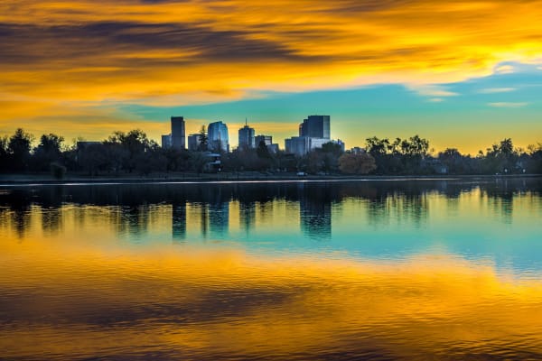
14.Sloan's Lake
Denver's biggest lake, with a 2.5-mile shoreline path and the downtown skyline rising across the water.
Lake size: About 177 acres · Park size: About 290 acres (Denver's 2nd largest) · Distance: About 2.5 mi paved loop
Best light: Sunset is the signature time. From the west shore, you shoot east across the lake as the downtown towers catch the last warm light, then stay through blue hour as the city lights reflect on calm water. At sunrise, the sun comes up behind downtown for silhouettes, while the foothills to the west glow pink.
Full guide →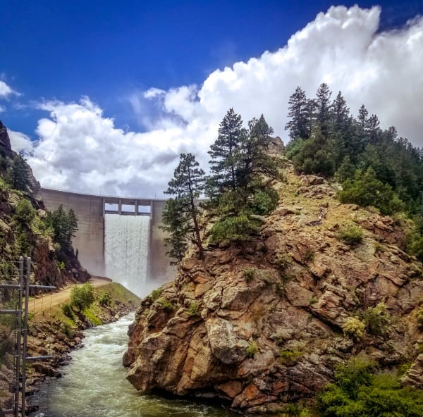
15.Waterton Canyon
A wide, gentle canyon road along the South Platte, famous for its resident bighorn sheep.
Distance: 6.2 mi one way to Strontia Springs Dam (12.4 mi round trip) · Difficulty: Easy, gradual dirt road · Hours: 30 minutes before sunrise to 30 minutes after sunset
Best light: The canyon runs deep and narrow, so direct sun reaches the floor late in the morning and leaves early; soft open shade in the first and last hours is ideal for wildlife. Bighorns can be seen year-round, and fall brings cottonwood color along the river.
Full guide →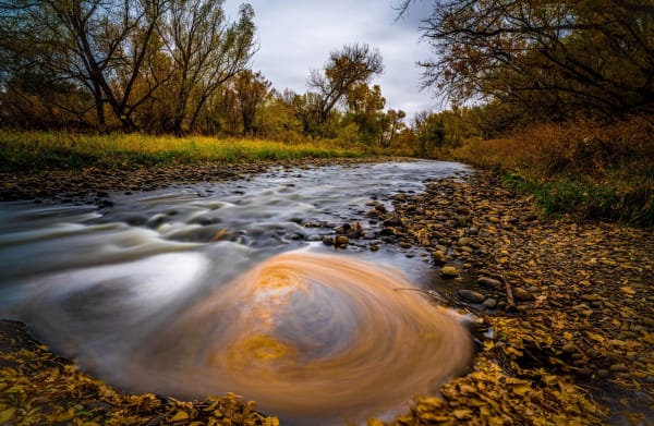
16.Clear Creek Trail
A creekside path from the Denver plains to the mouth of Clear Creek Canyon, now pushing into the canyon itself.
Distance: About 24 mi (Golden to Platte River Trail) · Surface: Mostly paved; some crushed stone and gravel · Difficulty: Easy, gently graded
Best light: In the canyon, the walls block direct sun early and late, giving you long periods of soft open shade that suit moving water. Midday can be harsh and contrasty. Through Golden and Wheat Ridge, mid-October brings golden cottonwoods along the creek, and spring runoff in late May and June turns the creek into whitewater.
Full guide →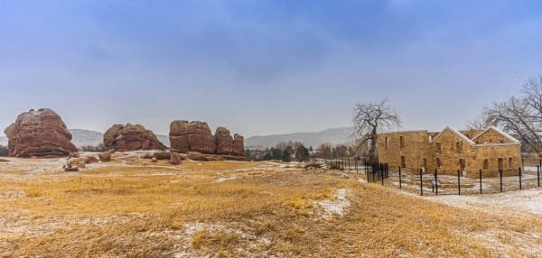
17.South Valley Park, Jefferson County
Red sandstone fins and foothills meadows just off C-470, with Red Rocks-style scenery minus the crowds.
Size: 909 acres · Distance: 6.2 mi figure-eight loop (about 8 mi of trail total) · Elevation gain: About 630 ft for the loop
Best light: Sunrise and the first hour after are the money shots, when low eastern light makes the red sandstone glow against the darker foothills. After a fresh snow, the red-and-white contrast is outstanding, and fall turns the Gambel oak orange and red.
Full guide →
More Colorado guides
Best Fall Color Spots in Colorado · Best Sunrise Photography Spots in Colorado · Winter Photography Spots in Colorado · Best Alpine Lake Hikes in Colorado · Colorado 14ers: Hiking and Photography Guide · Photography Spots Near Denver · Best Wildflower Hikes in Colorado · Colorado Waterfall Hikes · Where to Photograph Wildlife in Colorado · Night Sky and Storm Photography in Colorado