Clear Creek Trail
A creekside path from the Denver plains to the mouth of Clear Creek Canyon, now pushing into the canyon itself.
About Clear Creek Trail
The Clear Creek Trail follows Clear Creek for about 24 miles. It runs from the Platte River Trail near Welby, through Wheat Ridge and Golden, to US 6 at the mouth of Clear Creek Canyon. It's mostly paved, with crushed stone and short gravel sections, and it's one of the metro area's great bike and walking corridors. Along the way you get views of North and South Table Mountain and a busy stretch through downtown Golden.
West of Golden, the trail is being extended into the canyon as the Peaks to Plains Trail. When finished, that planned 65-mile route will connect Denver to the creek's headwaters near Loveland Pass. Built canyon segments include the paved Gateway segment from downtown Golden to Tunnel 1, a paved stretch at Mayhem Gulch and the Big Easy area, with more under construction.
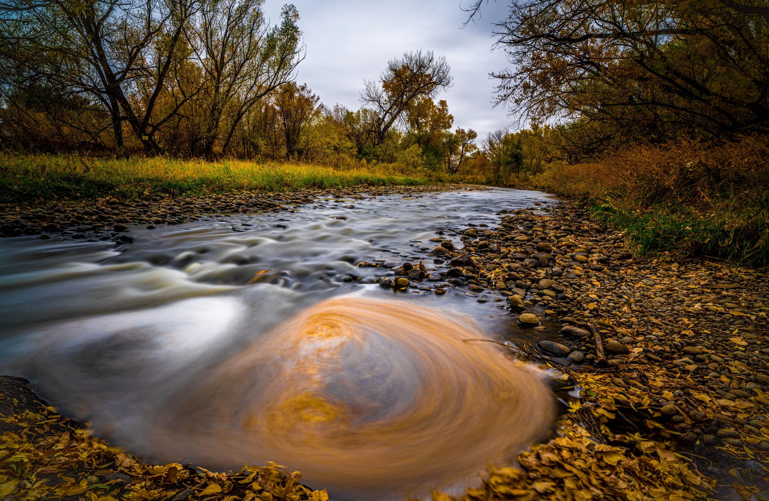
For photographers, it's an easy way to get to moving water, canyon walls and fall cottonwoods without a big hike.
A 19.1-mile point-to-point trail near Golden, easy enough for any skill level and popular with a wide range of users given the lake access along the way. Best March through October, dogs welcome on leash — long enough to treat as a proper bike or trail-running route rather than a casual stroll, and the creek itself offers moving-water shots at nearly any point along its length.
History
Clear Creek was known as Cannonball Creek by about 1820, for the round river rocks in its bed. In the 1830s it became Vasquez Fork, after fur trader Louis Vasquez. Its current name came from the gold seekers of 1859, when it became the scene of the most intense early mining of the Colorado Gold Rush. Mining camps like Idaho Springs, Georgetown and Silver Plume grew up along it.
The creek runs about 66 miles from the Continental Divide to the South Platte. The first four miles of Peaks to Plains trail in the canyon opened in 2016, the Gateway segment in 2021 and further canyon segments since. The route passes remnants of the historic Welch Ditch flume.
Photographing Clear Creek Trail
Best light: In the canyon, the walls block direct sun early and late, giving you long periods of soft open shade that suit moving water. Midday can be harsh and contrasty. Through Golden and Wheat Ridge, mid-October brings golden cottonwoods along the creek, and spring runoff in late May and June turns the creek into whitewater.
Shots to look for
- From the canyon overlook bridges, shoot downstream with a 24-70mm, using a slow shutter to blur the whitewater between rock walls.
- Near Tunnel 1, frame the tunnel portal and canyon walls with a cyclist on the trail for scale.
- In Golden, photograph the creek with the town and North or South Table Mountain behind it at golden hour.
- Use the remnants of the historic Welch Ditch flume as a leading line against the canyon.
- In Wheat Ridge, shoot autumn cottonwoods arching over the path in soft morning light.
Photo tips
- Golden's stretch is busy with tubers in summer and cyclists year-round. Shoot early on weekdays.
- Bring an ND filter for creek shots. Even shaded canyon light can be too bright for long exposures.
- Watch for detours and busy road crossings at some street intersections.
- Spring runoff is powerful and cold, so stay back from the banks during high water.
- Canyon segments are still under construction. Check Jeffco Open Space or Visit Golden for which sections are open.
Know before you go
- The trail is shared by cyclists, runners and walkers. Keep right and stay aware of fast bike traffic.
- Peaks to Plains canyon segments are opening in phases. Check current status before planning a canyon outing.
- Canyon trailheads have posted hours, roughly an hour before sunrise to an hour after sunset.
- Clear Creek is swift and cold, especially during May-June runoff.
Frequently asked questions
How long is the Clear Creek Trail?
The Clear Creek Trail is about 24 miles from Golden to the Platte River Trail. The Peaks to Plains extension into Clear Creek Canyon adds more miles each year.
Where do you park for the Clear Creek Canyon trail?
The Gateway and Tunnel 1 trailheads near Golden have more than 170 spaces combined, and Big Easy has more parking farther up the canyon.
Is the Clear Creek Trail paved?
It's mostly paved, with some crushed-stone and gravel sections, especially west of downtown Golden.
Featured in: Easy Colorado Hikes With Big Views
Combine it with
Clear Creek Welch Ditch · Crown Hill Lake · Dakota Ridge Trail · Golden
More Colorado spots
Sources & further reading: traillink.com · visitgolden.com · visitgolden.com · en.wikipedia.org. Conditions, fees and rules change; check with the managing agency before you go.