Floyd Hill
A quick I-70 foothills escape with rolling trails and big views west toward the Continental Divide.
About Floyd Hill
Floyd Hill is the long grade on I-70 between Evergreen and Idaho Springs in eastern Clear Creek County, and the county's Floyd Hill Open Space sits just west of Exit 248 off Highway 40. It's a developing multiuse park with stacked loops for hikers, mountain bikers and horseback riders.
The popular Outer Limits Loop runs about 5 miles with roughly 775 feet of climbing to a high point near 8,600 feet, where the view opens toward the Continental Divide. The trailhead has restrooms and no parking fee.
Because it's low, sunny and close to Denver, Floyd Hill works well in late fall and winter when higher trails are snowbound, and it's an easy pre- or post-mountain stop on I-70.
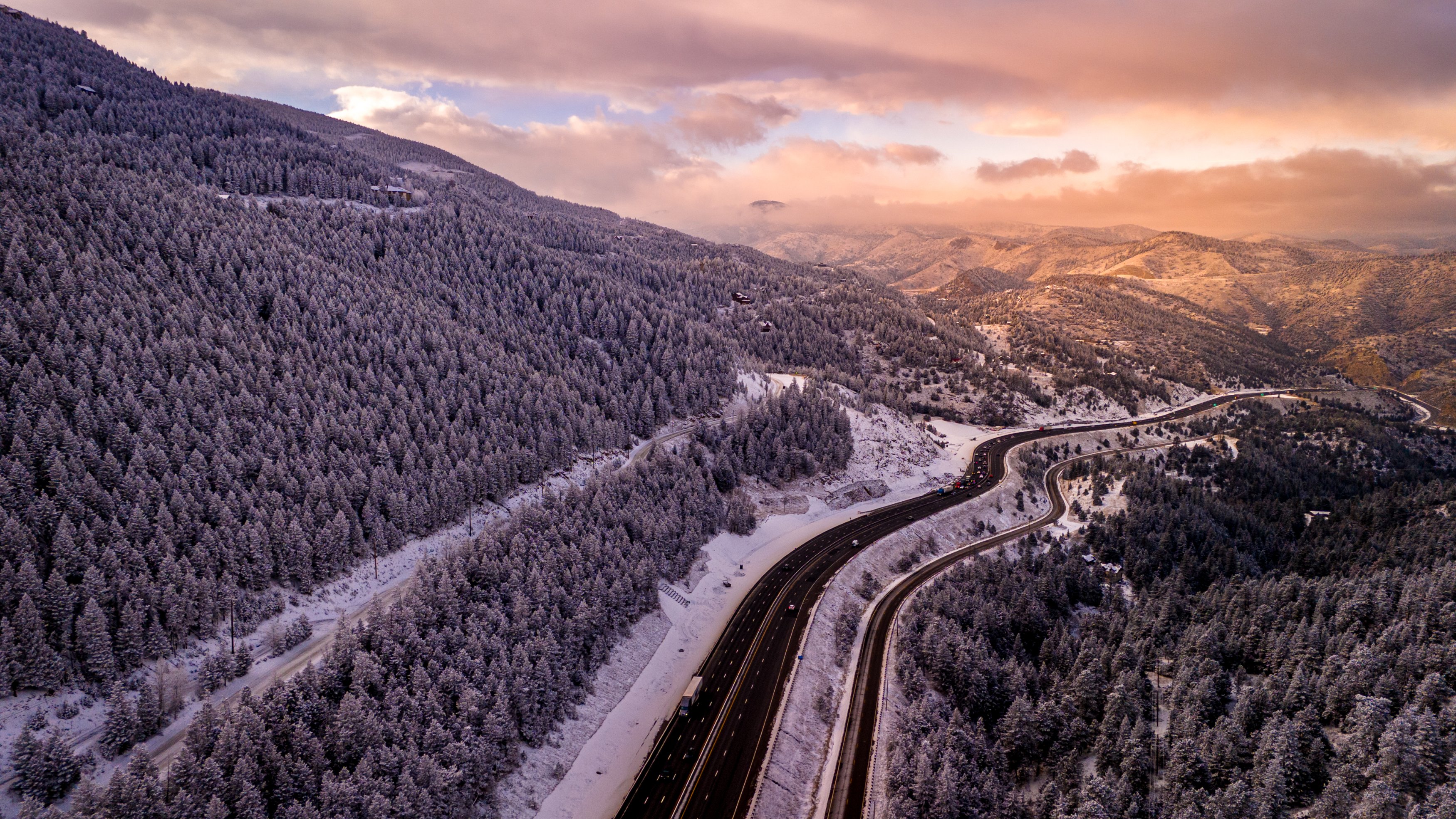
A steep, winding stretch of I-70 climbing out of Clear Creek Canyon west of Denver — infamous for weekend ski traffic backups, but also a genuine vantage point for photographing the highway itself as it threads through the canyon walls. A slow shutter from one of the pullouts above turns the traffic into ribbons of light against the rock, especially at dusk once headlights and taillights both start showing up clearly.
History
The hill is named for Merril H. Floyd, head of the Clear Creek Wagon Road Company in the 1860s, whose ranch sat on what became known as Floyd's Hill. His company built a wagon road from Idaho Springs to Bergen's ranch. In 1873 the Colorado Central Railroad completed a short spur up from Forks Creek to Floyd Hill. A Floyd Hill post office ran from 1912 to 1937. Today the I-70 corridor over the hill is the focus of a major CDOT reconstruction project.
Photographing Floyd Hill
Best light: Late afternoon and sunset are best, when light rakes across the ridges and the high peaks to the west silhouette. Winter after a light snow is also excellent, with snowy forest and clear distant views.
Shots to look for
- From the high point, a telephoto look west at layered ridges toward the Continental Divide
- Ponderosa pines and rock outcrops as foreground for sunset color
- Snow-dusted meadows and trail curves in winter
- The I-70 corridor winding through the canyon as a leading line at dusk with car light trails
Photo tips
- Expect lots of mountain bikers; The Sluice is a one-way downhill bike trail, so don't hike up it
- Check CDOT's I-70 Floyd Hill project updates for lane closures before you drive
- Afternoon wind is common on the ridges; a sturdy tripod helps
- Good winter alternative when higher trailheads are snowed in
Know before you go
- Trails are shared with bikes and horses; yield appropriately
- Restrooms at the trailhead; no parking fee
- I-70 construction on Floyd Hill can cause delays; check current traffic
Prints from Floyd Hill
Every photo is available as a print on metal, canvas, wood or fine art paper.

Frequently asked questions
How long is the Floyd Hill Outer Limits Loop?
About 5 miles with roughly 775 feet of elevation gain.
Who was Floyd Hill named after?
Merril H. Floyd, who ran the Clear Creek Wagon Road Company in the 1860s and had a ranch on the hill.
Featured in: Winter Photography Spots in Colorado
Combine it with
Evergreen · Chief Mountain · Buffalo Herd Nature Preserve · Idaho Springs
More Colorado spots
Sources & further reading: en.wikipedia.org · cmc.org · clearcreekcounty.us. Conditions, fees and rules change; check with the managing agency before you go.