Lake Isabelle
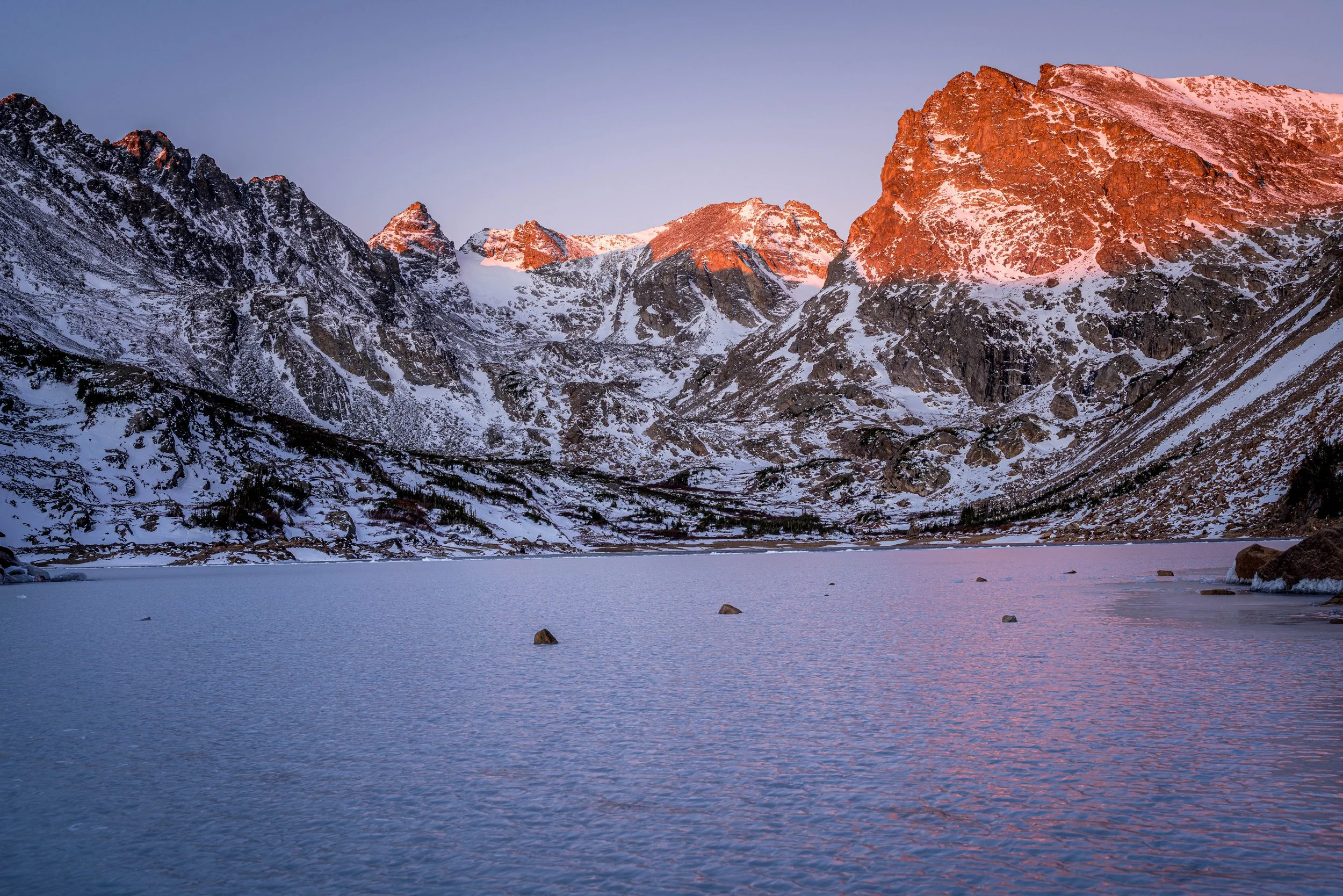
A broad alpine lake beneath Navajo, Apache and Shoshoni Peaks in the Indian Peaks.
About Lake Isabelle
Lake Isabelle sits just below treeline in the Indian Peaks Wilderness, at the end of a gentle hike from Long Lake Trailhead in the Brainard Lake Recreation Area west of Ward. The trail follows the shore of Long Lake, then wanders up the valley and makes one short climb to the lake.
The round trip is roughly 4.5 miles with only around 500 feet of gain, which makes it one of the easiest ways to get to a true high-alpine scene from the Front Range. Navajo Peak, Apache Peak and Shoshoni Peak form a jagged skyline along the Continental Divide above the lake, and the Isabelle Glacier is tucked into the cirque to the west.
Lake Isabelle is also a working reservoir, which matters for timing: it is typically drawn down for irrigation in August, sometimes to mudflats.
A 5.5-mile out-and-back via the Pawnee Pass Trail near Ward, with a waterfall along the way and a moderate rating that keeps it accessible without being crowded out entirely. Dogs are welcome on leash, best from June through October, and the waterfall on the approach is a good candidate for a slow shutter if you've got a filter with you.
History
Although it looks natural, Lake Isabelle stores water for irrigation. The Left Hand Ditch Company holds the water rights; rather than a dam, a drain near the middle of the lake feeds a shaft and tunnel that carry water east. The lake covers more than 30 acres when full.
The Isabelle Glacier, a small remnant ice field about a quarter mile southwest of Shoshoni Peak, feeds South St. Vrain Creek, which flows through the lake and down the valley.
Photographing Lake Isabelle
Best light: The peaks sit to the west, so sunrise lights Navajo, Apache and Shoshoni while the lake is still calm, with good odds of a reflection. Go before August, when the lake is often drawn down, or in late September; July brings wildflowers along the trail.
Shots to look for
- Navajo Peak and Apache Peak reflected in the lake at sunrise from the eastern shore, with rocks or wildflowers as foreground.
- Long Lake at dawn on the way up, with the Indian Peaks skyline catching first light.
- Telephoto details of Navajo's summit block and the cirque walls in warm early light.
- Wildflower meadows along South St. Vrain Creek above the lake, toward the Isabelle Glacier.
Photo tips
- Check whether the lake has been drawn down before planning a late-summer reflection shoot.
- Reserve your Long Lake parking ahead, and download or print it; there's no cell service at the trailhead.
- Arrive early for calm water and to beat the afternoon storms that build over the Divide.
- Mosquitoes can be intense in early summer; bring repellent.
Know before you go
- A timed-entry reservation is required to park in the Brainard Lake Recreation Area in season, booked on Recreation.gov, in addition to the day-use fee or an interagency pass.
- From mid-November to April 30 the road is closed to vehicles, so the hike becomes much longer on skis or snowshoes.
- Dogs must be on a hand-held leash from May 1 to Nov 14; in winter they're limited to the access roads.
- Camping is prohibited on the Pawnee Pass Trail (which passes the lake) from May 1 through November 30, and campfires are banned year-round.
Frequently asked questions
Do you need a reservation for Lake Isabelle?
In season, yes: a timed-entry parking reservation for the Brainard Lake Recreation Area (Long Lake Trailhead) on Recreation.gov, plus the day-use fee or a pass.
How long is the Lake Isabelle hike?
About 4.5 miles round trip from Long Lake Trailhead with roughly 500 feet of elevation gain.
Why is Lake Isabelle sometimes empty?
It's a reservoir. The Left Hand Ditch Company drains it for irrigation, usually in August, so visit earlier in summer or in late September.
Featured in: Best Alpine Lake Hikes in Colorado · Best Wildflower Hikes in Colorado
Combine it with
Long Lake · Brainard Lake · Mitchell Lake · Pawnee Pass
More Colorado spots
Mount Morrison · Lake Haiyaha · Continental Divide National Scenic Trail (CDT)
Sources & further reading: fs.usda.gov · fs.usda.gov · indianpeakswilderness.org · 10adventures.com. Conditions, fees and rules change; check with the managing agency before you go.