Old Dillon Reservoir Trail
A short, easy climb to a hidden pond with big views of Lake Dillon and the Tenmile Range.
About Old Dillon Reservoir Trail
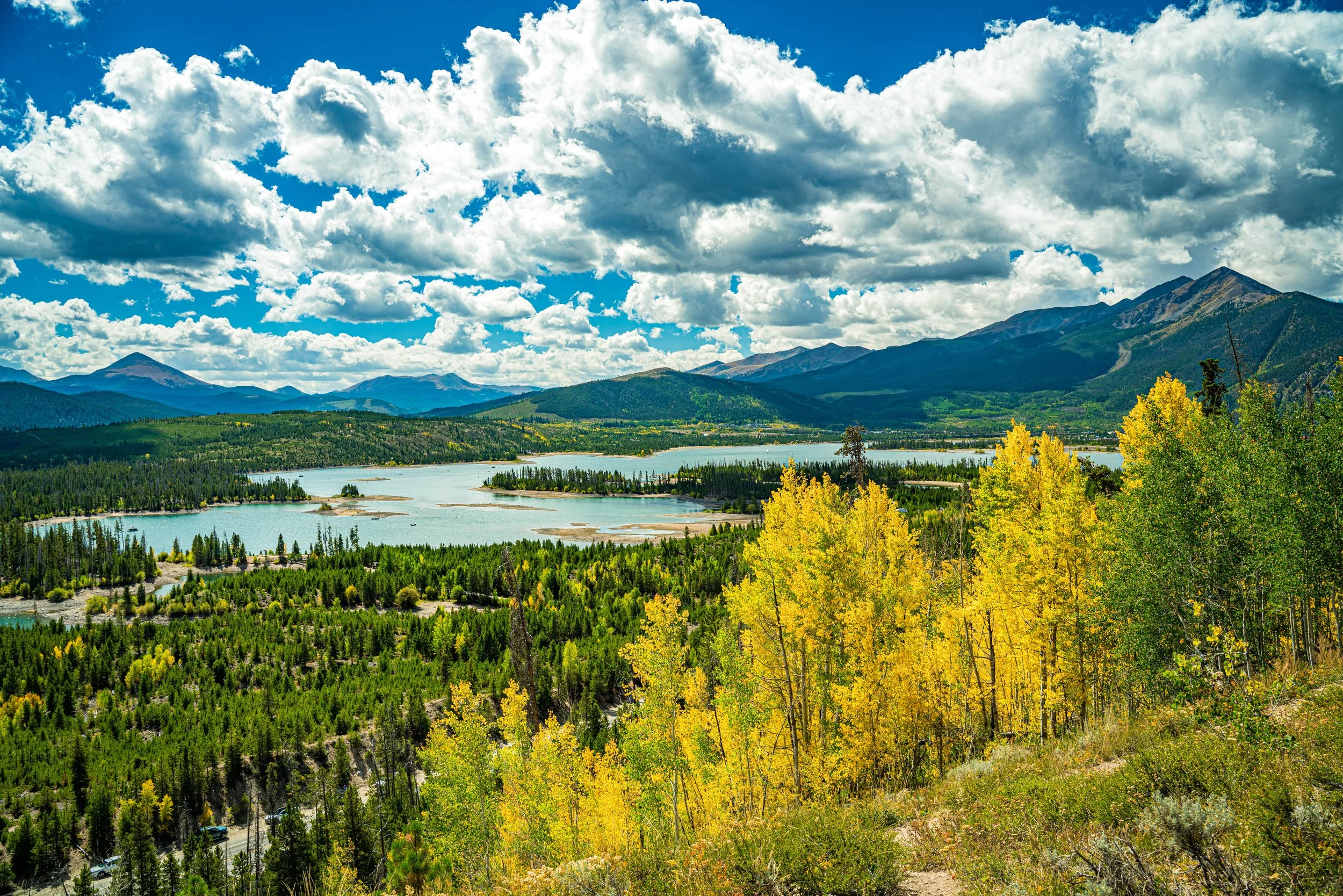
The Old Dillon Reservoir Trail is one of Summit County's best quick hikes. From a small trailhead on Dillon Dam Road, just past Heaton Bay Campground, a gentle path climbs through lodgepole and aspen to a small reservoir perched on a bench above Lake Dillon.
The round trip is only about 1.7 miles with roughly 200 feet of gain, so it works for kids, visitors adjusting to altitude, or a sunset outing between Frisco and Dillon. Benches around the water give you a place to sit with the Tenmile Range and the Continental Divide spread out across the skyline.
In winter, the route works well for snowshoeing and cross-country skiing.
A 1.7-mile loop near Dillon rated easy enough for any skill level, with a lake as the centerpiece and reliable use from May through October. Dogs are welcome on leash, and the loop gives you several vantage points around the water to choose from rather than being locked into one composition.
History
The little reservoir was built in the 1930s to supply water to the original town of Dillon. That town was later moved, and its old site now lies beneath the much larger Dillon Reservoir. Old Dillon Reservoir still receives water through a diversion ditch from Salt Lick Creek, north of I-70. The trail and trailhead are managed by the White River National Forest's Dillon Ranger District.
Photographing Old Dillon Reservoir Trail
Best light: Morning light falls on the Tenmile Range to the west and southwest, and calm dawn conditions give reflections in the small reservoir. Late September aspen color along the trail and wildflowers in July make both seasons rewarding; sunset brings colorful skies over the peaks.
Shots to look for
- Tenmile Range reflected in Old Dillon Reservoir at sunrise, using shoreline grasses as foreground (16-35mm)
- Overlook shots of Lake Dillon with the Continental Divide beyond from the trail's high points
- Aspen trunks framing the view in fall
- Winter scenes of the snowy reservoir with snowshoe tracks as leading lines
Photo tips
- The small trailhead lot fills on summer weekends; go early or late
- No restrooms or potable water at the trailhead
- This is an easy spot to combine with sunset at Sapphire Point Overlook
- Wind often riffles the water by midday; shoot reflections early
Know before you go
- Parking is limited; don't block Dillon Dam Road
- Dogs must be leashed
- At over 9,000 ft, visitors from low elevation may feel the altitude even on this short hike
- Fishing is allowed in summer under Colorado Parks and Wildlife rules
Frequently asked questions
How long is the Old Dillon Reservoir hike?
About 1.7 miles round trip with roughly 200 feet of elevation gain.
Are dogs allowed on the Old Dillon Reservoir Trail?
Yes, on leash.
Where do you park for Old Dillon Reservoir?
At the small Forest Service trailhead on Dillon Dam Road, about 1.4 miles east of CO-9 and just past Heaton Bay Campground.
Featured in: Easy Colorado Hikes With Big Views · Winter Photography Spots in Colorado
Combine it with
Lake Dillon · Sapphire Point Overlook · Frisco · Dillon
More Colorado spots
Green Mountain Reservoir · Clear Creek Welch Ditch · Cascade Creek Trail
Sources & further reading: fs.usda.gov · blog.breckenridgegrandvacations.com. Conditions, fees and rules change; check with the managing agency before you go.