Waterton Canyon
A wide, gentle canyon road along the South Platte, famous for its resident bighorn sheep.
About Waterton Canyon
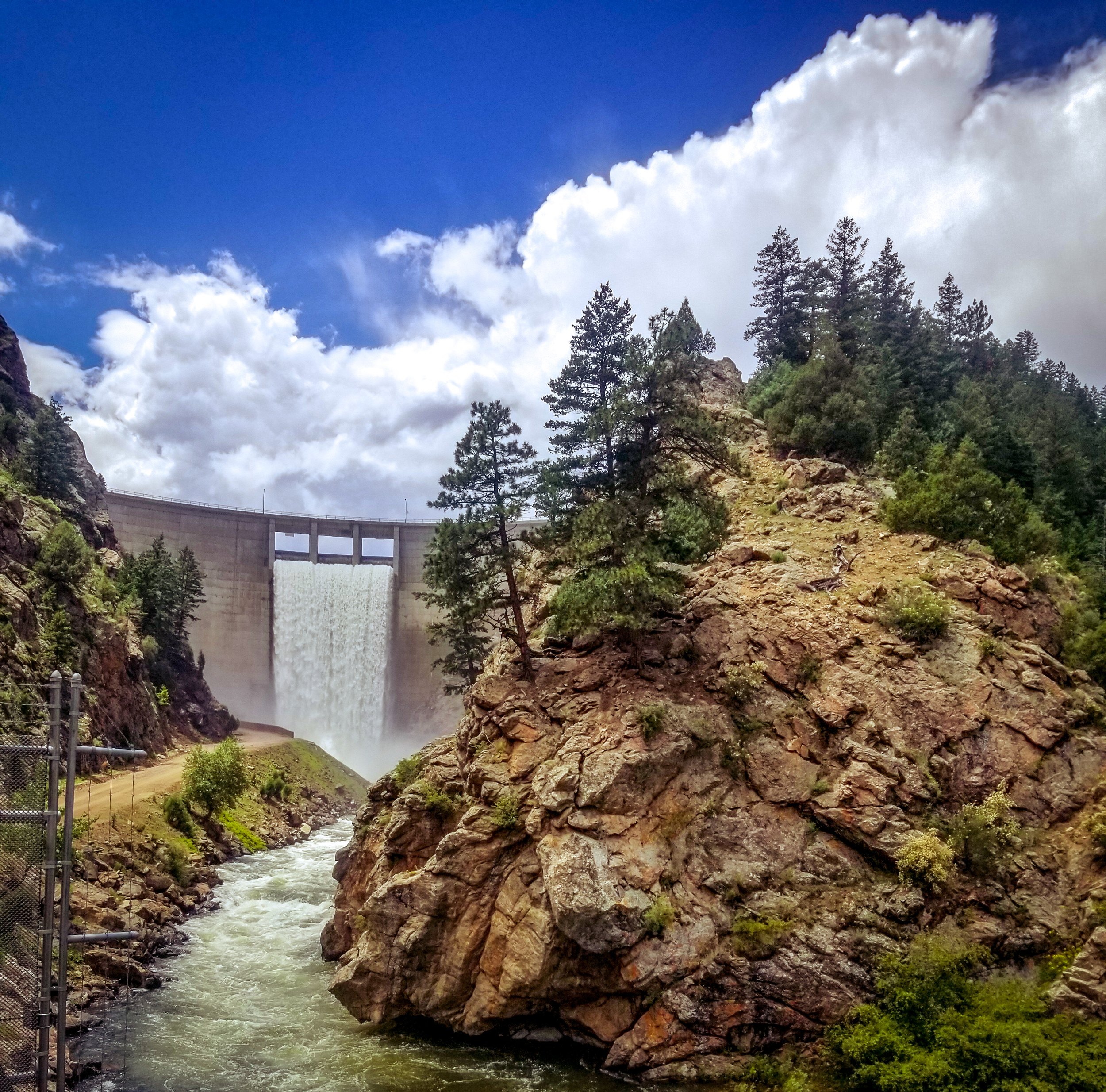
Waterton Canyon is the narrow lower gorge of the South Platte River on Denver's southwest edge, near Kassler and the Chatfield area. Denver Water owns and manages the canyon, and a wide dirt service road climbs gently along the river for 6.2 miles to Strontia Springs Dam.
The grade is mellow enough for families, runners and road bikes, and the road doubles as the eastern start of the Colorado Trail, which continues into the mountains above the reservoir.
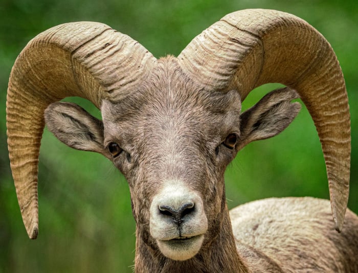
What sets the canyon apart is wildlife. A herd of Rocky Mountain bighorn sheep lives here and often grazes right beside the road, and mule deer are common. For photographers, that makes Waterton one of the most reliable places near Denver to shoot bighorns in a natural canyon setting, with the river and steep canyon walls as backdrop.
A winding dirt road along the South Platte River, with bighorn sheep and eagles both realistic sightings depending on the day. Options range from a short in-and-out for a picnic to the full 12.4-mile round trip to Strontia Springs Dam, and the canyon accommodates hiking, biking, and fishing all on the same route — the bighorn sheep here are genuinely reliable enough that a dedicated wildlife telephoto trip is worth planning around this canyon specifically.
History
The Denver, South Park and Pacific Railroad built the first line through the canyon in the 1870s; it later became part of the Colorado and Southern, and service ended in 1937.
Denver's water board proposed damming the canyon as early as the late 1920s, but that plan was turned down. Strontia Springs Reservoir was finally completed in 1983 as part of the Foothills Project, flooding about 1.7 miles of the upper canyon and feeding water to the metro area.
Photographing Waterton Canyon
Best light: The canyon runs deep and narrow, so direct sun reaches the floor late in the morning and leaves early; soft open shade in the first and last hours is ideal for wildlife. Bighorns can be seen year-round, and fall brings cottonwood color along the river.
Shots to look for
- Bighorn sheep on the rocky slopes above the road with a 100-400mm, framing them against the canyon walls rather than the dirt road.
- Eye-level portraits of sheep grazing near the river from the road edge, keeping a respectful distance and letting them come closer on their own.
- The South Platte cascading over rocks with a slow shutter, using cottonwoods or canyon walls as a frame.
- Strontia Springs Dam and the reservoir at the top of the 6.2 miles, a wide view up-canyon toward the Colorado Trail.
Photo tips
- Bring a long lens; you'll often find sheep within the first few miles, but don't approach or crowd them.
- Consider riding a bike to cover distance quickly, then shoot on foot; it's a long walk to the dam and back.
- Watch for rattlesnakes in warm months and give construction and service vehicles room on the road.
- Expect phone service to drop a couple of miles up the canyon.
Know before you go
- No dogs or other pets are allowed anywhere in the canyon.
- Annual road work usually closes the canyon for about two weeks in early June; check Denver Water before you go.
- Camping, grills and open flames are prohibited in the canyon, and swimming or wading in the river is not allowed.
- Motorized devices, including e-bikes, are prohibited (ADA accommodations can be arranged with Denver Water).
- Overnight parking at the trailhead is prohibited.
Prints from Waterton Canyon
Every photo is available as a print on metal, canvas, wood or fine art paper.

Frequently asked questions
Can you bring dogs to Waterton Canyon?
No. Denver Water prohibits dogs and other pets to protect the canyon's bighorn sheep herd.
How long is the Waterton Canyon trail?
It's 6.2 miles one way from the trailhead to Strontia Springs Dam, or 12.4 miles round trip, on a gentle dirt road.
Where can you see bighorn sheep near Denver?
Waterton Canyon is one of the most reliable spots; the resident herd is often seen grazing on the slopes beside the road.
Featured in: Easy Colorado Hikes With Big Views · Photography Spots Near Denver · Where to Photograph Wildlife in Colorado
Combine it with
Roxborough State Park · Chatfield State Park · South Platte Park · Colorado Trail Segment 1
More Colorado spots
South Valley Park, Jefferson County · Moraine Park · Loveland Pass
Sources & further reading: denverwater.org · en.wikipedia.org. Conditions, fees and rules change; check with the managing agency before you go.