Mt Belford
A direct, steep Collegiate Peaks fourteener above the old mining camp of Vicksburg.
About Mt Belford
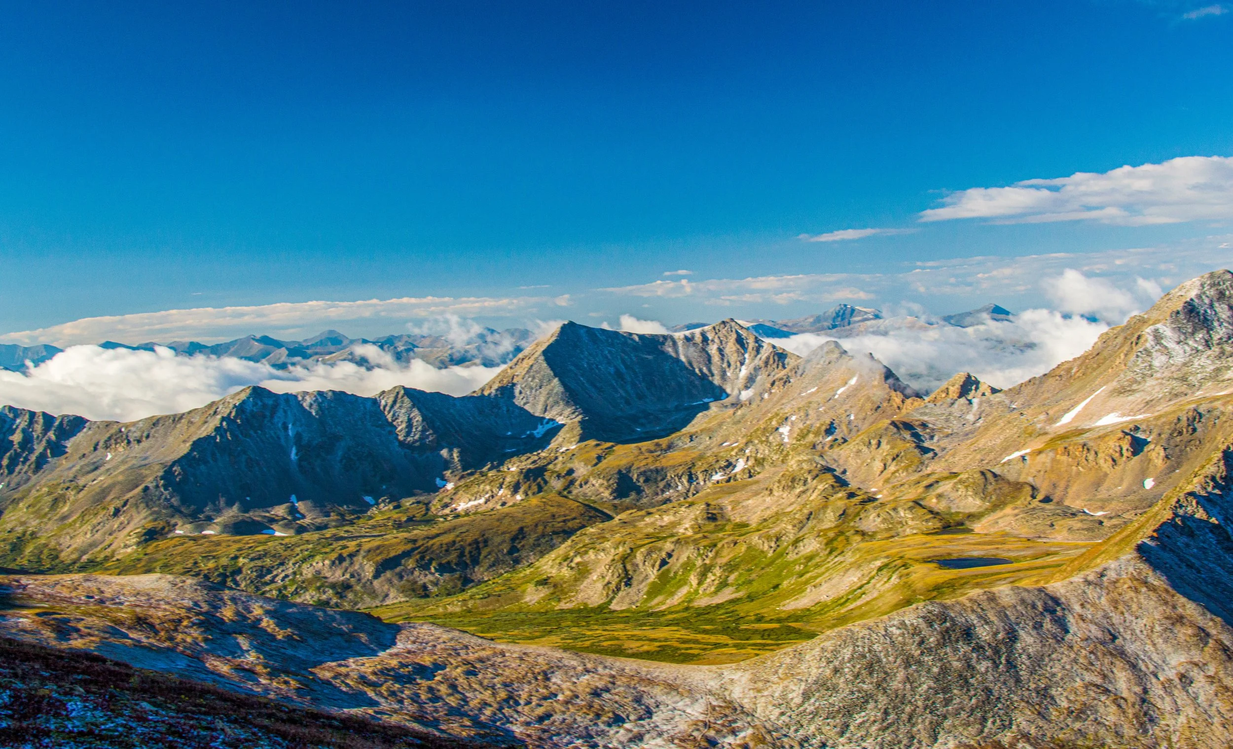
Mount Belford rises to about 14,200 feet in the Collegiate Peaks of the Sawatch Range, in Chaffee County northwest of Buena Vista. It's often paired with neighboring Mount Oxford or Missouri Mountain. Its rounded summit is capped with a distinctive orange-rust rock outcrop.
The standard Northwest Ridge route starts at the Missouri Gulch Trailhead on Chaffee County Road 390, which leaves US 24 between Leadville and Buena Vista. The route covers about 8 miles round trip with roughly 4,500 feet of gain and is rated Class 2. It climbs steep switchbacks into Missouri Gulch, follows the creek into a beautiful upper basin and then switchbacks up the northwest ridge to the top.
Few fourteeners approach the summit this directly. Missouri Gulch is also a pleasure to photograph, with cascades, wildflower meadows and a ring of high peaks.
An 8.1-mile out-and-back near Granite rated difficult, with wildflowers along the route and use for hiking, running, and even horses. Best May through October, both dogs and horses are welcome — the connecting ridge to neighboring Mt. Oxford opens up a genuinely different panorama than the standard out-and-back summit shot.
History
The peak honors James B. Belford, Colorado's first congressman. Local lore says miners thought the rusty summit block looked like his red hair. The trailhead sits beside Vicksburg, a former mining camp in the Clear Creek valley. Several of its restored buildings still stand, and on the way up you pass an old grave from the 1880s.
Missouri Gulch itself saw comparatively little mining disturbance. The Colorado Fourteeners Initiative has since rebuilt the steep north-ridge trail with switchbacks and steps to curb erosion.
Photographing Mt Belford
Best light: Start early so you're in the upper Missouri Gulch basin around sunrise. The surrounding peaks catch alpenglow while the basin floor stays in shade. Mid-July through early August is best for wildflowers in the upper gulch. Late September brings gold to the aspens along the Clear Creek valley and County Road 390.
Shots to look for
- In the upper Missouri Gulch basin, use a wide lens with wildflowers and the creek in the foreground and Belford's ridge rising beyond.
- From the summit, make a telephoto panorama of the crowded Collegiate and Sawatch skyline, including Oxford and Missouri Mountain.
- On the ridge, frame Belford's orange summit outcrop against deep blue sky with a polarizer.
- Shoot the cascades along the lower gulch with a slow shutter, as side trips to the falls overlooks.
- On the drive, photograph the Vicksburg cabins with autumn aspens.
Photo tips
- The ridge is steep and relentless. Use trekking poles and pace yourself for the full 4,500 feet of gain.
- Many peaks look alike from the summit, so carry a map or GPS for the descent.
- If you plan to add Oxford, budget extra time and an early start, because storms come fast.
- Wilderness rules apply, including group-size and camping limits, and drones are not allowed.
- The trailhead lot is large and has restrooms, but it still fills on summer weekends.
Know before you go
- The route enters the Collegiate Peaks Wilderness. Check current rules on party size, camping, campfires and dogs.
- The standard route isn't recommended for skiing. Winter and spring conditions call for avalanche skills.
- Afternoon lightning is common in summer. Plan to be off the ridge by early afternoon.
- Respect the historic Vicksburg buildings and graves near the trailhead.
Frequently asked questions
How long is the Mount Belford hike?
The standard Northwest Ridge route is about 8 miles round trip, with roughly 4,500 feet of elevation gain.
Can you combine Belford and Oxford?
Yes. Many hikers continue from Belford to Mount Oxford and back. It adds significant distance and gain, so start early.
Who is Mount Belford named after?
James B. Belford, Colorado's first congressman. Miners reportedly thought the rusty summit rock resembled his red hair.
Featured in: Colorado 14ers: Hiking and Photography Guide
Combine it with
La Plata Peak · Mount Yale · Mount Shavano · Turquoise Lake Trail
More Colorado spots
Sources & further reading: 14ers.com · en.wikipedia.org · gazette.com. Conditions, fees and rules change; check with the managing agency before you go.