James Peak
A Continental Divide thirteener above St. Mary's Glacier, with a permanent snowfield on the way up.
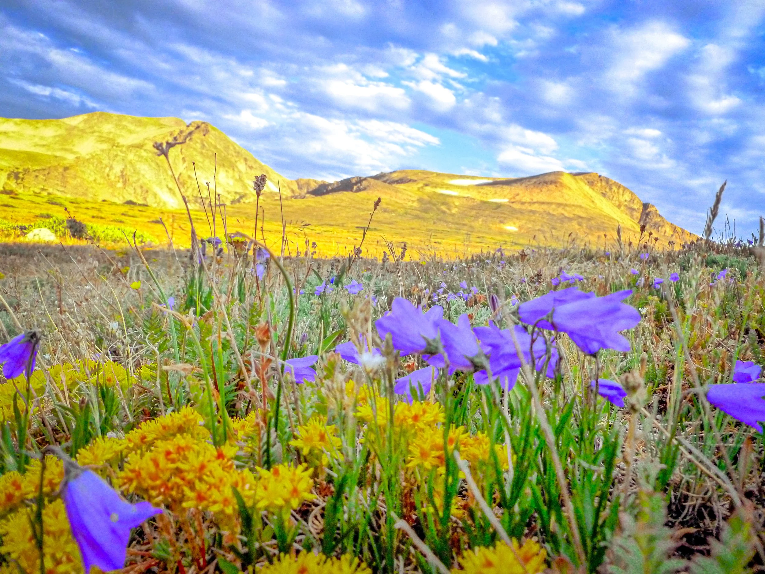
About James Peak
James Peak is a 13,271-foot summit on the Continental Divide, where Clear Creek, Gilpin and Grand counties meet, and it's the highest point in Gilpin County. It lies within the James Peak Wilderness in Arapaho and Roosevelt National Forests, northwest of Idaho Springs.
The standard route starts at the St. Mary's Glacier trailhead above the hamlet of Alice, off I-70 exit 238 via Fall River Road. You hike up to St. Mary's Lake, climb past the permanent snowfield known as St. Mary's Glacier, and then cross open tundra to the summit along the Continental Divide Trail. Expect roughly 8 to 9 miles round trip with about 3,000 feet of gain, and Class 2 terrain.
You don't need the 14er crowds for 14er-scale views here. From the summit you can follow the Continental Divide for miles in both directions. The glacier and lake below make strong foregrounds.
An 8-mile out-and-back near Black Hawk rated difficult, with a lake along the route and use for hiking, downhill skiing, and snowshoeing depending on the season. Best June through October, dogs welcome on leash — the lake sits well below the summit, so plan two separate compositions rather than trying to force both into one frame.
History
The peak is named for Edwin James, the botanist on Major Stephen H. Long's 1820 expedition. That same summer James made the first documented ascent of Pikes Peak. The surrounding James Peak Wilderness, about 17,000 acres, was established by Congress in the early 2000s. It protects the high Divide country between the Indian Peaks and Berthoud Pass.
The St. Mary's area below drains toward Clear Creek, the scene of Colorado's earliest and most intense gold-rush mining after 1859. Much of the land around the hamlet of Alice is still private.
Photographing James Peak
Best light: Sunrise is best. The glacier and the peak's east flank face the morning sun, so they catch the first light while St. Mary's Lake is still in shadow. July and early August bring tundra wildflowers and the most reliable trail conditions. Early summer leaves more snow on the glacier for strong white-on-rock contrast.
Shots to look for
- From the outlet of St. Mary's Lake, shoot a calm-morning reflection of the glacier and the ridges above it with a 16-35mm.
- From partway up the glacier, look back down toward the lake and the I-70 corridor with hikers on the snow for scale.
- On the tundra plateau, use a wide lens with alpine flowers or lichen-covered rocks in the foreground and James Peak's summit cone beyond.
- From the summit, use a telephoto to pull in the Indian Peaks to the north and the long line of the Continental Divide.
- Late-day sidelight brings out the texture of sun cups and ripples on the snowfield.
Photo tips
- The glacier can be icy early in the day. Microspikes help, and an ice axe is useful if you climb the snow gully directly.
- The lower lots fill on summer weekends because St. Mary's Lake is a popular short hike. Arrive early and pay at the self-serve station.
- Respect private property around Alice. Don't park or camp on private land.
- The plateau is fully exposed to wind and lightning. Be off the summit before afternoon storms.
- Bring a polarizer to control glare on the snow and deepen the sky at altitude.
Know before you go
- Parking at the St. Mary's lots requires a small fee, paid at self-serve stations. Check current rates.
- The land around Alice and the lower trail is largely private. Stay on the trail and park only in designated lots.
- Snow travel on the glacier can be slick. Carry traction and know how to self-arrest if you take the snow route.
- Wilderness rules apply above the glacier. Check current James Peak Wilderness regulations for dogs, group size and camping.
Frequently asked questions
How long is the James Peak hike?
The standard St. Mary's Glacier route is roughly 8 to 9 miles round trip, with about 3,000 feet of elevation gain.
Is St. Mary's Glacier a real glacier?
It's usually described as a remnant glacier or permanent snowfield. Either way, it holds snow all summer and can be icy.
Do you have to pay to park at St. Mary's Glacier?
Yes. The trailhead lots charge a small fee, paid at self-serve stations. Check current rates before you go.
Combine it with
Mt Evans · Chief Mountain · Lost Lake · Hells Hole
More Colorado spots
Sources & further reading: en.wikipedia.org · en.wikipedia.org · trails.colorado.gov · climb13ers.com. Conditions, fees and rules change; check with the managing agency before you go.