Sloan's Lake
Denver's biggest lake, with a 2.5-mile shoreline path and the downtown skyline rising across the water.

About Sloan's Lake
Sloan's Lake Park sits on Denver's northwest side, along Sheridan Boulevard at the Edgewater line. Its 290 acres make it the second-largest park in Denver after City Park. The lake covers about 177 acres, and a paved path of roughly 2.5 miles loops around it.
On any given day you'll find runners, cyclists, anglers, sailboats and paddlers, plus big events like the summer Dragon Boat Festival. Lawns and mature trees line the shore, and a marina and sports fields occupy the north side.
For a photographer, Sloan's is the classic city-lake shot. From the west shore, you look east across open water to the downtown Denver skyline. Turn around and the foothills and mountains line the western horizon.
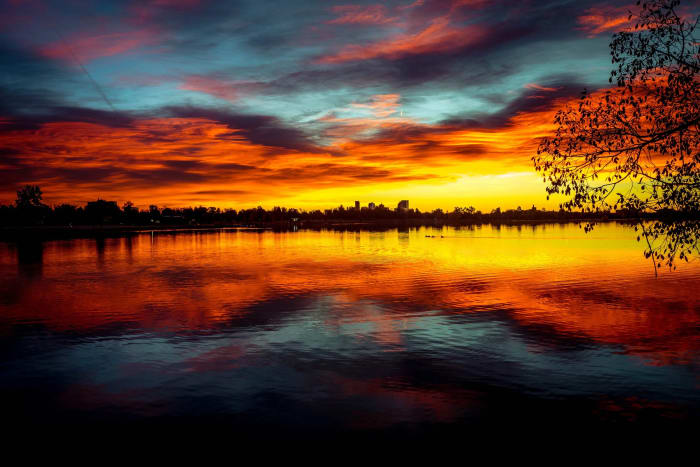
Denver's second-largest park and the city's largest body of water, on the western edge of town. Legend has it the lake formed by accident when homesteader Thomas Sloan struck an aquifer while digging an irrigation well — today its 290 acres draw tennis players, paddleboarders, and a steady 2.6-mile loop of runners, plus a healthy population of Canada geese that seem to have taken over permanently. The downtown Denver skyline sits directly across the water, making this one of the better in-city sunset shoots with a genuine reflection.
History
Thomas M. Sloan began farming the land in the 1860s. A popular story says he dug an irrigation well that hit an aquifer and flooded his farm, earning the lake the nickname "Sloan's Leak." Historians dispute that story, because accounts suggest the lake already existed by 1863.
In 1881 the Manhattan Beach amusement park opened on the north shore. It burned in 1908, was rebuilt as Luna Park and closed in 1914. The land became a public park in 1923. Between 1931 and 1935, the WPA connected Sloan's Lake and neighboring Cooper Lake with a channel, and parts of the original shoreline were later filled.
Photographing Sloan's Lake
Best light: Sunset is the signature time. From the west shore, you shoot east across the lake as the downtown towers catch the last warm light, then stay through blue hour as the city lights reflect on calm water. At sunrise, the sun comes up behind downtown for silhouettes, while the foothills to the west glow pink.
Shots to look for
- From the west shore, use a 70-200mm to compress the downtown skyline across the water at blue hour.
- Shoot a long exposure of the skyline reflection on a windless evening with a sturdy tripod.
- From the east side at sunset, frame the mountains to the west with silhouetted trees or paddleboarders.
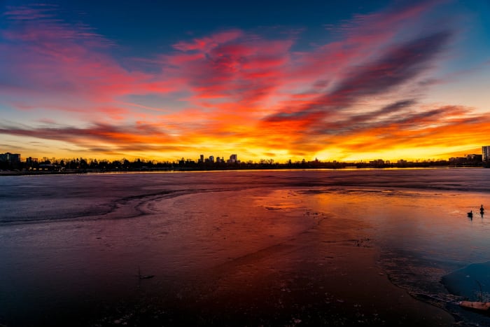
- In winter, include ice patterns and geese in the foreground with the skyline beyond.
- Photograph sailboats or dragon boats on the lake with downtown as the backdrop.
Photo tips
- Wind often picks up in the afternoon. Calm evenings are best for reflections, so check the forecast.
- Parking along the park roads fills on summer weekends and event days. Arrive early or walk in from the neighborhood.
- Watch for fast cyclists and runners on the loop when you set up a tripod. Stay off the path itself.
- Waterfowl gather on the open water in the colder months, which makes for good bird-and-skyline shots.
- Check Denver Parks and Recreation for event closures and current rules.
Know before you go
- Boating and fishing are popular. Follow current Denver Parks rules and Colorado fishing license requirements.
- Major events like the Dragon Boat Festival bring big crowds and road closures in summer.
- The path is shared by bikes, runners and walkers.
- Check Denver Parks and Recreation for park hours and any rules on swimming and pets.
Prints from Sloan's Lake
Every photo is available as a print on metal, canvas, wood or fine art paper.




Frequently asked questions
How long is the walk around Sloan's Lake?
The paved loop around the lake is about 2.5 miles and essentially flat.
Where is the best spot to photograph the skyline at Sloan's Lake?
The west shore looks east across the water at downtown. Go at sunset and stay through blue hour on a calm evening.
How did Sloan's Lake form?
A popular legend credits a leaky irrigation well dug by homesteader Thomas Sloan, but historians dispute it. Early accounts suggest the lake already existed in the early 1860s.
Featured in: Easy Colorado Hikes With Big Views · Photography Spots Near Denver
Combine it with
Crown Hill Lake · Lakeside, CO (Lakeside Amusement Park) · Clear Creek Trail
More Colorado spots
Sources & further reading: en.wikipedia.org · tclf.org. Conditions, fees and rules change; check with the managing agency before you go.