Mount Holy Cross and Halo Ridge
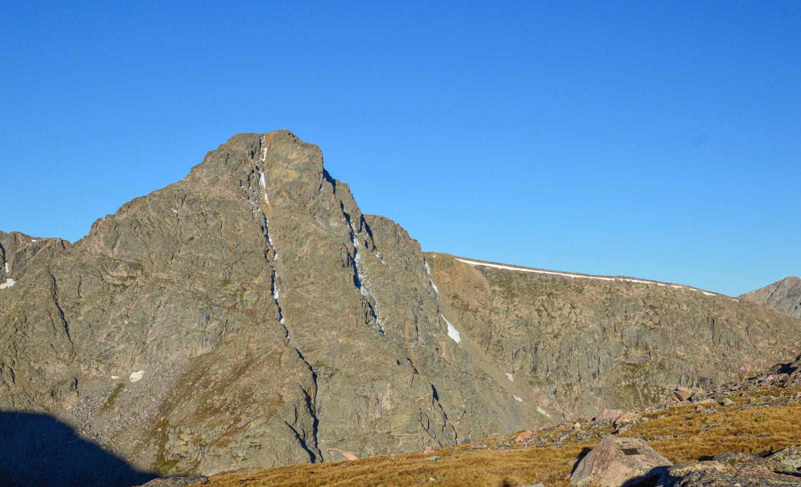
The legendary snow cross of the Sawatch, seen from Notch Mountain and circled by one of Colorado's great ridge walks.
About Mount Holy Cross and Halo Ridge
Mount of the Holy Cross is the northernmost fourteener in the Sawatch Range, rising in the Holy Cross Wilderness of White River National Forest in Eagle County, south of Minturn. Its fame comes from the snow-filled cross on the northeast face, formed where two eroded ravines intersect and hold snow into summer.
The standard North Ridge route starts at the Half Moon Pass trailhead at the end of Tigiwon Road, crosses Half Moon Pass, drops about 1,000 feet to East Cross Creek, then climbs the ridge. The Halo Ridge route instead takes the Fall Creek and Notch Mountain trails up more than 30 switchbacks to the historic Notch Mountain shelter, then follows a high, exposed ridge around the Bowl of Tears to the summit.
For photographers, the Notch Mountain shelter is the destination in itself: it sits directly across from the cross.
A 13.8-mile out-and-back via the Halo Ridge Route near Minturn, recommended only for very experienced hikers given the exposure and route-finding involved. Best May through September, with a real chance of wildlife sightings for those who make the trip — the cross-shaped snow couloir the mountain is named for is most visible and best defined in early summer before it melts out completely.
History
Reports of a giant cross on a Colorado peak circulated for years before William Henry Jackson, photographer for the Hayden Survey, climbed a mountain opposite it and photographed the cross in early light on August 24, 1873. The image ended doubts that it existed and became one of his most famous. Thomas Moran later painted the mountain.
President Hoover designated Holy Cross National Monument in 1929, and the mountain had already become a pilgrimage destination; the stone Notch Mountain shelter was built in 1924 for those visitors. The monument was abolished in 1950 and the land returned to the national forest.
Photographing Mount Holy Cross and Halo Ridge
Best light: The cross faces east toward Notch Mountain, so sunrise from the shelter is the shot, exactly as Jackson did it in 1873. The snow cross is most complete in early summer and fades by late season; late June through July is the best balance of open road and good snow.
Shots to look for
- The full cross at first light from the Notch Mountain shelter, mid-telephoto to fill the frame with the face
- The historic stone shelter in the foreground with the cross beyond, wide angle at dawn
- Bowl of Tears Lake directly beneath the east face from Halo Ridge, with a wide or normal lens
- Hikers on the narrow Halo Ridge catwalk for scale against the cirque
- Long-exposure star photography over the cross from the shelter if you overnight
Photo tips
- The shelter is first-come, first-served Forest Service property and doubles as a lightning refuge; carry a backup plan if you hope to sleep there.
- There is no reliable water above about 11,600 ft on the Notch Mountain route.
- Halo Ridge has no safe escape routes between you and the Bowl of Tears; commit only in stable weather.
- Drones are prohibited in the Holy Cross Wilderness.
- Tigiwon Road is closed seasonally, roughly Nov 22 to June 21, so early-season snow shots mean a long walk in.
Know before you go
- Tigiwon Road is a rough 8.5-mile dirt road; most cars can make it, but it is closed roughly from late November to late June.
- On the North Ridge route you must regain about 1,000 ft back to Half Moon Pass on the way out.
- Halo Ridge stays above 13,000 ft for hours with considerable exposure, rockfall and route-finding.
- Use the designated campsites near East Cross Creek; check Forest Service wilderness rules.
- Start early: storms build fast and there is little shelter on either ridge.
Frequently asked questions
Where is the best view of the cross on Mount of the Holy Cross?
From Notch Mountain, directly east of the face. The Notch Mountain Trail leads to a historic stone shelter at about 13,077 ft with a straight-on view.
How hard is Halo Ridge?
It is a 15-mile, Difficult Class 2 route with about 5,210 ft of gain, long stretches above 13,000 ft, and no safe escape routes. It is best for experienced hikers in stable weather.
When is Tigiwon Road open?
The road is closed each year roughly from November 22 to June 21. Contact the Eagle-Holy Cross Ranger District to confirm the gate is open.
Featured in: Colorado 14ers: Hiking and Photography Guide
Combine it with
Minturn · Shrine Pass · Vail · Camp Hale
More Colorado spots
Sources & further reading: en.wikipedia.org · 14ers.com · 14ers.com · history.com. Conditions, fees and rules change; check with the managing agency before you go.