Mt Elbert
Stand on the roof of the Rockies: Colorado's highest summit, reached by a steady Class 1 trail above Twin Lakes.
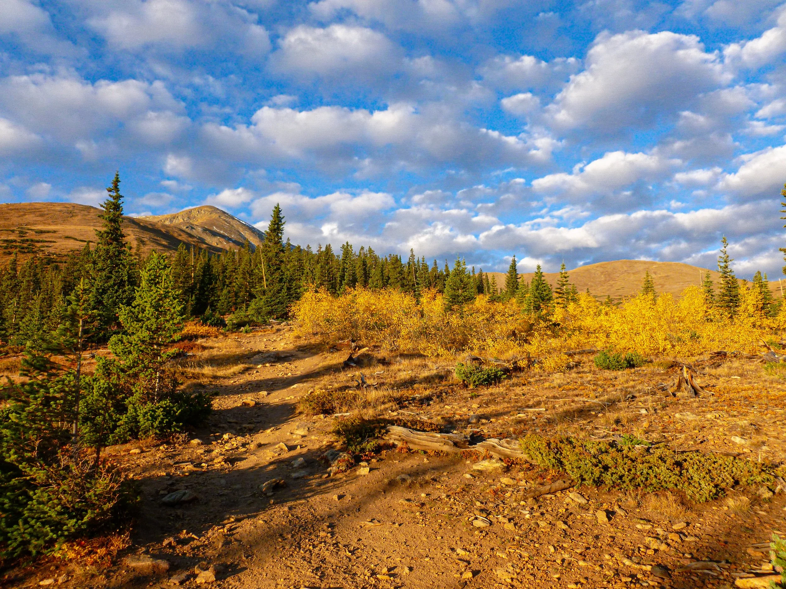
About Mt Elbert
Mount Elbert is the highest peak in Colorado and in the entire Rocky Mountain chain, and the second-highest summit in the Lower 48 after Mount Whitney. It rises in Lake County in the Sawatch Range, inside San Isabel National Forest, with Twin Lakes at its base and Leadville a short drive north.
The most popular route, the Northeast Ridge from the Mt. Elbert North trailhead on Halfmoon Creek Road, is a Class 1 walk-up that never requires scrambling. That makes it a first fourteener for many people, but it is still a long, high day with roughly 4,500 feet of gain.
For photographers the appeal is perspective. From the broad summit you look across the Arkansas Valley, down the long Sawatch spine, over the Twin Lakes basin and next door to Mount Massive, and on clear mornings the whole state seems to fall away below you.
A 10.4-mile out-and-back via the North Trail near Twin Lakes, rated challenging as the tallest peak in the state deserves. Best May through October, no dogs allowed — as the highest point in Colorado, the summit view genuinely does show more of the Sawatch Range than any neighboring peak can offer.
History
The peak is named for Samuel Hitt Elbert, governor of Colorado Territory in 1873-1874, who helped broker a September 1873 treaty with the Ute people, whose homeland this was. The first recorded ascent came in 1874, when Henry W. Stuckle of the Hayden Survey reached the top.
Leadville's mining boom brought roads and settlement to the valley below, and the Colorado Trail now skirts the mountain's flanks between Halfmoon Creek and Twin Lakes. Today the North, South and Black Cloud trails give hikers several ways up the state's high point.
Photographing Mt Elbert
Best light: Summit at or shortly after sunrise: you will be hiking in the dark, but the low eastern light rakes across the Arkansas Valley and the Mosquito Range, and you get off the ridge before afternoon storms build. July through September is the usual snow-free window; late September adds gold aspen in the lower forest and around Twin Lakes.
Shots to look for
- From the summit, a wide-angle frame looking north along the ridge to Mount Massive's long, multi-summit crest
- Telephoto compression of the Twin Lakes basin and Independence Pass road from the south side of the summit
- Hikers silhouetted on the northeast ridge false summits against the morning sky, shot from above with a mid-range zoom
- Pre-dawn headlamp trails snaking up the ridge from treeline, a long exposure on a light travel tripod
- Back at the base, golden-hour reflections of Elbert and the Sawatch in Twin Lakes on a calm evening
Photo tips
- The trailhead lot fills early on weekends; start in the dark both for parking and to beat lightning.
- Pack a lightweight tripod only if you plan sunrise on top; the wind at 14,000 ft makes long exposures hard.
- Batteries drain fast in the cold; keep spares in an inside pocket.
- Treeline ends well below the summit, so most of your shooting will be fully exposed; watch the sky west over the Sawatch.
- Drone rules differ between National Forest and the nearby Mount Massive Wilderness, where drones are not permitted; check boundaries before flying.
Know before you go
- Thunderstorms build most summer afternoons; plan to be off the summit by late morning.
- Altitude sickness is real here; acclimatize a night or two in Leadville or Twin Lakes if you live low.
- Halfmoon Creek Road is dirt; most cars make it, but drive carefully.
- Snow can linger on the upper ridge into early summer and return by October.
Frequently asked questions
How long is the Mount Elbert hike?
The standard Northeast Ridge route is about 9.75 miles round trip with roughly 4,500 feet of gain.
Is Mount Elbert hard to climb?
It is rated Class 1, meaning a trail all the way with no scrambling, but the altitude and length make it a strenuous day.
Is Mount Elbert the tallest mountain in Colorado?
Yes. It is the highest point in Colorado and the Rocky Mountains, and second-highest in the contiguous U.S. after Mount Whitney.
Featured in: Colorado 14ers: Hiking and Photography Guide
Combine it with
Mount Massive · Twin Lakes · Independence Pass · Leadville
More Colorado spots
Sources & further reading: en.wikipedia.org · 14ers.com · 14ers.com. Conditions, fees and rules change; check with the managing agency before you go.