Mt Bierstadt
The Front Range's most approachable 14er, named for the painter who made the Rockies famous.
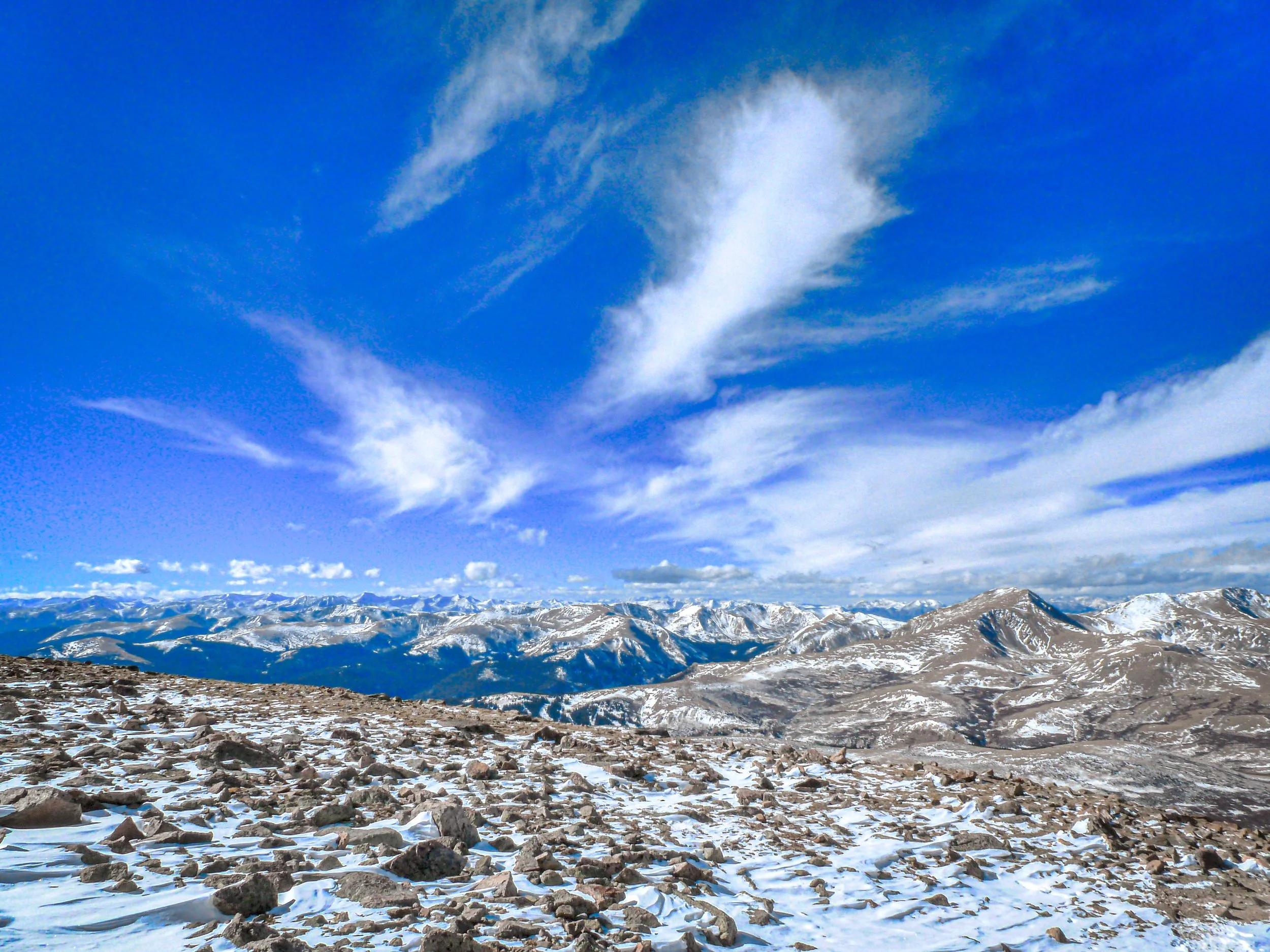
About Mt Bierstadt
Mount Bierstadt, in Clear Creek County, rises just over 14,000 feet east of Guanella Pass, between Georgetown and Grant. The standard West Slopes route starts at the top of the pass and runs about 7 to 7.25 miles round trip with roughly 2,400 to 2,850 feet of gain, crossing the willows and marshes along Scott Gomer Creek before climbing the broad west slope.
The high trailhead and paved road access make it one of the most popular 14ers in Colorado, especially for first-timers. Bierstadt is connected to Mount Blue Sky by the Sawtooth, a jagged Class 3 ridge that is a separate and much more serious undertaking.
For photographers, Guanella Pass itself is half the draw: alpine ponds, willow flats and, in late September, some of the best aspen color in the Front Range along the road.
A 7.8-mile out-and-back near Idaho Springs and one of the more approachable fourteeners near Denver, rated challenging but genuinely popular for it. Best May through October, dogs welcome on leash — Sawtooth Ridge connecting to Mt. Evans is one of the more dramatic knife-edge formations visible from any Front Range fourteener trail.
History
The peak is named for Albert Bierstadt, the German-American landscape painter whose grand paintings of the West helped shape how the nation saw the Rockies. He made the first recorded ascent in 1863. The mountain lies within the wilderness surrounding Mount Blue Sky, and Guanella Pass Road provides the high access that made Bierstadt a classic beginner 14er.
Photographing Mt Bierstadt
Best light: Bierstadt's west face looks right at Guanella Pass, so sunset alpenglow on the peak from the pass ponds is the classic shot. If you summit at sunrise, turn west to catch first light on Grays, Torreys and the Divide. Late September aspen color on Guanella Pass Road is outstanding.
Shots to look for
- Bierstadt's west face reflected in the ponds near the top of Guanella Pass at sunset, wide angle with a low camera
- The Sawtooth ridge between Bierstadt and Mount Blue Sky from the upper trail, short telephoto
- Willow flats along Scott Gomer Creek glowing gold in late September
- From the summit at sunrise, first light on Grays and Torreys to the west
- Fall aspens along Guanella Pass Road with the peaks behind
Photo tips
- Top-of-pass lots routinely fill before 6 a.m. on summer and fall weekends — arrive by 5 a.m.
- Never park on the road shoulder within a half mile of the summit; Clear Creek County fines and tows
- The willows hold water and mud early in the season; waterproof boots help
- Mountain goats and ptarmigan are common; use a telephoto and keep your distance
- Leaf-peeping weekends bring heavy traffic; visit Monday through Thursday if you can
Know before you go
- Parking is only in designated lots and signed spaces; shoulder parking near the summit draws fines and towing
- The Sawtooth is an exposed Class 3 ridge for experienced scramblers only
- Afternoon lightning is common; plan to summit by late morning
- Guanella Pass Road may close briefly during peak fall traffic for emergency access
Frequently asked questions
How long is the Mount Bierstadt hike?
About 7 to 7.25 miles round trip with roughly 2,400 to 2,850 feet of elevation gain from the Guanella Pass trailhead.
Where do you park for Mount Bierstadt?
In the lots at the top of Guanella Pass. They fill before dawn on weekends, and parking on the road shoulder near the summit is prohibited.
Who is Mount Bierstadt named after?
Landscape painter Albert Bierstadt, who made the first recorded ascent in 1863.
Featured in: Colorado 14ers: Hiking and Photography Guide
Combine it with
Mt Evans · Georgetown · Grays and Torreys Peak · Three Mile Creek
More Colorado spots
Sources & further reading: 14ers.com · en.wikipedia.org · clearcreekcounty.us. Conditions, fees and rules change; check with the managing agency before you go.