Pawnee Buttes
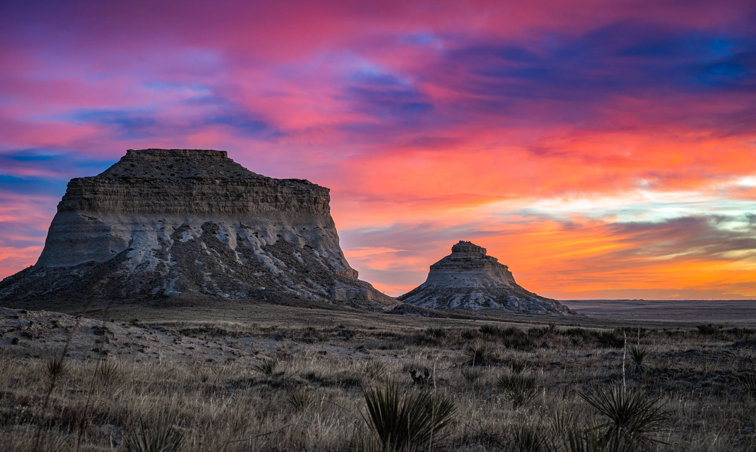
Twin sandstone buttes rising 300 feet above the shortgrass prairie in Colorado's far northeast corner.
About Pawnee Buttes
The Pawnee Buttes stand alone on the high plains of northeast Weld County, about 13 miles south of the Wyoming line, inside the Pawnee National Grassland. Both buttes rise roughly 300 feet above the surrounding prairie, and the trail from the Forest Service trailhead drops across open grassland and badlands to the base of West Pawnee Butte.
The round trip runs a little over 4 miles with modest gain. The western butte is on the grassland; the eastern one is on private land. Beyond the buttes themselves, this is a place for huge skies, wind, nesting raptors and the kind of emptiness that is hard to find anywhere else along the Front Range.
Getting there involves a long drive on county gravel roads east from Ault via CO-14. Rain or snow can turn those roads slick quickly.
Two sandstone buttes rising 300 feet above the plains in the northeast corner of Weld County, inside the Pawnee National Grassland. There's nothing else like this stretch of open sky and prairie anywhere near the mountains — it's a completely different kind of Colorado landscape, and one of the better dark-sky spots in the region too, with wide, unobstructed horizons that make it a genuinely good Milky Way location once the moon's out of the way.
History
The buttes are erosional remnants of the High Plains: soft, clay-rich Brule Formation (Oligocene) capped by tougher Miocene sandstone and conglomerate that has kept them from wearing away. They appeared in U.S. Geological Survey reports by 1905. James Michener used them as the 'Rattlesnake Buttes' in his 1974 novel Centennial, and the area served as a filming location for the 1978 miniseries. The surrounding land saw limited farming in the early 1900s and was withdrawn after the Dust Bowl; it became the 193,060-acre Pawnee National Grassland in 1960, managed by the U.S. Forest Service.
Photographing Pawnee Buttes
Best light: Sunrise and sunset are both strong because nothing blocks the horizon: the buttes glow warm against the sky at either end of the day. Late spring brings green grass and wildflowers, and summer afternoons can deliver dramatic thunderstorms building over the plains.
Shots to look for
- Both buttes lined up from the overlook near the trailhead at golden hour (70-200mm) - outside the seasonal closure
- Low wide-angle from the prairie with grasses or yucca leading to West Pawnee Butte
- Night sky and Milky Way over the buttes; light pollution is minimal out here
- Storm cells and lightning over the buttes from a safe distance along the access roads
- Telephoto details of eroded badland ridges and cap rock
Photo tips
- Watch the forecast closely: rain turns the county roads greasy and storms bring lightning on an exposed plain
- Stay on the designated trail during the March-June nesting closure and keep distance from cliff nests
- Bring lots of water; there is no potable water and summer temperatures can top 100 F
- Don't climb the buttes or bluffs; the sandstone is crumbling
- Wind is constant; use a sturdy tripod and protect your sensor when changing lenses
Know before you go
- Seasonal raptor closure March 1 - June 30 for the Overlook, Lips Bluff trail and nearby cliffs
- East Pawnee Butte sits on private land; respect posted signs and leave gates as you find them
- Vault toilets and picnic tables at the trailhead; no water
- Oil and gas development is active in the grassland, so expect industrial traffic on some roads
Frequently asked questions
How long is the Pawnee Buttes trail?
About 4.4 miles round trip to the base of West Pawnee Butte, with roughly 300 feet of elevation change.
Can you climb the Pawnee Buttes?
Climbing is not recommended. The sandstone is crumbling, and the cliffs host nesting raptors.
Is there a seasonal closure at Pawnee Buttes?
Yes. From March 1 through June 30, the Overlook, Lips Bluff trail and areas near the cliffs close to protect nesting hawks, eagles and falcons. Stay on the main trail.
Featured in: Easy Colorado Hikes With Big Views · Night Sky and Storm Photography in Colorado
Combine it with
Keota · Chalk Bluffs · Sterling · Briggsdale
More Colorado spots
The Loch · Mestaa'Ėhehe Mountain Fire Lookout · Golden Ponds
Sources & further reading: fs.usda.gov · trails.colorado.gov · en.wikipedia.org · en.wikipedia.org. Conditions, fees and rules change; check with the managing agency before you go.