The Loch
A moderate walk past Alberta Falls to a sparkling subalpine lake beneath Taylor Peak and the Sharkstooth.
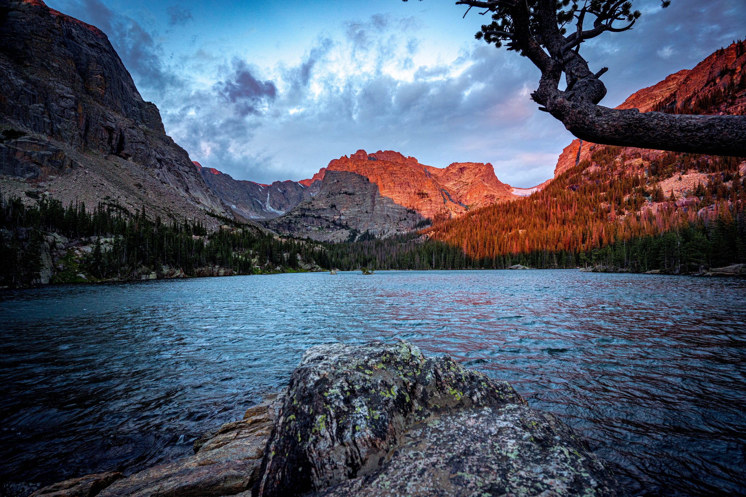
About The Loch
The Loch is the first lake in Loch Vale and one of the best-value hikes in Rocky Mountain National Park. From Glacier Gorge Trailhead on Bear Lake Road, the trail passes 30-foot Alberta Falls under a mile in, climbs through forest and switchbacks, and reaches the shore of The Loch at 10,190 feet.
The round trip is about 5.7 miles with roughly 1,040 feet of gain, a solid half-day for most hikers. Taylor Peak (13,153 ft) and Taylor Glacier dominate the view across the water, with Thatchtop Mountain and the Sharkstooth framing the valley and Powell Peak rising on the north side.
If you have energy left, the trail continues to Timberline Falls, Lake of Glass and Sky Pond.
Rated moderately challenging, this trail near Estes Park runs 5.4 miles round trip and sees hikers, snowshoers, and trail runners depending on the season. Best March through October, no dogs permitted — the lake sits in a quieter, more sheltered basin than its more famous neighbors, which usually means calmer water for a reflection.
History
'Loch' is the Scottish and Irish word for a lake, and Loch Vale is a classic glacier-carved valley beneath the Continental Divide. The watershed has been the subject of more than 40 years of scientific monitoring, making it one of the most studied mountain watersheds in the world. Alberta Falls on the approach is named for Alberta Sprague, wife of early settler Abner Sprague. The area has been part of Rocky Mountain National Park since 1915.
Photographing The Loch
Best light: Morning is best: the peaks at the head of Loch Vale catch early light while the lake often sits calm, though wind can rise quickly. Mid to late September brings aspen color around Alberta Falls, and winter turns The Loch into a frozen, snow-covered amphitheater.
Shots to look for
- Taylor Peak and the Sharkstooth reflected from the east shore, with weathered limber pine or boulders as foreground (16-35mm)
- Alberta Falls with a slow shutter, especially with fall aspen in frame
- Wind-sculpted trees along the shoreline against Taylor Glacier
- Telephoto views of the cliffs and gullies at the head of the valley (70-200mm)
Photo tips
- Glacier Gorge Trailhead parking fills very early in summer; arrive before dawn
- Bring microspikes in shoulder seasons; switchbacks above Alberta Falls get icy
- Wind often ruffles the lake by mid-morning; shoot reflections early
- Drones are prohibited in national parks
- Starting from Bear Lake Trailhead adds only about 0.2 mi if Glacier Gorge is full
Know before you go
- Bear Lake Road requires a Timed Entry+ reservation during posted hours in peak season
- Park entrance fee required (America the Beautiful pass accepted)
- The free park shuttle serves the Glacier Gorge Trailhead in season
- No dogs on park trails
Frequently asked questions
How long is the hike to The Loch?
About 5.7 miles round trip from Glacier Gorge Trailhead with roughly 1,040 feet of gain.
Is The Loch hike hard?
It's moderate: steady climbing and switchbacks, but no scrambling. Altitude is the main challenge for visitors from lower elevations.
Can you continue from The Loch to Sky Pond?
Yes. Sky Pond is about 1.7 miles farther, including a hands-on scramble beside Timberline Falls.
Featured in: Winter Photography Spots in Colorado · Best Alpine Lake Hikes in Colorado · Colorado Waterfall Hikes
Combine it with
Sky Pond · Mills Lake · Alberta Falls · Bear Lake
More Colorado spots
Abyss Trail to Helms Lake · Pawnee Buttes · Mestaa'Ėhehe Mountain Fire Lookout
Sources & further reading: rockymountainhikingtrails.com · home.nps.gov. Conditions, fees and rules change; check with the managing agency before you go.