South Table Mountain Park
A lava-capped mesa above Golden with Front Range sunsets, city lights and a surprising backstory.
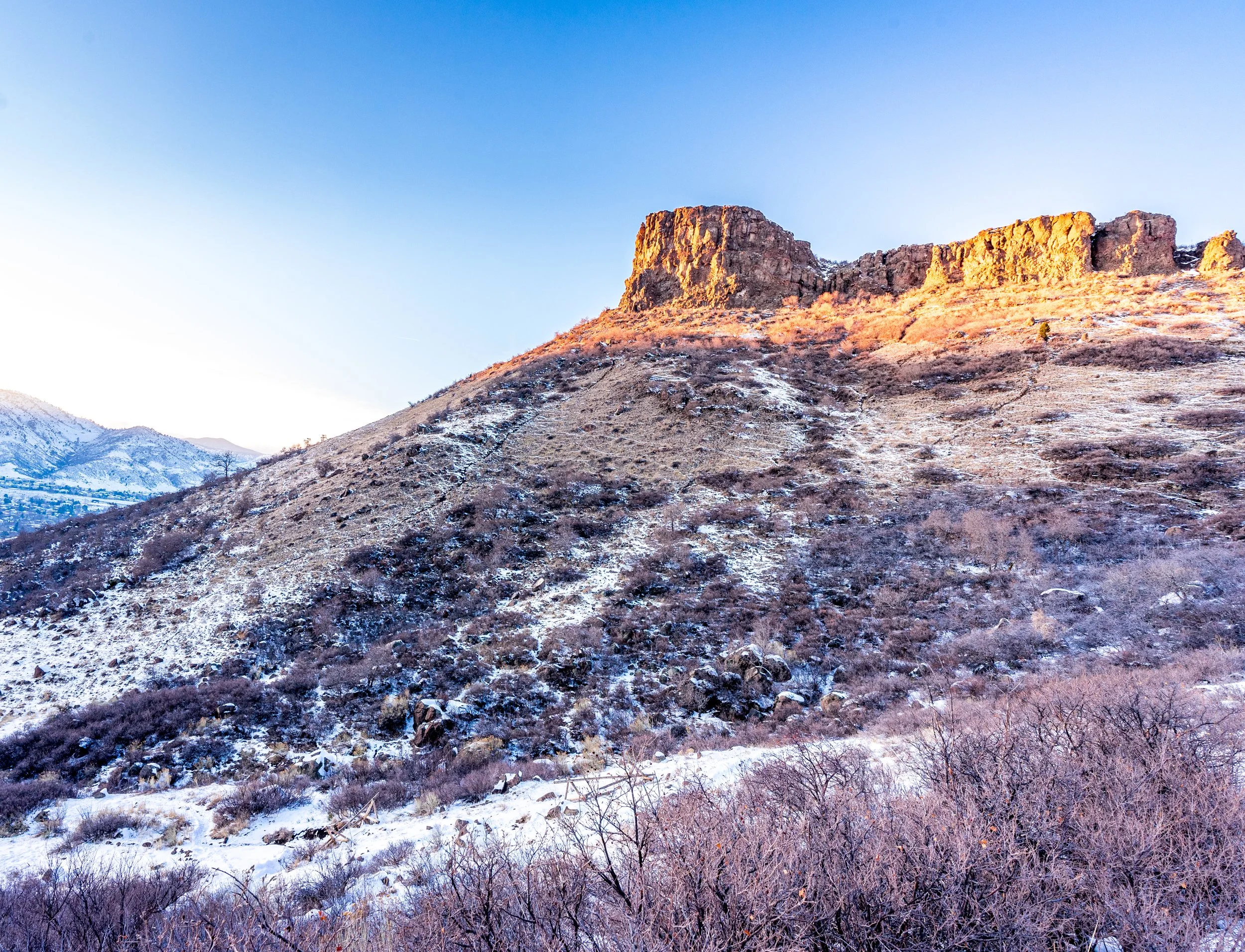
About South Table Mountain Park
South Table Mountain is the flat-topped mesa that rises right out of Golden, facing North Table Mountain across Clear Creek. Most of it is protected as South Table Mountain Park, a Jefferson County Open Space property with a network of trails that climb onto the mesa top from several trailheads around its edge.
The top is broad, open grassland ringed by a band of dark volcanic cliffs. From the rim you look west to Lookout Mountain and the foothills, north across the Clear Creek gap to North Table, and east to the Denver skyline. It is a short drive from almost anywhere in the metro area, which makes it one of the easiest places to catch a big Front Range sunset without committing to a mountain drive.
The mesa's signature landmark, Castle Rock, is the butte on the northwest corner overlooking downtown Golden. It is private property and closed to visitors, but it makes a strong subject from the public trails.
Panoramic mesa-top views over Golden, with nesting habitat for cliff raptors and easy access for hikers, runners, and riders. Stick to the marked trails here — undesignated paths damage the mesa ecology, and Castle Rock, the landmark outcropping, sits on private property that isn't open to the public. The mesa edge itself gives you a clean, elevated vantage over Golden and Coors Field's stadium lights after dark.
History
The mesa owes its shape to two lava flows dated to about 62 to 64 million years ago, which formed a hard cap over the softer Denver Formation below; the boundary marking the end of the age of dinosaurs is exposed on its slopes. In the 1870s Colorado School of Mines fossil hunters worked these slopes, and a T. rex tooth found here is commemorated in the park's T. rex Tooth Trail.
Castle Rock had a lively early-1900s life as a resort, with a summit cafe in 1906 and later a dance hall and funicular, before an arson fire destroyed it in 1927. In 1935 the Works Progress Administration built the Colorado Amphitheater on the south slope for National Guard training; it sits on non-public land today. Decades of public hearings eventually defeated a quarry proposal and preserved the mesa as open space.
Photographing South Table Mountain Park
Best light: Sunset is the classic shot here: the west rim faces straight into the foothills and the light rakes across Castle Rock and the mesa-top grasses. Spring green-up and the golden grasses of late summer and fall both work, and a dusting of snow on the basalt cliffs is a winter bonus.
Shots to look for
- Castle Rock silhouetted against a sunset sky from the public trail along the northwest rim, with a short telephoto to compress it against the foothills
- North Table Mountain across the Clear Creek gap with Golden's lights below during blue hour
- The Denver skyline from the east side of the mesa at sunrise or after dark, with a 70-200mm
- Columnar basalt cliffs along the rim as a foreground, wide angle, with the plains or foothills beyond
- Wildflowers or seed heads on the mesa top backlit by low evening sun
Photo tips
- Castle Rock and other signed areas are private — stay on designated trails and shoot the butte from public land
- Wind can be strong on the open mesa top; bring a sturdy tripod and weight it down
- Rattlesnakes are present on the warmer slopes from spring through fall; watch your step around rocks
- Dogs must be leashed under Jeffco Open Space rules, and the trails are shared with mountain bikers
- Check Jeffco Open Space park hours if you plan to stay past dusk for blue hour
Know before you go
- Castle Rock is private property and closed to the public
- Parts of the mesa belong to the Colorado State Patrol and the National Renewable Energy Laboratory and are not open; obey boundary signs
- There is little shade on top — bring water and sun protection in summer
- Trails are multi-use; expect bikes and runners, especially after work and on weekends
Frequently asked questions
Can you hike to Castle Rock on South Table Mountain?
No. Castle Rock sits on private property and is closed to visitors. You can photograph it from the public trails on the mesa.
Where do you park for South Table Mountain?
The main public access points are the Camp George West Trailhead on Kilmer Street, the Golden Hills Road access and the Rimrock Drive access, all in Golden.
How was South Table Mountain formed?
Lava flows about 62 to 64 million years ago left a hard volcanic cap that protected softer rock below from erosion, leaving the flat-topped mesa you see today.
Featured in: Easy Colorado Hikes With Big Views · Photography Spots Near Denver
Combine it with
North Table Mountain Park · Lookout Mountain · Clear Creek Trail · Downtown Golden
More Colorado spots
Cascade Creek Trail · Emerald Lake (Crested Butte) · Snowmass Trail
Sources & further reading: en.wikipedia.org · jeffco.us · cmc.org. Conditions, fees and rules change; check with the managing agency before you go.