Colorado History Hikes: Ghost Towns, Railroads, Lookouts and Ancient Sites
By Chris Heaton · access details checked October 2026
Colorado's mountains are full of the things people left behind: mining camps that boomed and emptied within a decade, railroad grades blasted across the Divide, stone fire lookouts, homesteads on the plains, and cliff dwellings far older than any of them. Many make wonderful photographs, and most are a short walk or drive from a trailhead. This guide covers thirty of them across the state, grouped by theme, with the history behind each and what to know before you go.
Before you go: protect what's left
These places survive only because visitors leave them alone. Old cabins collapse under climbing kids, and every nail or bottle taken is gone for good.
- Look, photograph, and leave everything where it is. Removing or damaging archaeological resources on public land is a federal crime under the Archaeological Resources Protection Act, with fines up to $10,000 and a year in jail for a first offense. Graves more than 100 years old count as archaeological resources.
- Never enter old mine tunnels or shafts. Colorado has about 23,000 inactive and abandoned mines, with deadly air (some of it odorless), rotten timbers, hidden shafts and old explosives. The state's slogan says it plainly: Stay Out, Stay Alive.
- Many ghost-town buildings are private property even when the land around them is public. Stay outside fences and off porches.
- Don't touch rock art or climb ruin walls; skin oils and footsteps do lasting damage.
Mining ghost towns and mills
Colorado's mining camps rose fast after the 1859 gold rush and the silver booms of the 1870s and 1880s, and most emptied just as fast after the Silver Panic of 1893.
Crystal Mill and Crystal townsite
- Getting there
- About 8 miles round trip on foot from the Marble lot, or a rocky 4WD shelf road. A Forest Service parking permit is required.
- What to shoot
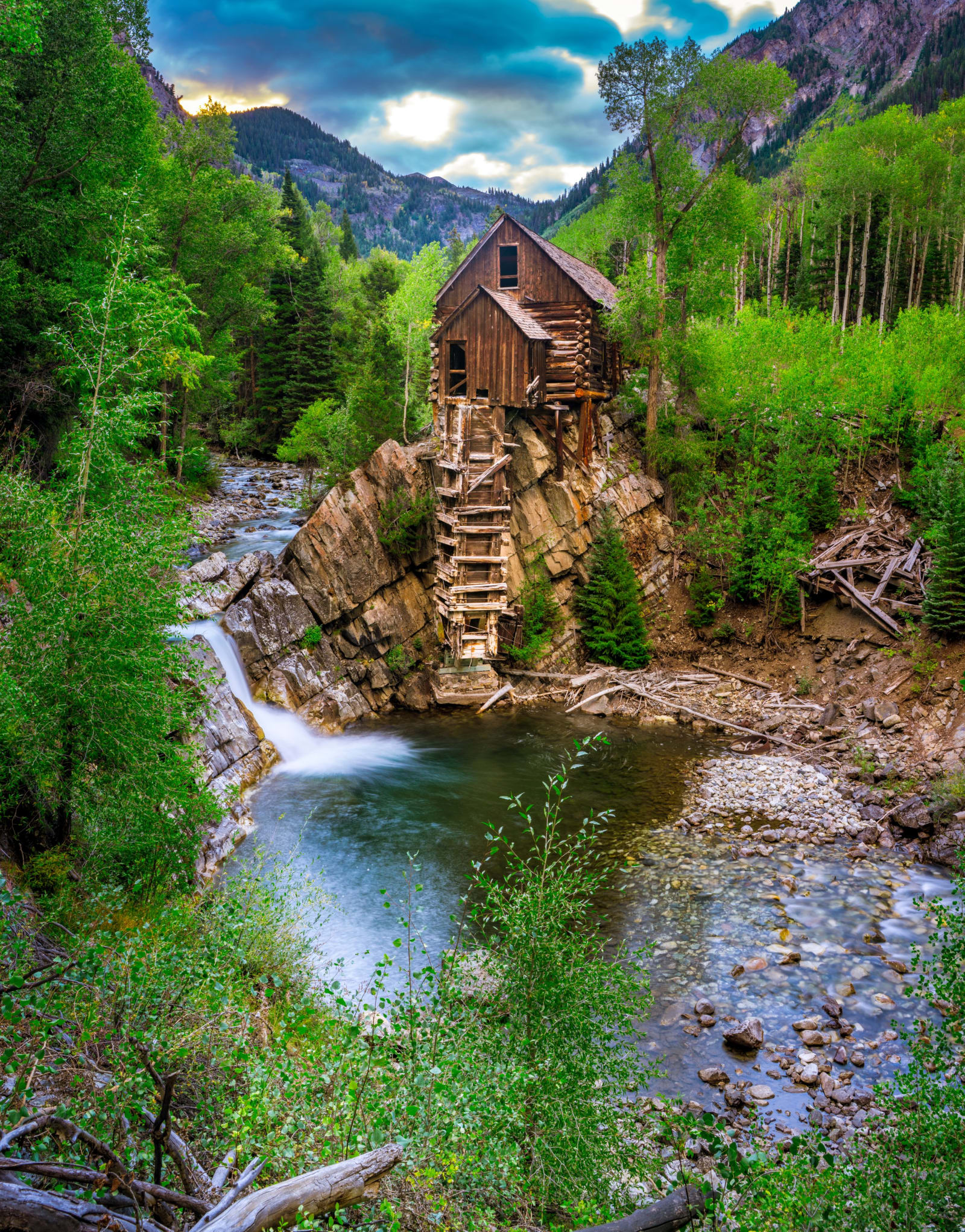
- The mill above the Crystal River in late-September aspen, ideally in early light or overcast.
- Good to know
- Built in 1892 as a powerhouse, not a true mill: a water wheel drove an air compressor for drills in the Sheep Mountain Tunnel. It shut down in 1917 and has been privately owned since 1954. Crystal itself had over 500 people in the mid-1880s. Access to the riverbank is by the owners' fee.
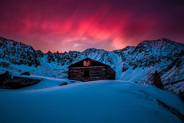
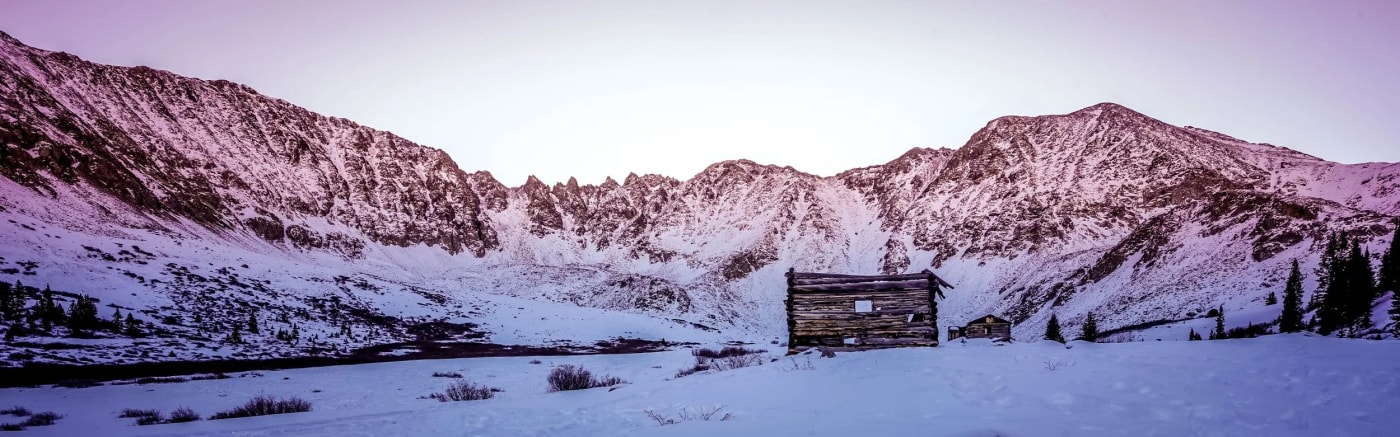
Mayflower Gulch and the Boston Mine camp
- Getting there
- About 3 miles round trip and 550–630 feet of gain on an old road; an easy snowshoe in winter.
- What to shoot
- Weathered cabins framed by the Tenmile Range cirque, especially at sunrise and after fresh snow.
- Good to know
- Miners and their families lived in the cirque below Mount Fletcher in the early 1900s. There's an open adit at the camp: stay out. The slopes above the camp are avalanche terrain.
St. Elmo
- Getting there
- A drive-up town with a walkable main street.
- What to shoot
- False-front buildings on Main Street at golden hour; aspen in late September.
- Good to know
- Laid out in 1880 as Forest City and renamed when the post office objected. The Mary Murphy Mine kept it alive until 1936. Around 40 structures remain, many privately owned.
Animas Forks
- Getting there
- Reachable by 2WD from Silverton in summer; the passes beyond may need 4WD. Best May to October.
- What to shoot
- The 1879 Duncan House and its bay window against the peaks, early in the morning; wildflowers in July.
- Good to know
- About 450 people lived here by 1883. A 23-day blizzard in 1884 buried the town in about 25 feet of snow. The BLM restored the Duncan House and the 1882 jail in 2013–14.
Independence
- Getting there
- Short interpretive trails from the roadside lot.
- What to shoot
- Cabins with the Continental Divide behind, and tundra color in late August.
- Good to know
- Gold was struck around July 4, 1879, and about 1,000 people lived here in 1882. During the long winter of 1899, residents made about 75 pairs of skis and fled to Aspen. Independence Pass closes around November 7. A $5 donation is suggested; no dogs.
Ashcroft
- Getting there
- A short walk among restored buildings; open year-round.
- What to shoot
- The hotel and saloon in snow, or with the Castle Creek peaks in fall.
- Good to know
- A silver camp from 1880 that faded quickly when the ore proved shallow. The Aspen Historical Society manages it ($5 per adult; no dogs).
Hessie townsite
- Getting there
- Take Boulder County's weekend shuttle from Nederland in season; Lost Lake is 4.2 miles round trip.
- What to shoot
- The restored 1874 Hessie Cabin, collapsed buildings and the waterfalls above.
- Good to know
- Founded by J.H. Davis around a lumber mill and named for his wife. About 30 people lived here in 1899; it was deserted by 1905. Crews restoring the cabin in 2022 found a hidden cache of gold ore under the floor.
Caribou
- Getting there
- Roadside; the cemetery is about half a mile past the townsite.
- What to shoot
- Two stone ruins with the Indian Peaks behind. It's famously windy, so bring a sturdy tripod.
- Good to know
- Founded around 1870 for the Caribou silver mine; burned in 1879 and lost its post office in 1917. Much of the land around it is private and some mining is active. Don't trespass.
Gold Hill
- Getting there
- A living town, not a ghost town; walk the public streets.
- What to shoot
- Log buildings along Main Street.
- Good to know
- Site of Colorado's first lode gold discovery on January 15, 1859. The schoolhouse has run continuously since 1873. Homes are private.
Lulu City
- Getting there
- About 7.4 miles round trip with roughly 950 feet of gain; the Shipler Mine cabins are about 2 miles in.
- What to shoot
- River meadows in fall, with moose and elk.
- Good to know
- Silver was found here in 1879, and the camp had about 40 cabins in 1881 before it was abandoned by 1885. Little remains but foundations.
Bonanza
- Getting there
- A drive through a near-empty town; 2WD from Villa Grove.
- What to shoot
- Old cabins and mine buildings in a quiet valley.
- Good to know
- Founded in 1881 and home to over 1,000 people by 1882; mining ended in 1970.
Railroad grades and tunnels
Narrow-gauge railroads chased the mines over the highest passes in the state. Most were abandoned in the 1910s to 1930s, leaving gentle grades that make easy hikes and drives today.
Boreas Pass and Baker's Tank
- Getting there
- The Baker's Tank loop is about 6 miles with 690 feet of gain, starting where the pavement ends.
- What to shoot
- The old maroon water tank against gold aspens in late September, and the 11,481-foot pass.
- Good to know
- The Denver, South Park & Pacific laid narrow-gauge track over the pass in 1882. The line was abandoned in 1937 and rebuilt as a road after World War II.
Rollins Pass (the Moffat Road)
- Getting there
- Drive to Forest Lakes on the east side, then hike the grade.
- What to shoot
- Old trestles, the Divide at sunset, and the blocked Needle's Eye Tunnel from outside.
- Good to know
- The railroad over the pass opened in 1904 with 33 tunnels and closed when the Moffat Tunnel opened in 1928. The Needle's Eye Tunnel has been blocked by rockfall since 1990, so there's no through route. The west road is closed from November 15 to June 15.
Alpine Tunnel
- Getting there
- A boulder blocks the last mile; park and walk in. Typically accessible July to September.
- What to shoot
- The rebuilt stone Palisade Wall, the restored telegraph office and turntable.
- Good to know
- Bored through in 1881 at about 11,523 feet, one of the highest railroad tunnels ever built, and abandoned in 1910. A 2016 avalanche closed the road until it reopened in fall 2024. The tunnel portals are sealed. Check current road status before going.
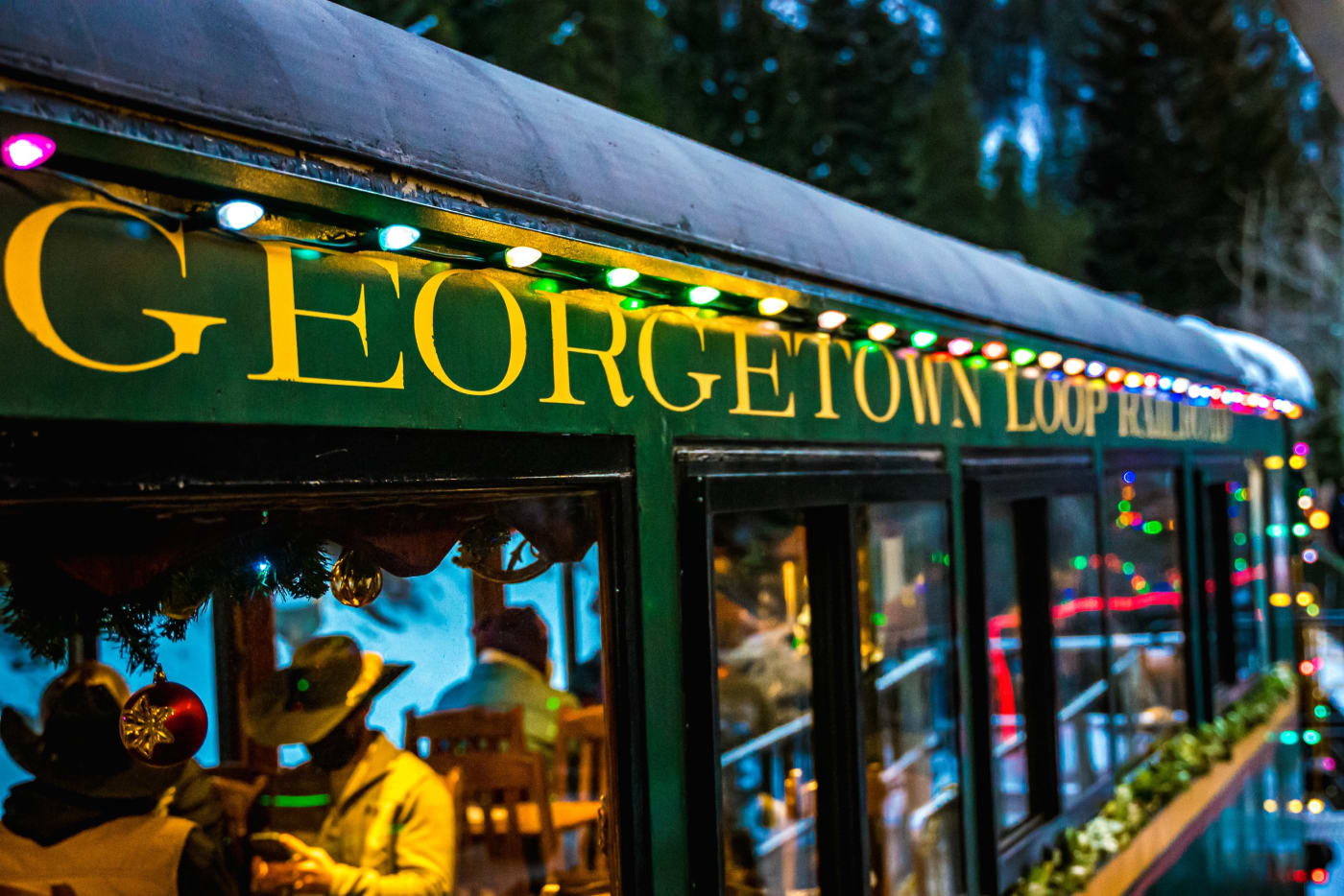
Georgetown Loop Railroad
- Getting there
- A steam train ride in summer, with an optional tour about 500 feet into the 1870s Lebanon Mine.
- What to shoot
- The steam train crossing the 95-foot Devil's Gate High Bridge over Clear Creek, and the holiday trains in winter.
- Good to know
- The original loop was completed in 1884 and scrapped in 1939. The restored line reopened in 1984. Check the current schedule.
Fire lookouts and CCC work
Fire lookouts once dotted Colorado's high points. A few remain, and two of the best are within an hour of Denver.
Devil's Head Lookout
- Getting there
- 1.4 miles one way and about 865 feet of gain, then 143 stairs to the cab at 9,748 feet.
- What to shoot
- The cab perched on a granite pinnacle, and sunrise over the plains.
- Good to know
- In use since 1912, it's Colorado's last active fire lookout; the current cab dates to 1951. The tower is open only when staffed, from about mid-June to fall. No dogs on the stairs.
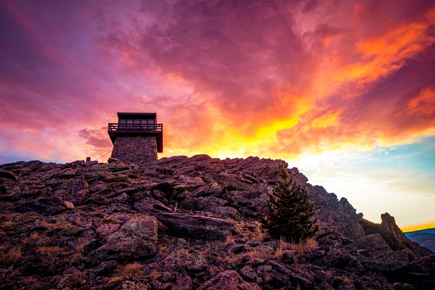
Mestaa'ēhehe Mountain Lookout
- Getting there
- About a mile on foot past a gate in summer, about 2 miles in winter.
- What to shoot
- The stone lookout at blue hour with Mount Blue Sky behind, and sunrise over the plains.
- Good to know
- Built by the Civilian Conservation Corps of native granite and rentable overnight for up to four people on Recreation.gov. The mountain was renamed in 2021 to honor Owl Woman, a Cheyenne translator and peacemaker, replacing a slur.
Ancestral Puebloan and Indigenous sites
Southwest Colorado holds some of the best-preserved archaeological sites in North America. They are sacred places for many tribes today; visit quietly and stay on the trails.
Mesa Verde National Park
- Getting there
- Ranger-led cliff dwelling tours run roughly May to October and are booked on Recreation.gov up to 14 days ahead. Step House is a self-guided 1-mile round trip.
- What to shoot
- Cliff Palace from Sun Point overlook in late-afternoon light.
- Good to know
- About 600 cliff dwellings among nearly 5,000 sites, built from the late 1190s and left by about 1300. A World Heritage Site since 1978. Balcony House involves a 32-foot ladder and a tunnel crawl.
Hovenweep National Monument
- Getting there
- The Square Tower loop is 2 miles round trip; be off the trails by sunset.
- What to shoot
- Stone towers on canyon rims at sunset, and very dark night skies.
- Good to know
- Built by Ancestral Puebloans during the droughts of the late 1100s and early 1200s.
Sand Canyon, Canyons of the Ancients
- Getting there
- About 6.5 miles one way between the lower and upper trailheads; free.
- What to shoot
- Small cliff dwellings tucked in alcoves, in low-angle light. Best in spring and fall; summer is hot.
- Good to know
- No entering sites, climbing walls or touching rock art.
Chimney Rock National Monument
- Getting there
- Guided tours in season, roughly mid-May to September 30.
- What to shoot
- The twin spires above the Great House pueblo; special full-moon programs.
- Good to know
- The Chacoan Great House was built in 1076 and expanded in 1093, both years of a major lunar standstill, when the moon rises between the spires.
Frontier, ranching and homestead sites
Bent's Old Fort National Historic Site
- Getting there
- A quarter-mile paved walk; tours on a set schedule.
- What to shoot
- Adobe walls at sunrise, and living-history events.
- Good to know
- A trading post on the Santa Fe Trail from 1833 to 1849, reconstructed by the Park Service in 1976. Entrance fee.
Holzwarth Historic Site
- Getting there
- A level half-mile walk; buildings staffed in summer, grounds open year-round.
- What to shoot
- 1920s ranch cabins with the Never Summer Mountains behind, on frosty fall mornings.
- Good to know
- Homesteaded in 1917 and run as a dude ranch through the 1920s.
Mount Falcon Park
- Getting there
- About 3 miles round trip from the west trailhead to the castle ruins and the Summer White House site.
- What to shoot
- The stone chimneys and arched windows of John Brisben Walker's home at sunset, and in snow.
- Good to know
- Walker began the house in 1909; lightning burned it in 1918. He laid the cornerstone of a 'Summer White House' for presidents in 1914, but it was never built.
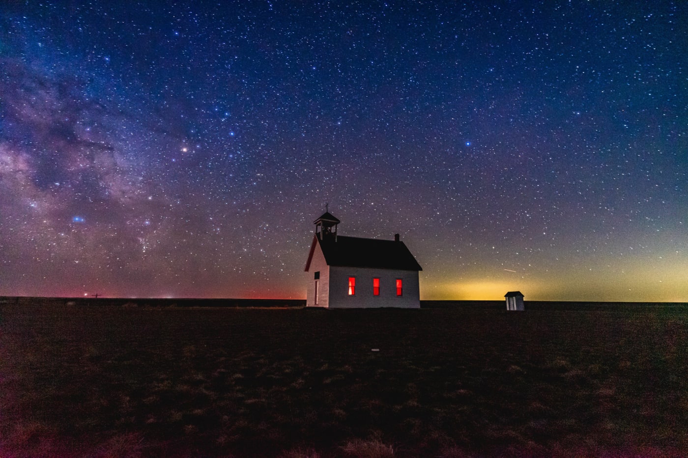
Abbott Church
- Getting there
- A roadside stop.
- What to shoot
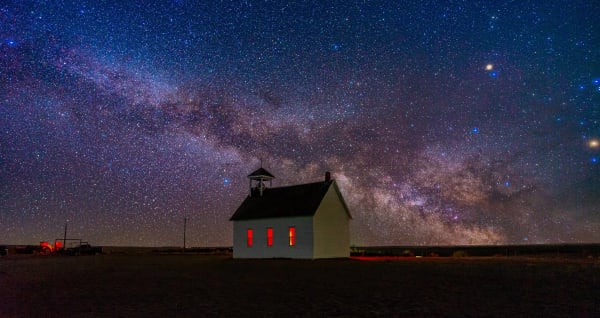
- A lone white church on the open prairie at sunset or under the Milky Way.
- Good to know
- Built in 1913 by homesteader Albert Abbott; around 70 burials lie in the cemetery behind it. Be respectful of the graves.
Dearfield
- Getting there
- View from the roadside.
- What to shoot
- The remaining buildings against big prairie skies.
- Good to know
- A Black homestead colony founded in 1910 by O.T. Jackson, home to up to about 300 people around 1917–21 before drought and the Dust Bowl emptied it. Listed on the National Register in 1995.
Memorials and hard history
Some of Colorado's most important historic sites mark tragedies. Visit them as memorials: quietly, on the trails, and without photographing offerings or mourners.
Sand Creek Massacre National Historic Site
- Getting there
- A half-mile trail to the Monument Hill overlook and a 1.5-mile bluff trail.
- What to shoot
- The open landscape of the creek and bluffs, respectfully.
- Good to know
- On November 29, 1864, about 675 Colorado volunteers attacked a peaceful camp of Cheyenne and Arapaho, killing more than 230 people, mostly women, children and elders. It's sacred ground; stay on the designated trails.
Ludlow Massacre site
- Getting there
- A short walk to the memorial.
- What to shoot
- The granite monument against the prairie.
- Good to know
- On April 20, 1914, an attack on a striking miners' tent colony killed at least 19 people, including two women and twelve children who died in a cellar beneath a tent. Owned by the United Mine Workers and a National Historic Landmark since 2009.
Castlewood Canyon dam ruins
- Getting there
- Loops of 2, 4 or 6 miles via the Dam Trail; state parks pass required.
- What to shoot
- The broken stone dam across the canyon.
- Good to know
- The dam, built around 1890, failed on August 3, 1933, flooding Denver and forcing about 5,000 people to evacuate.
Central City cemeteries
- Getting there
- Walk among six historic cemeteries on the flats above town.
- What to shoot
- Iron-fenced plots and leaning stones in fog or fall light.
- Good to know
- Graves were sometimes blasted out of solid rock, and many headstones record mining accidents. Don't touch fragile markers or make rubbings.
Photographing old buildings and ruins
Historic places reward a slower approach. Walk the whole site before you set up, and look for the detail that tells the story: a doorway, a rusted hinge, a window frame with the mountains behind it.
- Golden hour and blue hour flatter weathered wood and stone; harsh midday sun flattens texture and blows out highlights.
- Shoot through doorways and windows from outside to frame the landscape. You get the interior feel without stepping inside.
- Overcast days are ideal for cabin details, gravestones and mill interiors seen from outside.
- Old buildings are usually crooked. Keep your camera level and fix verticals in editing so the building, not your lens, looks tilted.
- Night photography works well at remote sites like Abbott Church, Hovenweep and the Boston Mine. Light the building softly with a dim, warm light for a second or two instead of blasting it with a headlamp.
- Include scale: a person on the trail or a vehicle on the road shows how small these towns were in the landscape.
Spot guides mentioned here
Useful on this site
- Old Colorado: Photos of ghost towns, cabins and historic landmarks
- Hidden gem photo spots: Quieter places across the state
- 2027 calendar: Includes Mayflower Gulch
Questions
What is the best ghost town to visit in Colorado?
St. Elmo is the most complete and easiest to reach. Animas Forks and Independence have dramatic high-country settings, and Mayflower Gulch is an easy hike near Copper Mountain.
Can you take artifacts from ghost towns?
No. Removing artifacts from public land is illegal under federal law, and many ghost-town buildings are private property.
Is it safe to go into old mines?
No. Abandoned mines can have deadly air, rotten timbers and hidden shafts. Colorado's message is Stay Out, Stay Alive.
Where can you see cliff dwellings in Colorado?
Mesa Verde National Park, Hovenweep National Monument and Canyons of the Ancients near Cortez all protect Ancestral Puebloan sites.
What is the oldest active fire lookout in Colorado?
Devil's Head Lookout in Pike National Forest has been in use since 1912 and is the last active fire lookout in the state.
Fees, reservations and road dates change. Confirm with the managing agency before you go. Sources: drms.colorado.gov, blm.gov, aspenhistory.org, aspenhistory.org, npgallery.nps.gov, fs.usda.gov, moffatroad.org, cpr.org, fs.usda.gov, nps.gov, nps.gov, nps.gov, home.nps.gov, nps.gov, historycoloradodev.exemplifi.io.
More guides