Hidden Gem Photo Spots in Colorado (and How to Keep Them That Way)
By Chris Heaton · access details checked October 2026
Colorado's famous views are famous for a reason, but they come with timed-entry permits, full parking lots and a line of tripods at sunrise. Spread across the state are places with the same kind of light and scenery and a fraction of the people. None of these are truly secret; they're public, legal and on the map. They're just quieter, usually because they're farther from Denver, behind a rough road, or simply not the name everyone searches. This guide covers thirty of them, region by region, with what it takes to get there and when to go.
How to use this guide
Each spot lists how to get there, what to photograph and anything that trips people up: fees, permits, road conditions and seasonal closures. Where a spot is a good stand-in for a crowded icon, it says so. Spots with a page on this site link to it for full trail details.
Road and closure details were checked in October 2026, but rough roads change with every storm. Check the managing agency before you drive, and assume clay roads on the plains and Western Slope are impassable after rain.
Close to Denver: the Front Range foothills
You don't have to drive four hours to get away from the crowds. These are all within about two hours of Denver.
Roxborough State Park
- Getting there
- Fountain Valley Loop is 2.5 miles; Carpenter Peak is 6.5 miles round trip. Open 7 a.m. to 7 p.m.; a state parks day pass is required.
- What to shoot
- Tilted red fins of the Fountain Formation, the same rock as Garden of the Gods, with far fewer people.
- Good to know
- Large groups aren't approved on weekends from May to October, which keeps it calm. Organized or commercial photo shoots may need a special activity agreement filed well ahead.
Abyss Trail to Helms Lake
- Getting there
- About 12 miles round trip to Helms Lake, roughly 2,400 feet of gain; a long day.
- What to shoot
- Gold aspen and willows along Scott Gomer Creek in late September, and Mount Bierstadt's quieter south side above the lake.
- Good to know
- Free self-issued wilderness permit at the trailhead.
Three Mile Creek
- Getting there
- A stream-laced valley climb into the Mount Blue Sky Wilderness from the Whiteside Picnic Area.
- What to shoot
- Cascades and wildflowers in July; aspen on the drive in during late September.
- Good to know
- The valley is narrow, so mid-morning light works better here than sunrise.
Hells Hole
- Getting there
- About 8 miles round trip and 1,900 feet of gain to a willow meadow at about 11,500 feet.
- What to shoot
- Aspen groves in late September, wildflowers in July, and bristlecone pines near treeline.
Idaho Springs Reservoir
- Getting there
- About 2 miles one way on the Chicago Lakes Trail.
- What to shoot
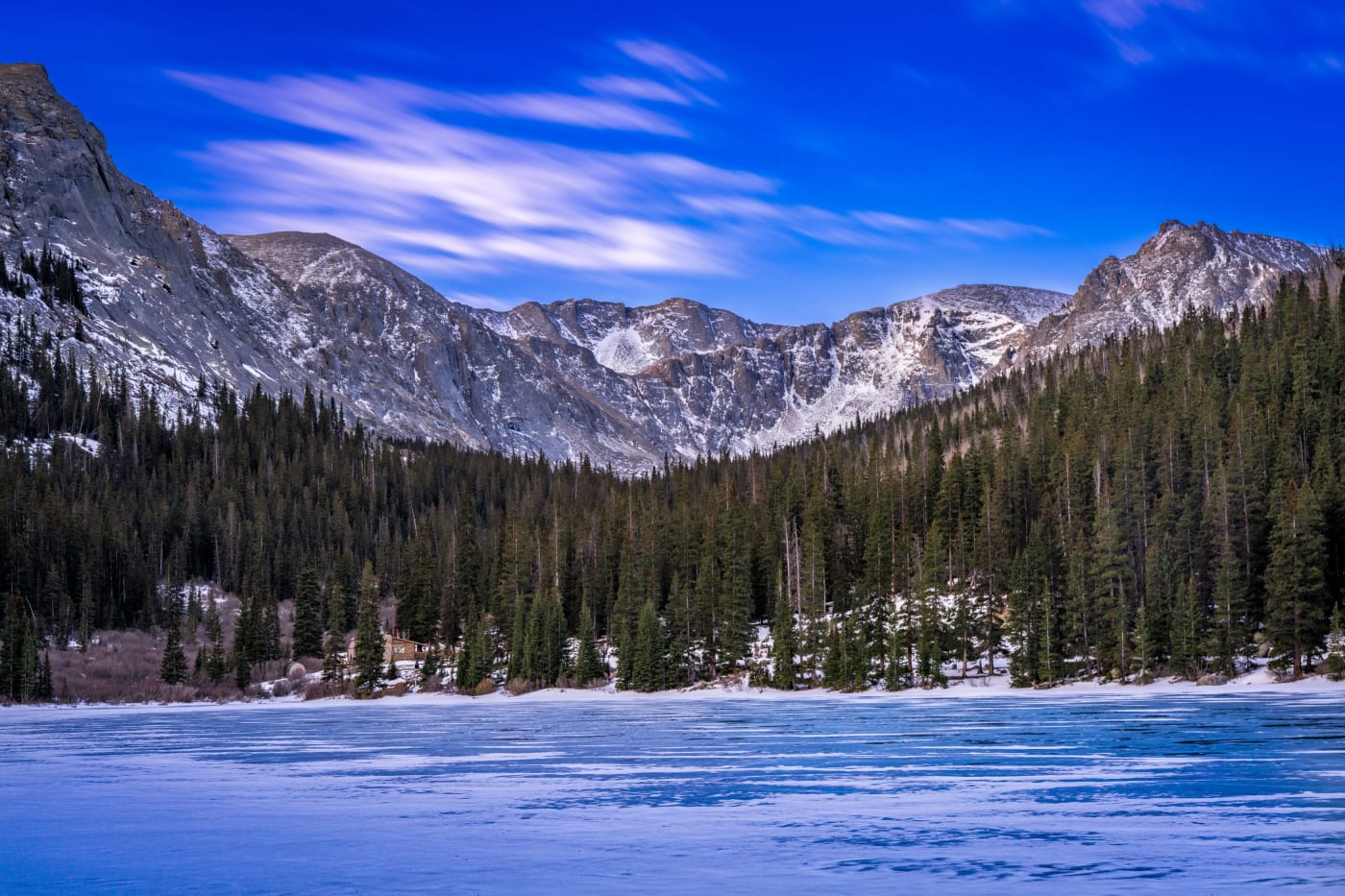
- Reflections of the ridges at the head of the valley on calm mornings, and ice in early winter.
Lost Creek Wilderness: Goose Creek to the Shafthouse
- Getting there
- 3.8 miles one way, high point about 8,766 feet. Free self-issued wilderness permit; groups capped at 12.
- What to shoot
- Early-1900s cabins and the old shafthouse, giant granite domes, and creek pools. An overlook above the cabins works at sunrise or sunset.
- Good to know
- It's a long day for a photo hike, which thins the crowd. No drones in wilderness.
Eleven Mile Canyon
- Getting there
- A 9-mile drive along the South Platte, with pullouts the whole way.
- What to shoot
- Pikes Peak granite walls up to 500 feet above the river, and fall cottonwoods.
- Good to know
- A day-use fee applies inside the fee zone (about $10–11); you can park outside it and walk in. Paving and a new entry station were planned for 2025–2026, so check the current status.
Florissant Fossil Beds National Monument
- Getting there
- The Petrified Forest Loop is 1.1 miles with almost no climbing; the Hornbek trail is 3.9 miles.
- What to shoot
- Giant petrified redwood stumps, meadows and the Hornbek homestead. The Twin Rock trail is described by the Park Service as having quiet views.
- Good to know
- National park rules apply: no drones.
Mueller State Park
- Getting there
- Outlook Ridge is a 2.5-mile loop, with many other trails across the park.
- What to shoot
- Aspen and bugling elk in late September and October.
- Good to know
- State parks pass required.
Lory State Park: Arthur's Rock
- Getting there
- 3.4 miles round trip and about 1,100 feet of gain to roughly 6,800 feet.
- What to shoot
- Horsetooth Reservoir, Fort Collins and the plains from the summit; a meadow overlook about a mile up.
- Good to know
- State parks pass required.
Golden Ponds
- Getting there
- About 2.6 miles of easy paved and gravel paths.
- What to shoot
- Alpenglow on Longs Peak reflected in the ponds at sunrise, and migrating birds in spring and fall.
Clear Creek Welch Ditch
- Getting there
- About a half mile on a restored 19th-century wooden flume.
- What to shoot
- The flume clinging to the canyon wall, and golden cottonwoods in fall.
- Good to know
- The canyon is deep, so overcast days give the most even light.
The plains: big skies, nobody around
Eastern Colorado is where to go when you want an open horizon and dark skies. Roads here are often dirt or clay: fine when dry, impassable after rain.
Paint Mines Interpretive Park
- Getting there
- About 4 miles of trails; free, open dawn to dusk.
- What to shoot
- Candy-striped clay hoodoos in the first and last hour of light, and after snow.
- Good to know
- No dogs, bikes or drones, and no climbing on the formations. Night and astrophotography need a county permit (allow 10–14 days). It's a protected archaeological district.
Pawnee Buttes
- Getting there
- About 2 miles to the first butte; no fee.
- What to shoot
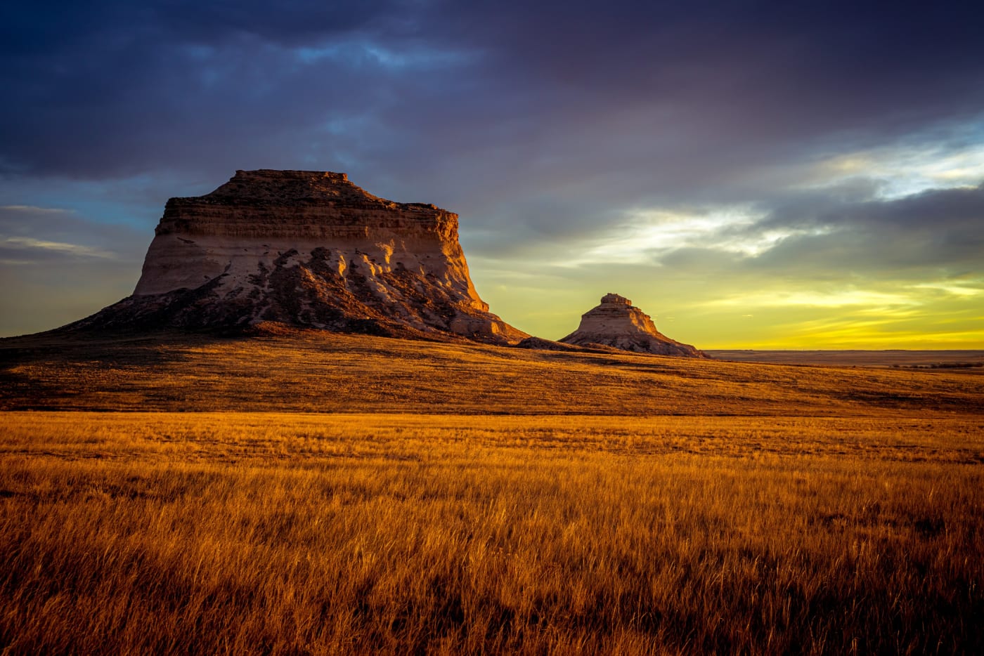
- Sandstone buttes glowing at sunrise and sunset, storm skies in summer, and the Milky Way.
- Good to know
- The overlook area and bluff base are closed March 1 to June 30 for nesting raptors. The second butte is on private land. County roads turn to gumbo when wet.
Vogel Canyon
- Getting there
- About a 5-mile loop with little climbing. Open year-round; a parking permit is required.
- What to shoot
- Rock art roughly 500 to 800 years old, canyon walls and prairie sunsets.
- Good to know
- Look, don't touch: oils from your hands damage the petroglyphs.
Picket Wire Canyonlands dinosaur tracks
- Getting there
- 11.2 miles round trip on foot from Withers Canyon, day use only; carry at least a gallon of water. The only motorized access is a guided tour in your own high-clearance 4WD, on Saturdays in May, June, September and October, booked on Recreation.gov.
- What to shoot
- One of North America's largest dinosaur trackways along the Purgatoire River, plus an old mission and cemetery.
- Good to know
- AWD cars aren't allowed on the tour; it has to be true 4WD.
Abbott Church
- Getting there
- A roadside stop.
- What to shoot
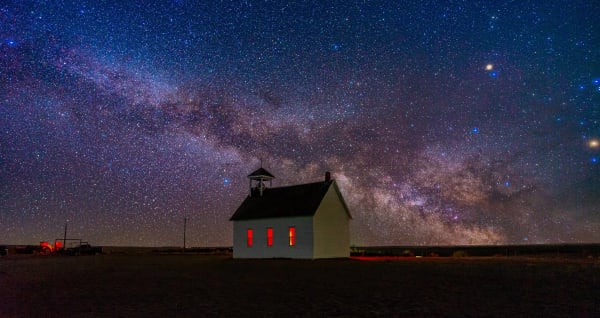
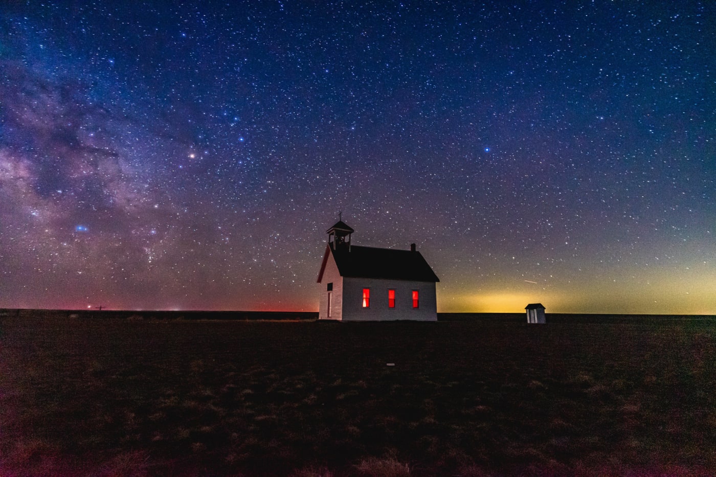
- A lone white 1913 church on the open prairie, at sunset or under the Milky Way.
- Good to know
- Be respectful of the cemetery behind it.
Southern Colorado and the San Luis Valley
Highway of Legends and the Spanish Peaks dikes
- Getting there
- An 82-mile scenic byway, about two hours. Cordova Pass (11,248 ft) is partly gravel and closed in winter.
- What to shoot
- Volcanic dikes radiating from the Spanish Peaks like stone walls, including the Devil's Stairsteps between Cuchara and La Veta, and fall aspen on Cordova Pass.
- Good to know
- Locals call it 'Forgotten Colorado.' Traffic is light even on fall weekends.
Zapata Falls
- Getting there
- A steep, rough 3.5-mile access road (4WD recommended), then about half a mile each way. You wade the creek into a slot to see the falls.
- What to shoot
- A 25-foot-plus waterfall hidden in a rock slot, and the dunes below at sunset from the trailhead.
- Good to know
- In winter the falls freeze, but the ice may not hold your weight. Bring shoes that can get wet.
Wellington Lake
- Getting there
- Day use and camping by fee; check in on arrival.
- What to shoot
- Pink granite spires of The Castle in late light, and calm-morning reflections.
Central mountains
Owl Creek Pass, Chimney Rock and Courthouse Mountain
- Getting there
- A well-maintained gravel road that conventional cars handle, to 10,114 feet.
- What to shoot
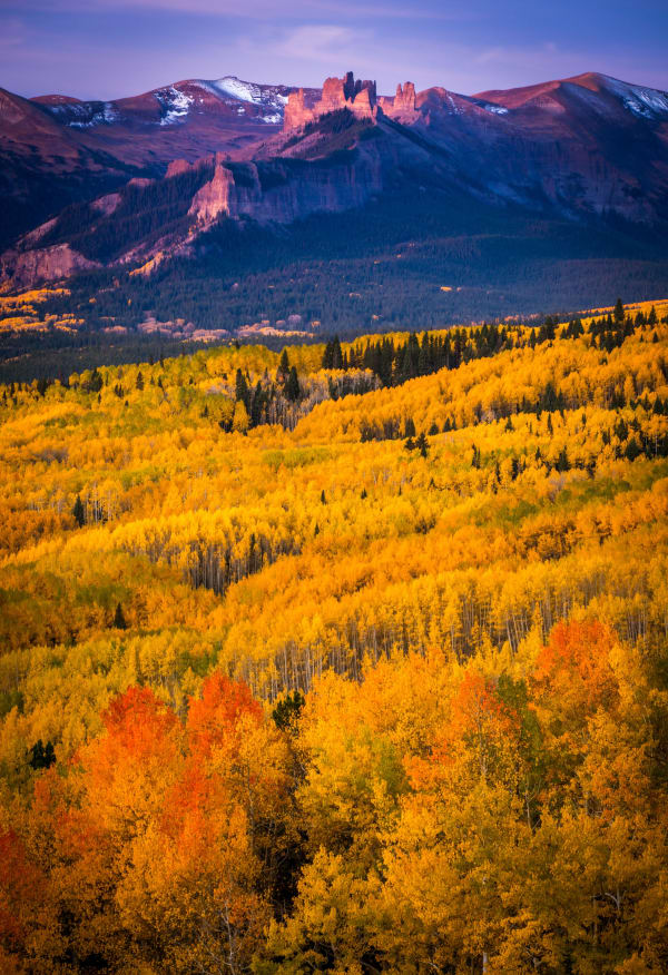
- Volcanic spires above aspen forests, best in late September; wildflowers in July. Parts of True Grit were filmed here.
- Good to know
- Sunrise from the meadows below Chimney Rock is the classic shot.
Dillon Pinnacles
- Getting there
- 1.9 miles one way, moderate.
- What to shoot
- Eroded volcanic pinnacles above Blue Mesa Reservoir, warm in late afternoon.
- Good to know
- National park rules: no drones.
Cumberland Pass
- Getting there
- A gravel road to 12,034 feet; usually closed from November to May.
- What to shoot
- Old mining-town cabins in Tincup and Pitkin, and huge views from the top.
- Good to know
- Check whether the road is open before driving up late in the year.
Snodgrass Mountain
- Getting there
- About 5.6 miles round trip and 1,500 feet of gain.
- What to shoot
- Some of the best aspen around Crested Butte in mid to late September, with fewer people than Kebler Pass.
Hartman Rocks
- Getting there
- Granite outcrops and sagebrush with many dirt roads and trails.
- What to shoot
- Boulders and junipers at sunset with the West Elk Mountains behind.
- Good to know
- Motorized roads close March 15 to May 15 for sage-grouse, and walkers are asked to wait until after 9 a.m. during that period. It's busy with mountain bikers on weekends.
Almont
- Getting there
- Roadside and riverside.
- What to shoot
- Morning mist on the rivers and fall cottonwoods; Taylor Canyon walls at sunset.
The San Juans
Lizard Head Pass and Trout Lake
- Getting there
- A free day-use pullout at the pass (sunrise to sunset); Trout Lake is just off the highway on a county road.
- What to shoot
- Lizard Head's spire, wildflowers from mid-July to early August, aspen around Trout Lake in fall, and the old railroad trestle on the lake's southeast shore.
- Good to know
- Hope Lake, a 6-mile out-and-back nearby, makes a good half day.
Last Dollar Road
- Getting there
- 13.3 miles; a high-clearance 4x4 is required.
- What to shoot
- Aspen-lined ranch land with the Sneffels Range and Wilson Peak behind it, best in late September.
- Good to know
- Don't confuse it with County Road 7, which goes up East Dallas Creek.
Slumgullion Earthflow and Lake San Cristobal
- Getting there
- A pullout at milepost 67 and the Windy Point overlook.
- What to shoot
- A 4-mile slow-motion landslide that still moves up to 20 feet a year, and the lake it created, Colorado's second-largest natural lake.
- Good to know
- Late-day light picks out the slide's yellow and gray colors.
Spring Creek Pass
- Getting there
- Roadside, or onto the Colorado Trail and Continental Divide Trail, which cross here.
- What to shoot
- Wide tundra views from 10,898 feet, and Snow Mesa from the trail.
Western Slope and the northwest
Rifle Falls State Park
- Getting there
- The Coyote Trail is 1.5 miles and accessible to the base of the falls. Open 6 a.m. to 10 p.m.; state parks pass required, no reservation.
- What to shoot
- A triple waterfall over a travertine dam, with small limestone caves behind it.
- Good to know
- Summer weekends are busy; go on a weekday or in spring or fall.
Black Canyon of the Gunnison: North Rim
- Getting there
- The Chasm View trail is a 0.3-mile loop; the North Vista trail is 1.4 miles one way.
- What to shoot
- Sheer dark walls over 2,000 feet deep, best in late afternoon and under the stars. The park is an International Dark Sky Park.
- Good to know
- The North Rim road closes to vehicles in winter. Far fewer people than the South Rim.
Rattlesnake Arches
- Getting there
- 13 miles on Black Ridge Road (high clearance mandatory, 4WD recommended), then about 5 miles round trip on the Lower Arches trail.
- What to shoot
- One of the largest groups of natural arches outside Arches National Park.
- Good to know
- Road access alternates by season: the upper road April 15 to August 14, the lower road August 15 to February 14, and no motorized access February 15 to April 15. Impassable when wet.
Dominguez Canyons
- Getting there
- A mile along the railroad tracks, a footbridge over the Gunnison, then up the canyon; the 1911 Rambo homestead is a common turnaround at about 3.5–4 miles.
- What to shoot
- Rock art, waterfalls, desert bighorn sheep and red canyon walls.
- Good to know
- Gnats are fierce from May to August; clay roads are impassable when wet.
Colorado National Monument: Rim Rock Drive
- Getting there
- 23 miles with 19 overlooks.
- What to shoot
- Independence Monument and red canyons at sunrise and sunset; try the less-visited overlooks like Red Canyon and Cold Shivers Point.
- Good to know
- National park rules: no drones.
Dinosaur National Monument: Harpers Corner and Echo Park
- Getting there
- Harpers Corner Road is about 32 paved miles (usually closed December 31 to April 15). Echo Park Road is 13 miles of steep dirt, impassable when wet.
- What to shoot
- Overlooks up to 2,500 feet above the Green and Yampa rivers, and Steamboat Rock at Echo Park.
- Good to know
- No pets on the Harpers Corner trail.
Trappers Lake
- Getting there
- County Road 8 for 39 miles, then Forest Road 205 to the Outlet trailhead.
- What to shoot
- A 9,633-foot lake under a 1,650-foot cliff 'amphitheater,' with silver snags from the 2002 Big Fish fire.
- Good to know
- Often called the birthplace of the wilderness idea: in 1920 Forest Service planner Arthur Carhart recommended keeping it roadless.
Rabbit Ears Peak
- Getting there
- About 5.5–6 miles round trip and 1,000 feet of gain to 10,477 feet. Day fee at the trailhead (cash or check).
- What to shoot
- The volcanic 'ears' at sunset and wildflowers in July.
- Good to know
- The rock is fragile; part of the west ear fell in 2017. Stay off it.
North Sand Hills
- Getting there
- Off CO 125 via county and BLM roads.
- What to shoot
- Active dunes at 8,400 to 9,200 feet with mountains behind.
- Good to know
- The dunes are open to off-highway vehicles, so expect tracks and engine noise; go early and walk away from the staging areas.
Gilpin Lake
- Getting there
- A 10.5-mile loop with about 2,400 feet of gain. $5 day fee at the Slavonia trailhead.
- What to shoot
- A deep blue lake under a jagged ridge, wildflowers in July, and gold willows in September.
- Good to know
- Snow can linger into early July. No camping within a quarter mile of the lake.
Keeping quiet places quiet
Most of these places are quiet because they're fragile or hard to reach, and a single viral post can change that in a season. The Leave No Trace Center's social media guidance boils down to a few habits: tag thoughtfully, show good behavior in your photos, give back, and encourage others by example.
- Tag the region, not the exact spot: 'San Juan Mountains' instead of a pin on a lake.
- Don't post photos of people off trail, on fragile formations or too close to wildlife; it teaches others to do the same.
- Stay on durable surfaces. Clay hoodoos, cryptobiotic desert soil and alpine tundra take decades to recover.
- Drones are banned in national parks and wilderness, and illegal in Colorado state parks outside designated areas. Paint Mines bans them too.
- Leave artifacts where you find them. Old cabins, rock art and mining relics are protected.
- Pack out everything, and pick up one thing someone else left.
Photography tips for out-of-the-way places
Quiet places come with fewer services and less information, so plan a little more and give yourself time to explore.
- Scout in daylight and return for sunrise or sunset; it's much easier to find a composition you've already seen.
- Download offline maps and carry a paper map. Cell service is unreliable at most of these spots.
- On the plains and in the desert, the best light is often the first and last 20 minutes; midday is harsh and the heat haze softens distant detail.
- Watch the sky: summer thunderstorms over the plains and Western Slope make dramatic backgrounds, but leave canyons and clay roads before the rain arrives.
- Dark skies are a big bonus at many of these places (the Black Canyon, Hovenweep and the plains). Pack a headlamp with a red light and a wide, fast lens.
- Keep your gear simple when the hike is long: one wide lens, one telephoto, a light tripod and a polarizer cover nearly everything.
Spot guides mentioned here
Useful on this site
- Where to shoot this weekend: Spots matched to this week's conditions
- Colorado Photo Spots field guide: 42 spots in an offline PDF
- Photo map: Every photo on the site, pinned where it was taken
Questions
What are some less crowded alternatives to famous Colorado spots?
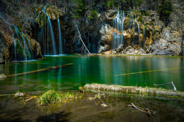
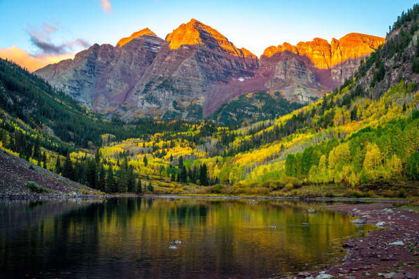
Roxborough State Park instead of Garden of the Gods, Owl Creek Pass instead of the Maroon Bells, Rifle Falls instead of Hanging Lake, and the North Sand Hills instead of Great Sand Dunes are good swaps.
Where can I photograph near Denver without crowds?
Roxborough State Park, the Abyss and Three Mile Creek trails off Guanella Pass, Hells Hole, Idaho Springs Reservoir and the Clear Creek Welch Ditch are all within about two hours.
Can I fly a drone at these spots?
Not in national parks or wilderness areas, and not in Colorado state parks outside designated areas. Paint Mines also bans drones. Check the rules for each place before you fly.
Should I geotag hidden spots?
Leave No Trace recommends tagging thoughtfully. Many photographers tag the general region rather than an exact location for fragile or little-known places.
Fees, reservations and road dates change. Confirm with the managing agency before you go. Sources: cpw.state.co.us, communityresources.elpasoco.com, fs.usda.gov, fs.usda.gov, codot.gov, blm.gov, nps.gov, nps.gov, cpw.state.co.us, wta.org.
More guides